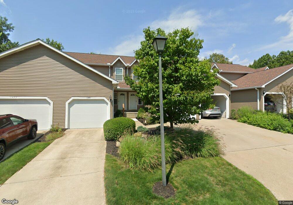
1381 Colony Dr Streetsboro, OH 44241
Estimated Value: $164,536 - $185,000
2
Beds
2
Baths
1,122
Sq Ft
$154/Sq Ft
Est. Value
About This Home
This home is located at 1381 Colony Dr, Streetsboro, OH 44241 and is currently estimated at $173,134, approximately $154 per square foot. 1381 Colony Dr is a home located in Portage County with nearby schools including Streetsboro High School and Crossroads Christian Academy.
Ownership History
Date
Name
Owned For
Owner Type
Purchase Details
Closed on
Jun 24, 2022
Sold by
Loska Diane K
Bought by
Safe Keeping Properties Llc
Current Estimated Value
Purchase Details
Closed on
Apr 20, 1998
Sold by
Umbel Randy S
Bought by
Loska Diane K
Home Financials for this Owner
Home Financials are based on the most recent Mortgage that was taken out on this home.
Original Mortgage
$87,300
Interest Rate
7.27%
Mortgage Type
FHA
Create a Home Valuation Report for This Property
The Home Valuation Report is an in-depth analysis detailing your home's value as well as a comparison with similar homes in the area
Home Values in the Area
Average Home Value in this Area
Purchase History
| Date | Buyer | Sale Price | Title Company |
|---|---|---|---|
| Safe Keeping Properties Llc | -- | Wagner Joy S | |
| Loska Diane K | $97,000 | -- |
Source: Public Records
Mortgage History
| Date | Status | Borrower | Loan Amount |
|---|---|---|---|
| Previous Owner | Loska Diane K | $87,300 |
Source: Public Records
Tax History Compared to Growth
Tax History
| Year | Tax Paid | Tax Assessment Tax Assessment Total Assessment is a certain percentage of the fair market value that is determined by local assessors to be the total taxable value of land and additions on the property. | Land | Improvement |
|---|---|---|---|---|
| 2024 | $2,256 | $53,520 | $5,250 | $48,270 |
| 2023 | $2,075 | $40,290 | $5,250 | $35,040 |
| 2022 | $2,078 | $40,290 | $5,250 | $35,040 |
| 2021 | $2,086 | $40,290 | $5,250 | $35,040 |
| 2020 | $1,891 | $33,500 | $5,250 | $28,250 |
| 2019 | $1,908 | $33,500 | $5,250 | $28,250 |
| 2018 | $1,574 | $30,000 | $5,250 | $24,750 |
| 2017 | $1,526 | $30,000 | $5,250 | $24,750 |
| 2016 | $1,527 | $30,000 | $5,250 | $24,750 |
| 2015 | $1,530 | $30,000 | $5,250 | $24,750 |
| 2014 | $1,699 | $33,040 | $5,250 | $27,790 |
| 2013 | $1,722 | $33,040 | $5,250 | $27,790 |
Source: Public Records
Map
Nearby Homes
- 1440 Trader Dr
- 9018 Patriot Dr
- 9012 Patriot Dr
- 1446 Trader Dr Unit H5
- 9315 June Dr
- 1489 Crescent Dr
- 8807 Kelly Ln
- 1648 Maple View Ct
- 1490 Evergreen Dr
- 1013 Ashwood Ln
- 1011 Ashwood Ln
- 9244 Lakeside Dr
- 9247 Chestnut Ct
- 1280 Shawnee Trail
- 9251 Chestnut Ct
- 1516 Gillie Dr
- 939 State Route 303
- 1405 Gillie Dr
- 1159 Shawnee Trail
- 9431 Briar Dr
- 1385 Colony Dr
- 1385 Colony Dr Unit I-4
- 1377 Colony Dr
- 1389 Colony Dr Unit 15
- 1389 Colony Dr Unit I-5
- 1373 Colony Dr Unit I1
- 1393 Colony Dr
- 9041 Merchant Dr
- 9039 Merchant Dr
- 9033 Merchant Dr
- 1401 Colony Dr
- 1401 Colony Dr Unit J2
- 9040 Merchant Dr Unit B1
- 1404 Colony Dr Unit M2
- 9036 Merchant Dr
- 9036 Merchant Dr Unit 2-B
- 9034 Merchant Dr
- 1405 Colony Dr
- 9031 Merchant Dr
- 9031 Merchant Dr Unit 5-C