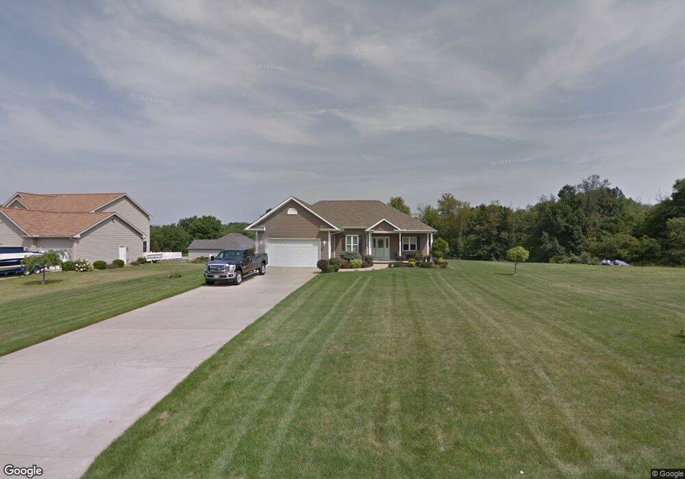
1381 McTweed Ln New Franklin, OH 44203
Estimated Value: $337,000 - $441,000
3
Beds
2
Baths
2,026
Sq Ft
$192/Sq Ft
Est. Value
About This Home
This home is located at 1381 McTweed Ln, New Franklin, OH 44203 and is currently estimated at $388,507, approximately $191 per square foot. 1381 McTweed Ln is a home located in Summit County with nearby schools including Nolley Elementary School, Manchester Middle School, and Manchester High School.
Ownership History
Date
Name
Owned For
Owner Type
Purchase Details
Closed on
Sep 22, 2017
Sold by
Tate Patricia L and Roland Patricia L
Bought by
Syx Timothy E and Syx Mallory L
Current Estimated Value
Home Financials for this Owner
Home Financials are based on the most recent Mortgage that was taken out on this home.
Original Mortgage
$200,000
Interest Rate
3.9%
Mortgage Type
New Conventional
Purchase Details
Closed on
Mar 24, 2017
Sold by
Tate Patricia L and Roland Patricia L
Bought by
Tate Patricia L
Purchase Details
Closed on
Apr 17, 2003
Sold by
Wm Barnard Realty Co
Bought by
Roland John R and Roland Patricia L
Home Financials for this Owner
Home Financials are based on the most recent Mortgage that was taken out on this home.
Original Mortgage
$120,000
Interest Rate
5.76%
Mortgage Type
Construction
Create a Home Valuation Report for This Property
The Home Valuation Report is an in-depth analysis detailing your home's value as well as a comparison with similar homes in the area
Home Values in the Area
Average Home Value in this Area
Purchase History
| Date | Buyer | Sale Price | Title Company |
|---|---|---|---|
| Syx Timothy E | $250,000 | Buckeye Reserve Title Agency | |
| Tate Patricia L | -- | None Available | |
| Roland John R | $34,100 | Johnson & Parrish Title |
Source: Public Records
Mortgage History
| Date | Status | Borrower | Loan Amount |
|---|---|---|---|
| Closed | Syx Timothy E | $200,000 | |
| Closed | Roland John R | $120,000 |
Source: Public Records
Tax History Compared to Growth
Tax History
| Year | Tax Paid | Tax Assessment Tax Assessment Total Assessment is a certain percentage of the fair market value that is determined by local assessors to be the total taxable value of land and additions on the property. | Land | Improvement |
|---|---|---|---|---|
| 2025 | $5,777 | $115,445 | $36,747 | $78,698 |
| 2024 | $5,777 | $115,445 | $36,747 | $78,698 |
| 2023 | $5,777 | $115,445 | $36,747 | $78,698 |
| 2022 | $6,288 | $97,973 | $31,140 | $66,833 |
| 2021 | $6,310 | $97,973 | $31,140 | $66,833 |
| 2020 | $6,201 | $97,970 | $31,140 | $66,830 |
| 2019 | $6,030 | $85,240 | $37,870 | $47,370 |
| 2018 | $3,770 | $62,000 | $14,630 | $47,370 |
| 2017 | $3,709 | $62,000 | $14,630 | $47,370 |
| 2016 | $3,666 | $55,270 | $13,060 | $42,210 |
| 2015 | $3,709 | $55,270 | $13,060 | $42,210 |
| 2014 | $3,681 | $55,270 | $13,060 | $42,210 |
| 2013 | $3,666 | $55,400 | $13,060 | $42,340 |
Source: Public Records
Map
Nearby Homes
- 4698 Manchester Rd
- 4851 Manchester Rd
- 1850 Turkeyfoot Lake Rd
- 4567 Rex Lake Dr
- 0 W Turkeyfoot Lake Rd Unit 5157637
- 4216 State Rd
- 855 Fowler Ave
- 3826 Powell Ave
- 375 Big Bend Cir
- 3809 Powell Ave
- 834 State Mill Rd
- 3719 Bower Ave
- 1283 S Azalea Blvd
- 986 S Azalea Blvd
- 4135 State Park Dr
- 4131 State Park Dr
- 951 S Azalea Blvd
- 3803 Bay Path Dr
- 1357 S Azalea Blvd
- 311 Holly Place
- 1391 McTweed Ln
- 1382 McTweed Ln
- 1372 McTweed Ln
- 4805 McBern Ln
- 1442 McTweed Ln
- 1362 McTweed Ln
- 1396 McTweed Ln
- 4790 McBern Ln
- 1442 1446 McTweed Ln
- 1352 McTweed Ln
- 4780 McBern Ln
- 4800 McBern Ln
- 4770 McBern Ln
- 1342 McTweed Ln
- 4810 McBern Ln
- 1332 McTweed Ln
- 1365 Vermillion Dr
- 1384 Swigart Rd
- 1403 Vermillion Dr
- 1379 Vermillion Dr