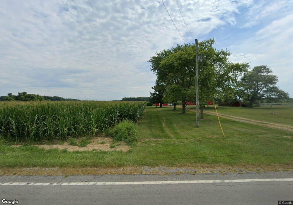
13819 State Route 37 Arlington, OH 45814
Estimated Value: $239,295 - $405,000
3
Beds
2
Baths
1,876
Sq Ft
$158/Sq Ft
Est. Value
About This Home
This home is located at 13819 State Route 37, Arlington, OH 45814 and is currently estimated at $296,074, approximately $157 per square foot. 13819 State Route 37 is a home located in Hancock County with nearby schools including Riverdale Middle School and Riverdale High School.
Ownership History
Date
Name
Owned For
Owner Type
Purchase Details
Closed on
Oct 18, 2016
Sold by
Bradley D Cherry
Bought by
Scanland Cynthia
Current Estimated Value
Home Financials for this Owner
Home Financials are based on the most recent Mortgage that was taken out on this home.
Original Mortgage
$275,000
Outstanding Balance
$220,534
Interest Rate
3.47%
Estimated Equity
$75,540
Purchase Details
Closed on
Sep 14, 1999
Sold by
Pever Robert
Bought by
Thomas Graham and Thomas Cyndi
Home Financials for this Owner
Home Financials are based on the most recent Mortgage that was taken out on this home.
Original Mortgage
$119,200
Interest Rate
5.99%
Mortgage Type
New Conventional
Purchase Details
Closed on
Nov 19, 1982
Bought by
Pever Robert and Pever Linda L
Create a Home Valuation Report for This Property
The Home Valuation Report is an in-depth analysis detailing your home's value as well as a comparison with similar homes in the area
Home Values in the Area
Average Home Value in this Area
Purchase History
| Date | Buyer | Sale Price | Title Company |
|---|---|---|---|
| Scanland Cynthia | -- | -- | |
| Thomas Graham | $149,000 | -- | |
| Pever Robert | -- | -- |
Source: Public Records
Mortgage History
| Date | Status | Borrower | Loan Amount |
|---|---|---|---|
| Open | Scanland Cynthia | $275,000 | |
| Closed | Scanland Cynthia | -- | |
| Previous Owner | Thomas Graham | $119,200 |
Source: Public Records
Tax History Compared to Growth
Tax History
| Year | Tax Paid | Tax Assessment Tax Assessment Total Assessment is a certain percentage of the fair market value that is determined by local assessors to be the total taxable value of land and additions on the property. | Land | Improvement |
|---|---|---|---|---|
| 2024 | $1,477 | $54,400 | $12,350 | $42,050 |
| 2023 | $1,466 | $54,400 | $12,350 | $42,050 |
| 2022 | $1,560 | $54,400 | $12,350 | $42,050 |
| 2021 | $1,308 | $39,760 | $12,130 | $27,630 |
| 2020 | $1,305 | $39,760 | $12,130 | $27,630 |
| 2019 | $1,274 | $39,760 | $12,130 | $27,630 |
| 2018 | $1,062 | $34,840 | $10,550 | $24,290 |
| 2017 | $1,088 | $34,840 | $10,550 | $24,290 |
| 2016 | $1,566 | $34,840 | $10,550 | $24,290 |
| 2015 | $957 | $32,340 | $10,550 | $21,790 |
| 2014 | $939 | $32,340 | $10,550 | $21,790 |
| 2012 | $1,014 | $32,340 | $10,550 | $21,790 |
Source: Public Records
Map
Nearby Homes
- 11955 State Route 37
- 15152 Township Road 190
- 15055 County Road 26
- 11787 County Road 180
- 14610 Township Road 205
- 10770 County Road 180
- 0 Township Road 227
- 13385 Deer Landing Dr
- 15739 Mallard Ln
- 15107 Township Road 208
- 3065 S Main St
- 1815 Eastview Dr
- 1818 Westview Dr
- 1726 Eastview Dr
- 1709 Eastview Dr
- 1933 Lippincott Ave
- 0 Viburnum Ct Unit 20243687
- 0 Viburnum Ct Unit 6121366
- 112 W Main St
- 0 Blanchard Ave
- 13840 State Route 37
- 13840 Ohio 37
- 14060 Ohio 37
- 14060 State Route 37
- 16297 Township Road 168
- 16297 Trail 168
- 14175 State Route 37
- 16424 Township Road 168
- 14180 State Route 37
- 14204 State Route 37
- 14300 State Route 37
- 15595 Township Road 168
- 14350 Ohio 37
- 14350 State Route 37
- 14350 State Route 37
- 14389 State Route 37
- 14389 Ohio 37
- 16612 Township Road 168
- 15467 Township Road 168
- 15954 Township Road 166
