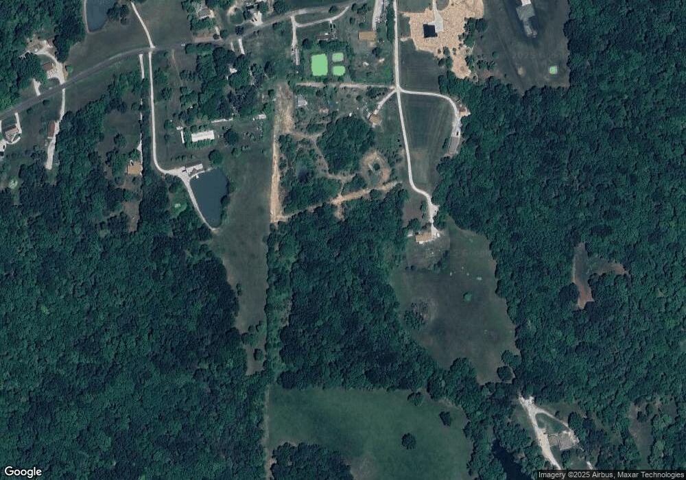
1382 Jones Potter Rd Holts Summit, MO 65043
Estimated Value: $250,000 - $589,000
--
Bed
1
Bath
1,159
Sq Ft
$327/Sq Ft
Est. Value
About This Home
This home is located at 1382 Jones Potter Rd, Holts Summit, MO 65043 and is currently estimated at $379,489, approximately $327 per square foot. 1382 Jones Potter Rd is a home located in Callaway County with nearby schools including North Elementary School, Lewis & Clark Middle School, and Jefferson City High School.
Ownership History
Date
Name
Owned For
Owner Type
Purchase Details
Closed on
Feb 13, 2009
Sold by
Jones Jack and Jones Lisa
Bought by
Wetzel Ii James Edwin and Wetzel Tracey Ann
Current Estimated Value
Home Financials for this Owner
Home Financials are based on the most recent Mortgage that was taken out on this home.
Original Mortgage
$54,601
Interest Rate
5.5%
Mortgage Type
Future Advance Clause Open End Mortgage
Create a Home Valuation Report for This Property
The Home Valuation Report is an in-depth analysis detailing your home's value as well as a comparison with similar homes in the area
Home Values in the Area
Average Home Value in this Area
Purchase History
| Date | Buyer | Sale Price | Title Company |
|---|---|---|---|
| Wetzel Ii James Edwin | -- | None Available |
Source: Public Records
Mortgage History
| Date | Status | Borrower | Loan Amount |
|---|---|---|---|
| Closed | Wetzel Ii James Edwin | $54,601 |
Source: Public Records
Tax History Compared to Growth
Tax History
| Year | Tax Paid | Tax Assessment Tax Assessment Total Assessment is a certain percentage of the fair market value that is determined by local assessors to be the total taxable value of land and additions on the property. | Land | Improvement |
|---|---|---|---|---|
| 2024 | $1,698 | $27,239 | $0 | $0 |
| 2023 | $1,698 | $0 | $0 | $0 |
| 2022 | $1,464 | $23,486 | $1,490 | $21,996 |
| 2021 | $1,454 | $23,486 | $1,490 | $21,996 |
| 2020 | $1,473 | $23,486 | $1,490 | $21,996 |
| 2019 | $1,412 | $23,486 | $1,490 | $21,996 |
| 2018 | $1,418 | $23,499 | $1,503 | $21,996 |
| 2017 | $1,002 | $16,847 | $1,598 | $15,249 |
| 2016 | $859 | $16,850 | $0 | $0 |
| 2015 | $861 | $16,850 | $0 | $0 |
| 2014 | $879 | $16,830 | $0 | $0 |
Source: Public Records
Map
Nearby Homes
- 11251 County Road 391
- 11065 Ridge Fork Dr
- LOT 31 Hailey Ln
- 1922 State Road Oo
- 10 The Bluffs
- LOT 6 Willow Woods
- 41 acres Dover Dr
- 11922 Oak Ridge Ln
- TBD Edwards Dr
- 0 Edwards Dr
- 425 Edwards Dr
- 208 S Greenway Dr
- 232 Pheasant Ln
- 633 Emerald Point Rd
- 1148 S Summit Dr
- 734 Vine Dr
- 270 Brookstone Dr
- 27 Walnut
- 10871 Mallard Ct
- 775 Vine Dr
- 11250 County Road 391
- 1362 Jones Potter Rd
- 11272 County Road 391
- 1350 Jones Potter Rd
- 11264 County Road 391
- 11217 County Road 391
- 11263 County Road 391
- 11274 County Road 391
- 1442 State Road Oo
- 11275 County Road 391
- 1425 State Road Oo
- 11310 County 391 Rd
- 11310 County Road 391
- 11311 County Road 391
- 1454 State Road Oo
- 11179 County Road 391
- 11154 County Road 391
- 1443 State Road Oo
- 11322 County Road 391
- 11172 County Road 391
