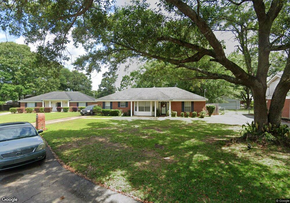
1382 Lexington Way Mobile, AL 36695
Baker NeighborhoodEstimated Value: $199,495 - $210,000
3
Beds
2
Baths
1,503
Sq Ft
$138/Sq Ft
Est. Value
About This Home
This home is located at 1382 Lexington Way, Mobile, AL 36695 and is currently estimated at $206,874, approximately $137 per square foot. 1382 Lexington Way is a home located in Mobile County with nearby schools including Elsie Collier Elementary School, Bernice J Causey Middle School, and Baker High School.
Ownership History
Date
Name
Owned For
Owner Type
Purchase Details
Closed on
Dec 28, 2022
Sold by
Turner Peggy A
Bought by
Not Given
Current Estimated Value
Purchase Details
Closed on
Jan 29, 1999
Sold by
Ramsey Jay John and Ramsey Tracey
Bought by
Turner Peggy A
Home Financials for this Owner
Home Financials are based on the most recent Mortgage that was taken out on this home.
Original Mortgage
$91,453
Interest Rate
6.72%
Mortgage Type
FHA
Create a Home Valuation Report for This Property
The Home Valuation Report is an in-depth analysis detailing your home's value as well as a comparison with similar homes in the area
Home Values in the Area
Average Home Value in this Area
Purchase History
| Date | Buyer | Sale Price | Title Company |
|---|---|---|---|
| Not Given | -- | -- | |
| Turner Peggy A | -- | -- |
Source: Public Records
Mortgage History
| Date | Status | Borrower | Loan Amount |
|---|---|---|---|
| Previous Owner | Turner Peggy A | $91,453 |
Source: Public Records
Tax History Compared to Growth
Tax History
| Year | Tax Paid | Tax Assessment Tax Assessment Total Assessment is a certain percentage of the fair market value that is determined by local assessors to be the total taxable value of land and additions on the property. | Land | Improvement |
|---|---|---|---|---|
| 2024 | -- | $16,900 | $3,000 | $13,900 |
| 2023 | $628 | $14,320 | $3,300 | $11,020 |
| 2022 | $556 | $12,840 | $3,000 | $9,840 |
| 2021 | $569 | $13,120 | $2,400 | $10,720 |
| 2020 | $583 | $13,400 | $2,400 | $11,000 |
| 2019 | $575 | $13,240 | $0 | $0 |
| 2018 | $536 | $12,440 | $0 | $0 |
| 2017 | $595 | $12,200 | $0 | $0 |
| 2016 | $562 | $12,960 | $0 | $0 |
| 2013 | $606 | $12,160 | $0 | $0 |
Source: Public Records
Map
Nearby Homes
- 0 New Neck Rd Unit 387066
- 9425 Yorktowne Way
- 9410 Ashwood Ct
- 9556 Bridgeton Ct
- 1111 Valley View Ct
- 860 Trailwood Dr E
- 821 Copperfield Dr W
- 9751 Pine Knoll Rd
- 11900 Airport Blvd
- 790 Hale Rd
- 791 Copperfield Dr W
- 789 Royal Woods Dr W Unit 7
- 0 Twelve Oaks Dr Unit 7603591
- 781 Copperfield Dr W
- 1235 Wakefield Dr E
- 11905 Airport Blvd
- 11905 Airport Blvd Unit 3
- 750 Hale Rd
- 10061 Sasser Ln
- 9721 Royal Woods Dr N
- 1380 Lexington Way
- 1384 Lexington Way
- 9475 Gaslight Ct
- 1370 Lexington Way
- 9515 Gaslight Ct
- 1386 Lexington Way
- 9525 Gaslight Ct
- 1360 Lexington Way
- 1387 Lexington Way
- 9485 Gaslight Ct
- 1349 Smokerise Dr
- 1339 Smokerise Dr
- 1389 Lexington Way
- 1391 Lexington Way
- 1385 Lexington Way
- 1359 Smokerise Dr
- 1350 Lexington Way
- 1315 Smokerise Dr
- 1379 Smokerise Dr
- 1379 Smokerise Dr Unit 2