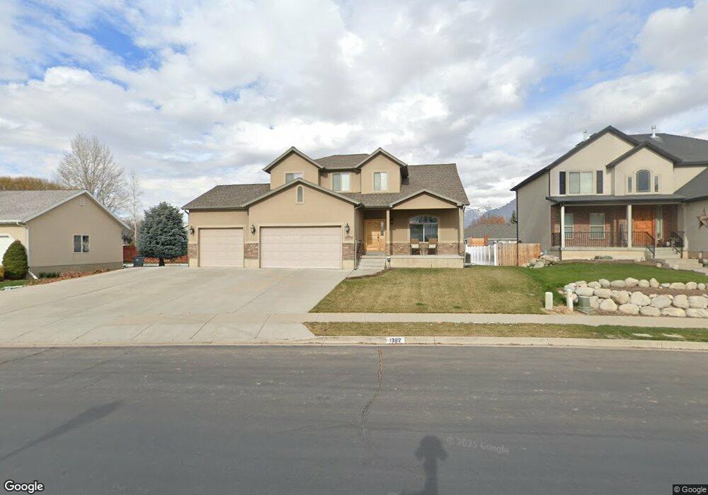
1382 W 800 N Pleasant Grove, UT 84062
Estimated Value: $661,000 - $726,000
4
Beds
3
Baths
3,158
Sq Ft
$220/Sq Ft
Est. Value
About This Home
This home is located at 1382 W 800 N, Pleasant Grove, UT 84062 and is currently estimated at $693,874, approximately $219 per square foot. 1382 W 800 N is a home located in Utah County with nearby schools including Mount Mahogany School, Pleasant Grove Junior High School, and Pleasant Grove High School.
Ownership History
Date
Name
Owned For
Owner Type
Purchase Details
Closed on
Apr 8, 2020
Sold by
Warwick David
Bought by
Warwick Judy
Current Estimated Value
Home Financials for this Owner
Home Financials are based on the most recent Mortgage that was taken out on this home.
Original Mortgage
$326,000
Outstanding Balance
$288,796
Interest Rate
3.4%
Mortgage Type
New Conventional
Estimated Equity
$405,078
Purchase Details
Closed on
Aug 11, 2006
Sold by
Allred Brothers Llc
Bought by
Lone Peak Development Llc
Create a Home Valuation Report for This Property
The Home Valuation Report is an in-depth analysis detailing your home's value as well as a comparison with similar homes in the area
Home Values in the Area
Average Home Value in this Area
Purchase History
| Date | Buyer | Sale Price | Title Company |
|---|---|---|---|
| Warwick Judy | -- | Integrated Title Ins Svc | |
| Lone Peak Development Llc | -- | Mountain West Title Company |
Source: Public Records
Mortgage History
| Date | Status | Borrower | Loan Amount |
|---|---|---|---|
| Open | Warwick Judy | $326,000 |
Source: Public Records
Tax History Compared to Growth
Tax History
| Year | Tax Paid | Tax Assessment Tax Assessment Total Assessment is a certain percentage of the fair market value that is determined by local assessors to be the total taxable value of land and additions on the property. | Land | Improvement |
|---|---|---|---|---|
| 2025 | $2,618 | $340,670 | $205,700 | $413,700 |
| 2024 | $2,618 | $312,510 | $0 | $0 |
| 2023 | $2,580 | $315,150 | $0 | $0 |
| 2022 | $2,815 | $342,155 | $0 | $0 |
| 2021 | $2,526 | $467,500 | $137,800 | $329,700 |
| 2020 | $2,315 | $420,000 | $123,000 | $297,000 |
| 2019 | $1,948 | $365,500 | $119,300 | $246,200 |
| 2018 | $1,936 | $343,600 | $111,800 | $231,800 |
| 2017 | $1,892 | $178,750 | $0 | $0 |
| 2016 | $1,905 | $173,745 | $0 | $0 |
| 2015 | $1,858 | $160,490 | $0 | $0 |
| 2014 | $1,747 | $149,490 | $0 | $0 |
Source: Public Records
Map
Nearby Homes
- 1443 W 1010 N
- 1491 W 1010 N
- 1515 W 1010 St N
- 1065 N 1420 W
- 1541 W 1060 N
- 1096 N 1420 St W Unit 27
- 1498 W 1060 N Unit 5
- Lytham Plan at Grove Acres
- 1598 W 220 N
- 1171 N 1430 W
- 1130 W State Rd
- 295 N 1580 W
- 1525 W 300 N
- 293 N 1630 W
- 1879 W 1100 N
- 1320 W 1340 N
- 1541 W 250 N
- 759 W 930 N Unit 502
- 708 W 930 N Unit 505
- 734 W 930 N Unit 506