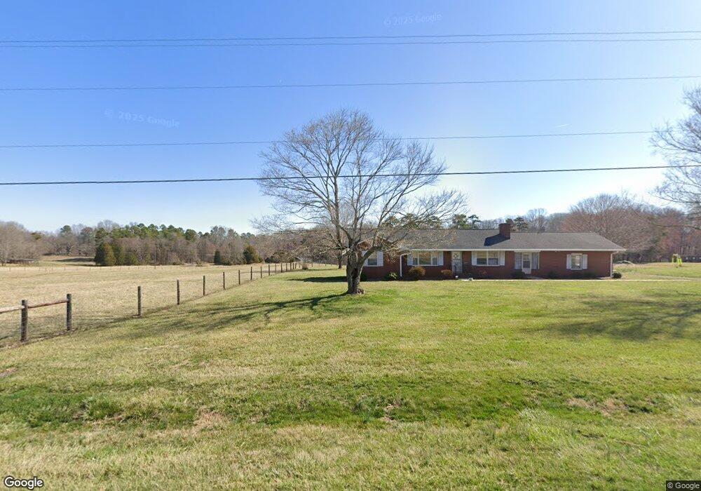
1383 Baltimore Rd Advance, NC 27006
Estimated Value: $399,000 - $434,000
3
Beds
2
Baths
1,420
Sq Ft
$293/Sq Ft
Est. Value
About This Home
This home is located at 1383 Baltimore Rd, Advance, NC 27006 and is currently estimated at $416,457, approximately $293 per square foot. 1383 Baltimore Rd is a home located in Davie County with nearby schools including Shady Grove Elementary School, William Ellis Middle School, and Davie County High School.
Ownership History
Date
Name
Owned For
Owner Type
Purchase Details
Closed on
Oct 19, 2023
Sold by
Foster Thomas Randell
Bought by
Nail W Eugene W and Nail Norma V
Current Estimated Value
Home Financials for this Owner
Home Financials are based on the most recent Mortgage that was taken out on this home.
Original Mortgage
$200,000
Outstanding Balance
$181,978
Interest Rate
5%
Mortgage Type
New Conventional
Estimated Equity
$234,479
Purchase Details
Closed on
Jun 1, 1997
Create a Home Valuation Report for This Property
The Home Valuation Report is an in-depth analysis detailing your home's value as well as a comparison with similar homes in the area
Home Values in the Area
Average Home Value in this Area
Purchase History
| Date | Buyer | Sale Price | Title Company |
|---|---|---|---|
| Nail W Eugene W | $390,000 | None Listed On Document | |
| Nail W Eugene W | $390,000 | None Listed On Document | |
| -- | $67,500 | -- |
Source: Public Records
Mortgage History
| Date | Status | Borrower | Loan Amount |
|---|---|---|---|
| Open | Nail W Eugene W | $200,000 | |
| Closed | Nail W Eugene W | $200,000 |
Source: Public Records
Tax History Compared to Growth
Tax History
| Year | Tax Paid | Tax Assessment Tax Assessment Total Assessment is a certain percentage of the fair market value that is determined by local assessors to be the total taxable value of land and additions on the property. | Land | Improvement |
|---|---|---|---|---|
| 2025 | $2,407 | $337,540 | $161,640 | $175,900 |
| 2024 | $2,121 | $265,990 | $161,640 | $104,350 |
| 2023 | $2,121 | $265,990 | $161,640 | $104,350 |
| 2022 | $2,134 | $265,990 | $161,640 | $104,350 |
| 2021 | $2,121 | $265,990 | $161,640 | $104,350 |
| 2020 | $1,912 | $238,230 | $142,920 | $95,310 |
| 2019 | $1,912 | $238,230 | $142,920 | $95,310 |
| 2018 | $1,853 | $238,230 | $142,920 | $95,310 |
| 2017 | $1,830 | $238,230 | $0 | $0 |
| 2016 | $1,845 | $240,240 | $0 | $0 |
| 2015 | $1,845 | $240,240 | $0 | $0 |
| 2014 | -- | $240,240 | $0 | $0 |
| 2013 | -- | $240,240 | $0 | $0 |
Source: Public Records
Map
Nearby Homes
- 200 Montclair Dr
- 326 Granada Dr
- 190 James Rd
- 117 Essex Farm Rd
- 443 Rabbit Farm Trail
- 104 Wyatt Dr
- 183 Arrow Glenn Ct
- 128 Lantern Dr
- 107 Meeting House Ln
- 224 Ralph Rd
- 137 Savannah Ct
- 1362 Cornatzer Rd
- 126 Crestwood Ct
- 2215 Milling Rd
- 260 Mocks Church Rd
- 2408 Milling Rd
- 153 Caudle Meadows Dr
- 376 Kingsmill Dr
- 123 Meadows Edge Dr
- 372 Comanche Dr
- 1401 Baltimore Rd
- 1393 Baltimore Rd
- 1413 Baltimore Rd
- 1339 Baltimore Rd
- 1423 Baltimore Rd
- 1430 Baltimore Rd
- 142 Jetry Ln
- 1332 Baltimore Rd
- 1323 Baltimore Rd
- 1340 Baltimore Rd
- 118 Princeton Ct
- 108 Princeton Ct
- 136 Princeton Ct
- 1318 Baltimore Rd
- 146 Princeton Ct
- 144 Camden Ct
- 132 Camden Ct
- 154 Princeton Ct
- 118 Camden Ct
- 156 Camden Ct