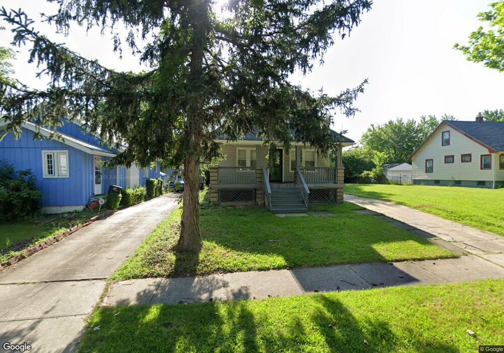
1383 E 219th St Euclid, OH 44117
Estimated Value: $82,311 - $151,000
2
Beds
1
Bath
966
Sq Ft
$110/Sq Ft
Est. Value
About This Home
This home is located at 1383 E 219th St, Euclid, OH 44117 and is currently estimated at $106,578, approximately $110 per square foot. 1383 E 219th St is a home located in Cuyahoga County with nearby schools including Bluestone Elementary School, Euclid Middle School, and Euclid High School.
Ownership History
Date
Name
Owned For
Owner Type
Purchase Details
Closed on
Dec 16, 2013
Sold by
Smith Leslie B and Smith Clarice
Bought by
Hobbs Stephanie Y
Current Estimated Value
Purchase Details
Closed on
Sep 1, 1998
Sold by
Miller Timothy
Bought by
Smith Leslie B and Smith Stephanie Y
Home Financials for this Owner
Home Financials are based on the most recent Mortgage that was taken out on this home.
Original Mortgage
$81,442
Interest Rate
7.03%
Mortgage Type
FHA
Purchase Details
Closed on
Dec 26, 1997
Sold by
Lucke B Harrison Est
Bought by
Miller Timothy
Purchase Details
Closed on
Jan 21, 1977
Sold by
Harrison Robert G and Harrison Lucille B
Bought by
Harrison Lucile B
Purchase Details
Closed on
Jan 1, 1975
Bought by
Harrison Robert G and Harrison Lucille B
Create a Home Valuation Report for This Property
The Home Valuation Report is an in-depth analysis detailing your home's value as well as a comparison with similar homes in the area
Home Values in the Area
Average Home Value in this Area
Purchase History
| Date | Buyer | Sale Price | Title Company |
|---|---|---|---|
| Hobbs Stephanie Y | $15,750 | Public | |
| Smith Leslie B | $81,500 | -- | |
| Miller Timothy | $40,000 | -- | |
| Harrison Lucile B | -- | -- | |
| Harrison Robert G | -- | -- |
Source: Public Records
Mortgage History
| Date | Status | Borrower | Loan Amount |
|---|---|---|---|
| Previous Owner | Smith Leslie B | $81,442 |
Source: Public Records
Tax History
| Year | Tax Paid | Tax Assessment Tax Assessment Total Assessment is a certain percentage of the fair market value that is determined by local assessors to be the total taxable value of land and additions on the property. | Land | Improvement |
|---|---|---|---|---|
| 2025 | $1,364 | $19,285 | $5,390 | $13,895 |
| 2024 | $1,406 | $19,285 | $5,390 | $13,895 |
| 2023 | $1,307 | $13,940 | $4,170 | $9,770 |
| 2022 | $1,363 | $15,260 | $4,170 | $11,100 |
| 2021 | $1,508 | $15,260 | $4,170 | $11,100 |
| 2020 | $1,276 | $11,550 | $3,150 | $8,400 |
| 2019 | $1,141 | $33,000 | $9,000 | $24,000 |
| 2018 | $1,229 | $11,550 | $3,150 | $8,400 |
| 2017 | $1,124 | $9,380 | $2,590 | $6,790 |
| 2016 | $1,127 | $9,380 | $2,590 | $6,790 |
| 2015 | $1,194 | $9,380 | $2,590 | $6,790 |
| 2014 | $1,194 | $11,030 | $3,050 | $7,980 |
Source: Public Records
Map
Nearby Homes
- 1554 E 221st St
- 21950 Euclid Ave
- 1545 E 214th St
- 23501 Effingham Blvd
- 1754 E 236th St
- 2010 E 226th St
- 931 E 214th St
- 1765 E 238th St
- 824 E 207th St
- 1775 Sherwood Blvd
- 24105 Chardon Rd
- 21840 Miller Ave
- 19210 Firwood Rd
- 1732 Glenridge Rd
- 19316 Shawnee Ave
- 934 E 223rd St
- 20430 Miller Ave
- 828 E 216th St
- 19810 Muskoka Ave
- 25031 Glenbrook Blvd
- 1379 E 219th St
- 1393 E 219th St
- 1395 E 219th St
- 1375 E 219th St
- 1401 E 219th St
- 1371 E 219th St
- 1410 E 221st St
- 1408 E 221st St
- 1420 E 221st St
- 1404 E 221st St
- 1414 E 221st St
- 1407 E 219th St
- 1390 E 221st St
- 1422 E 221st St
- 1413 E 219th St
- 1430 E 221st St
- 1417 E 219th St
- 1434 E 221st St
- 1440 E 221st St
- 1421 E 219th St
Your Personal Tour Guide
Ask me questions while you tour the home.