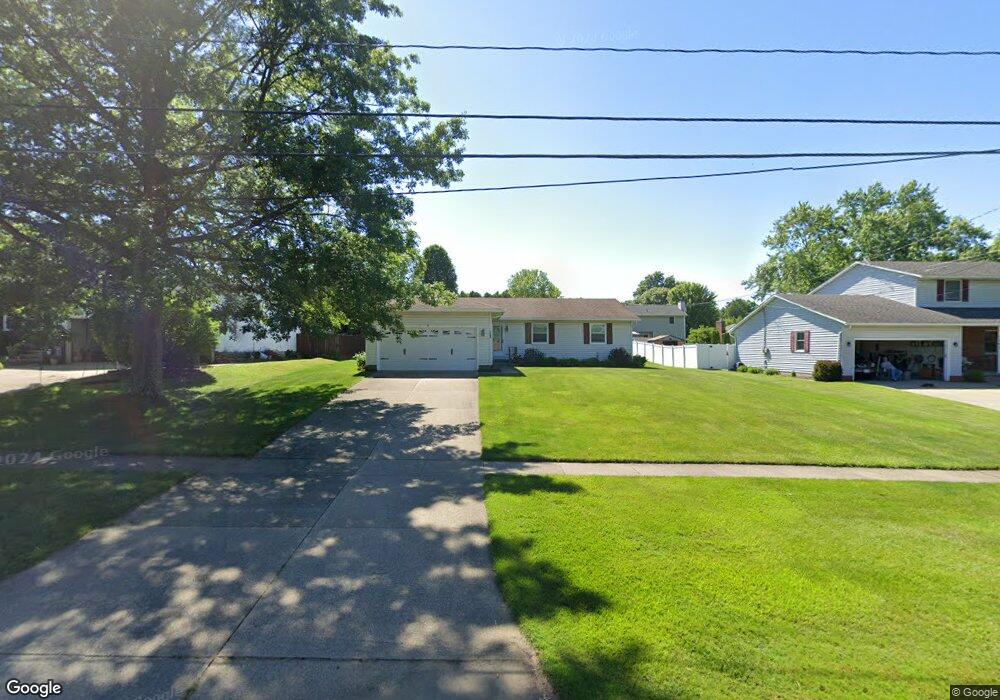
1384 State Rd Wadsworth, OH 44281
Estimated Value: $298,472 - $323,000
3
Beds
7
Baths
1,500
Sq Ft
$206/Sq Ft
Est. Value
About This Home
This home is located at 1384 State Rd, Wadsworth, OH 44281 and is currently estimated at $308,618, approximately $205 per square foot. 1384 State Rd is a home located in Medina County with nearby schools including Valley View Elementary School, Central Intermediate School, and Wadsworth Middle School.
Ownership History
Date
Name
Owned For
Owner Type
Purchase Details
Closed on
Sep 17, 2009
Sold by
Cummings Kimberly and Hoover Mark A
Bought by
Cummings Kimberly
Current Estimated Value
Purchase Details
Closed on
May 14, 2004
Sold by
Hoover Barbara A
Bought by
Cummings Kimberly and Hoover Mark A
Purchase Details
Closed on
Mar 12, 2004
Sold by
Cummings Kimberly and Hoover Mark A
Bought by
Hoover Barbara A
Purchase Details
Closed on
Dec 18, 2003
Sold by
Hoover Gary L and Hoover Barbara A
Bought by
Cummings Kimberly and Cummings Mark A
Create a Home Valuation Report for This Property
The Home Valuation Report is an in-depth analysis detailing your home's value as well as a comparison with similar homes in the area
Home Values in the Area
Average Home Value in this Area
Purchase History
| Date | Buyer | Sale Price | Title Company |
|---|---|---|---|
| Cummings Kimberly | -- | -- | |
| Cummings Kimberly | -- | -- | |
| Hoover Barbara A | -- | -- | |
| Cummings Kimberly | -- | -- |
Source: Public Records
Tax History
| Year | Tax Paid | Tax Assessment Tax Assessment Total Assessment is a certain percentage of the fair market value that is determined by local assessors to be the total taxable value of land and additions on the property. | Land | Improvement |
|---|---|---|---|---|
| 2024 | $3,310 | $69,990 | $21,880 | $48,110 |
| 2023 | $3,073 | $69,990 | $21,880 | $48,110 |
| 2022 | $3,083 | $69,990 | $21,880 | $48,110 |
| 2021 | $2,912 | $55,990 | $17,500 | $38,490 |
| 2020 | $2,565 | $55,990 | $17,500 | $38,490 |
| 2019 | $2,568 | $55,990 | $17,500 | $38,490 |
| 2018 | $2,612 | $53,420 | $19,760 | $33,660 |
| 2017 | $2,613 | $53,420 | $19,760 | $33,660 |
| 2016 | $2,657 | $53,420 | $19,760 | $33,660 |
| 2015 | $2,567 | $49,010 | $18,130 | $30,880 |
| 2014 | $2,609 | $49,010 | $18,130 | $30,880 |
| 2013 | $2,613 | $49,010 | $18,130 | $30,880 |
Source: Public Records
Map
Nearby Homes
- 1426 Cherry Wood Cir
- 1482 Barrymore Ln
- 4896 Ridge Rd
- 1396 Tullamore Trail
- 1411 Tullamore Trail
- 7565 John Arthur Ln
- 7553 John Arthur Ln
- 1250 Reserve Blvd
- 456 Weatherstone Dr
- 1166 Reserve Blvd
- 1138 Ledgestone Dr
- 976 Rosemarie Cir Unit 68
- 330 Deepwood Dr
- 281 Park Place Dr Unit 76
- 290 Park Place Dr Unit 72
- 681 Highland Ave
- V/L Hartman Rd
- 7743 Beach Rd
- 236 Knollwood Dr
- 1315 Fieldcrest Dr Unit 90
- 1392 State Rd
- 1376 State Rd
- 1425 Cherry Wood Cir
- 1400 State Rd
- 1368 State Rd
- 1417 Cherry Wood Cir
- 1411 Cherry Wood Cir
- 1435 Cherry Wood Cir
- 1360 State Rd
- 1408 State Rd
- 125 Cherry Hill Dr
- 1446 Cherry Wood Cir
- 1352 State Rd
- 1418 Cherry Wood Cir
- 1406 Cherry Wood Cir
- 1442 Cherry Wood Cir
- 1424 State Rd
- 1432 Cherry Wood Cir
- 0 State Rd
- 999 V/L State Rd
Your Personal Tour Guide
Ask me questions while you tour the home.