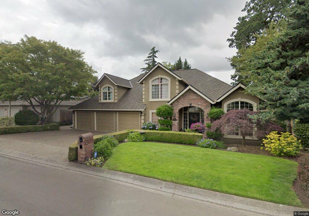
13848 Amberwood Cir Lake Oswego, OR 97035
Westlake NeighborhoodEstimated Value: $1,327,221 - $1,464,000
3
Beds
3
Baths
3,468
Sq Ft
$406/Sq Ft
Est. Value
About This Home
This home is located at 13848 Amberwood Cir, Lake Oswego, OR 97035 and is currently estimated at $1,407,555, approximately $405 per square foot. 13848 Amberwood Cir is a home located in Clackamas County with nearby schools including Lake Grove Elementary School, Lake Oswego Junior High School, and Lake Oswego Senior High School.
Ownership History
Date
Name
Owned For
Owner Type
Purchase Details
Closed on
Jun 12, 1998
Sold by
Wolff Thomas J and Wolff Margaret D
Bought by
Christenson Craig and Christenson Katherine A
Current Estimated Value
Home Financials for this Owner
Home Financials are based on the most recent Mortgage that was taken out on this home.
Original Mortgage
$320,000
Outstanding Balance
$63,344
Interest Rate
7.25%
Estimated Equity
$1,344,211
Create a Home Valuation Report for This Property
The Home Valuation Report is an in-depth analysis detailing your home's value as well as a comparison with similar homes in the area
Home Values in the Area
Average Home Value in this Area
Purchase History
| Date | Buyer | Sale Price | Title Company |
|---|---|---|---|
| Christenson Craig | $400,000 | Oregon Title Insurance Co |
Source: Public Records
Mortgage History
| Date | Status | Borrower | Loan Amount |
|---|---|---|---|
| Open | Christenson Craig | $320,000 |
Source: Public Records
Tax History Compared to Growth
Tax History
| Year | Tax Paid | Tax Assessment Tax Assessment Total Assessment is a certain percentage of the fair market value that is determined by local assessors to be the total taxable value of land and additions on the property. | Land | Improvement |
|---|---|---|---|---|
| 2025 | $13,844 | $720,902 | -- | -- |
| 2024 | $13,475 | $699,905 | -- | -- |
| 2023 | $13,475 | $679,520 | $0 | $0 |
| 2022 | $12,691 | $659,729 | $0 | $0 |
| 2021 | $11,722 | $640,514 | $0 | $0 |
| 2020 | $11,427 | $621,859 | $0 | $0 |
| 2019 | $11,146 | $603,747 | $0 | $0 |
| 2018 | $10,600 | $586,162 | $0 | $0 |
| 2017 | $10,228 | $569,089 | $0 | $0 |
| 2016 | $9,311 | $552,514 | $0 | $0 |
| 2015 | $8,996 | $536,421 | $0 | $0 |
| 2014 | $8,880 | $520,797 | $0 | $0 |
Source: Public Records
Map
Nearby Homes
- 5094 Denton Dr
- 86 SW Kingsgate Unit 22
- 5952 Sunbrook Dr
- 4674 Chelsea Ln
- 4735 Amherst Ct
- 5437 Rosalia Way
- 61 Galen Rd
- 5530 Bay Creek Dr
- 13541 SW 63rd Place
- 5093 Galen St
- 4963 Suntree Ln
- 4355 Silver Ct
- 4451 Golden Ln
- 13002 Sierra Vista Dr
- 4300 Orchard Way
- 4463 Thunder Vista Ln
- 4459 Thunder Vista Ln
- 4455 Thunder Vista Ln
- 5834 Ridgetop Ct
- 4437 Thunder Vista Ln
- 13852 Amberwood Cir
- 13836 Amberwood Cir
- 5459 Westfield Ct
- 5435 Westfield Ct
- 5413 Westfield Ct
- 5475 Westfield Ct
- 13845 Amberwood Cir
- 14231 Edenberry Dr
- 13857 Amberwood Cir
- 13864 Amberwood Cir
- 14257 Edenberry Dr
- 13833 Amberwood Cir
- 14283 Edenberry Dr
- 13869 Amberwood Cir
- 14205 Edenberry Dr
- 5493 Westfield Ct
- 13878 Amberwood Cir
- 5364 Denton Dr
- 5444 Westfield Ct
- 5326 Denton Dr