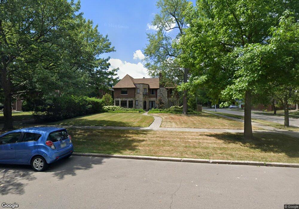
1385 Berkshire Rd Unit Bldg-Unit Grosse Pointe Park, MI 48230
Estimated Value: $716,874 - $816,000
--
Bed
4
Baths
3,452
Sq Ft
$218/Sq Ft
Est. Value
About This Home
This home is located at 1385 Berkshire Rd Unit Bldg-Unit, Grosse Pointe Park, MI 48230 and is currently estimated at $753,219, approximately $218 per square foot. 1385 Berkshire Rd Unit Bldg-Unit is a home located in Wayne County with nearby schools including George Defer Elementary School, Pierce Middle School, and Grosse Pointe South High School.
Ownership History
Date
Name
Owned For
Owner Type
Purchase Details
Closed on
Oct 29, 2021
Sold by
Blackford Eric and Blackford Eric T
Bought by
Risher Edward Henkel and Risher Ariadna
Current Estimated Value
Purchase Details
Closed on
Oct 26, 2018
Sold by
Szabla Sam
Bought by
Blackford Erick
Purchase Details
Closed on
Jan 19, 2018
Sold by
The Estate Of Raymond A Macdonald
Bought by
Szabla Sam
Purchase Details
Closed on
Jan 18, 2018
Sold by
Macdonald Susan M
Bought by
Macdonald Raymond A
Create a Home Valuation Report for This Property
The Home Valuation Report is an in-depth analysis detailing your home's value as well as a comparison with similar homes in the area
Home Values in the Area
Average Home Value in this Area
Purchase History
| Date | Buyer | Sale Price | Title Company |
|---|---|---|---|
| Risher Edward Henkel | $630,000 | Ata National Title Group Llc | |
| Blackford Erick | $515,000 | Colonial Title Co | |
| Szabla Sam | $250,000 | Fidelity National Title | |
| Macdonald Raymond A | -- | None Available |
Source: Public Records
Tax History Compared to Growth
Tax History
| Year | Tax Paid | Tax Assessment Tax Assessment Total Assessment is a certain percentage of the fair market value that is determined by local assessors to be the total taxable value of land and additions on the property. | Land | Improvement |
|---|---|---|---|---|
| 2025 | $6,945 | $311,000 | $0 | $0 |
| 2024 | $6,945 | $297,700 | $0 | $0 |
| 2023 | $6,632 | $270,400 | $0 | $0 |
| 2022 | $6,301 | $253,900 | $0 | $0 |
| 2021 | $11,621 | $263,700 | $0 | $0 |
| 2019 | $11,959 | $222,500 | $0 | $0 |
| 2018 | $4,396 | $192,100 | $0 | $0 |
| 2017 | $9,790 | $143,000 | $0 | $0 |
| 2016 | $9,952 | $204,300 | $0 | $0 |
| 2015 | $17,796 | $181,000 | $0 | $0 |
| 2013 | $17,240 | $175,500 | $0 | $0 |
| 2012 | $4,873 | $185,200 | $61,300 | $123,900 |
Source: Public Records
Map
Nearby Homes
- 1350 Buckingham Rd
- 1425 Bedford Rd
- 1417 Beaconsfield Ave
- 1306 Beaconsfield Ave Unit 1308
- 1451 Beaconsfield Ave
- 3636 Buckingham Ave
- 1254 Beaconsfield Ave
- 3485 Bedford St
- 3650 Somerset Ave
- 3477 Bedford St
- 3430 Bedford St
- 3666 Somerset Ave
- 15239 Mack Ave
- 3900 Somerset Ave
- 1386 Three Mile Dr
- 3479 Courville St
- 1316 Maryland St
- 3615 Barham St
- 3918 Nottingham Rd
- 3661 Beaconsfield St
- 1385 Berkshire Rd
- 1379 Berkshire Rd
- 1405 Berkshire Rd
- 1371 Berkshire Rd
- 1384 Balfour St
- 1378 Balfour St
- 1411 Berkshire Rd
- 1365 Berkshire Rd
- 1404 Balfour St
- 1372 Balfour St
- 1410 Balfour St
- 1366 Balfour St Unit Bldg-Unit
- 1366 Balfour St
- 1384 Berkshire Rd
- 1378 Berkshire Rd
- 1359 Berkshire Rd
- 1417 Berkshire Rd
- 1404 Berkshire Rd
- 1370 Berkshire Rd
- 1416 Balfour St