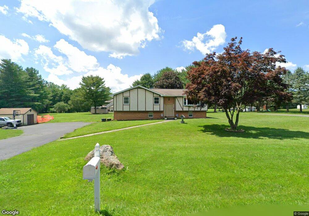
1385 Broad Rd Wind Gap, PA 18091
Estimated Value: $365,000 - $470,000
3
Beds
1
Bath
1,978
Sq Ft
$210/Sq Ft
Est. Value
About This Home
This home is located at 1385 Broad Rd, Wind Gap, PA 18091 and is currently estimated at $415,330, approximately $209 per square foot. 1385 Broad Rd is a home located in Northampton County with nearby schools including Kenneth N Butz Elementary School, Nazareth Area Middle School, and Nazareth Area High School.
Ownership History
Date
Name
Owned For
Owner Type
Purchase Details
Closed on
Aug 30, 2021
Sold by
Amy Eileen F
Bought by
Stillwell Erika R and Stillwell Daniel L
Current Estimated Value
Home Financials for this Owner
Home Financials are based on the most recent Mortgage that was taken out on this home.
Original Mortgage
$236,000
Outstanding Balance
$212,516
Interest Rate
2.7%
Mortgage Type
New Conventional
Estimated Equity
$202,814
Purchase Details
Closed on
May 1, 1979
Bought by
Amy Robert K and Amy Eileen F
Create a Home Valuation Report for This Property
The Home Valuation Report is an in-depth analysis detailing your home's value as well as a comparison with similar homes in the area
Home Values in the Area
Average Home Value in this Area
Purchase History
| Date | Buyer | Sale Price | Title Company |
|---|---|---|---|
| Stillwell Erika R | $295,000 | None Available | |
| Amy Robert K | $9,000 | -- |
Source: Public Records
Mortgage History
| Date | Status | Borrower | Loan Amount |
|---|---|---|---|
| Open | Stillwell Erika R | $236,000 |
Source: Public Records
Tax History
| Year | Tax Paid | Tax Assessment Tax Assessment Total Assessment is a certain percentage of the fair market value that is determined by local assessors to be the total taxable value of land and additions on the property. | Land | Improvement |
|---|---|---|---|---|
| 2025 | $738 | $68,300 | $20,300 | $48,000 |
| 2024 | $5,178 | $68,300 | $20,300 | $48,000 |
| 2023 | $5,129 | $68,300 | $20,300 | $48,000 |
| 2022 | $5,129 | $68,300 | $20,300 | $48,000 |
| 2021 | $5,125 | $68,300 | $20,300 | $48,000 |
| 2020 | $5,125 | $68,300 | $20,300 | $48,000 |
| 2019 | $5,040 | $68,300 | $20,300 | $48,000 |
| 2018 | $4,956 | $68,300 | $20,300 | $48,000 |
| 2017 | $4,872 | $68,300 | $20,300 | $48,000 |
| 2016 | -- | $68,300 | $20,300 | $48,000 |
| 2015 | -- | $66,500 | $20,300 | $46,200 |
| 2014 | -- | $66,500 | $20,300 | $46,200 |
Source: Public Records
Map
Nearby Homes
- 102 E Moorestown Rd
- 257 Hoffman Rd
- 1480 Bushkill Center Rd
- 1522 Corkscrew Dr Unit 6
- 1521 Corkscrew Dr Unit 8
- 1510 Corkscrew Dr Unit 3
- 1517 Corkscrew Dr Unit 9
- 1506 Corkscrew Dr Unit 2
- 1502 Corkscrew Dr Unit 1
- 1525 Corkscrew Dr
- 1509 Corkscrew Dr Unit 11
- 1513 Corkscrew Dr Unit 10
- 1505 Corkscrew Dr Unit 12
- 2040 Church Rd Unit 14
- 379 Meyer Rd
- 1147 Jacobsburg Rd
- 0 Pennsylvania 33
- 0 Male Rd
- 901 Renaldi Rd
- 6366 Sullivan Trail
Your Personal Tour Guide
Ask me questions while you tour the home.