Estimated Value: $381,000 - $533,000
2
Beds
1
Bath
2,239
Sq Ft
$212/Sq Ft
Est. Value
About This Home
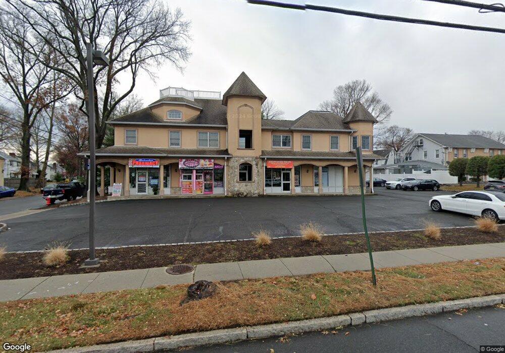
This home is located at 1385 Stuyvesant Ave Unit AVE202, Union, NJ 07083 and is currently estimated at $473,984, approximately $211 per square foot. 1385 Stuyvesant Ave Unit AVE202 is a home located in Union County with nearby schools including Franklin Elementary School, Burnet Middle School, and Union High School.
Ownership History
Date
Name
Owned For
Owner Type
Purchase Details
Closed on
Aug 4, 2006
Sold by
Badalamenti Giuseppe
Bought by
Carollo Anthony
Current Estimated Value
Home Financials for this Owner
Home Financials are based on the most recent Mortgage that was taken out on this home.
Original Mortgage
$230,000
Outstanding Balance
$137,713
Interest Rate
6.71%
Mortgage Type
Commercial
Estimated Equity
$336,271
Create a Home Valuation Report for This Property
The Home Valuation Report is an in-depth analysis detailing your home's value as well as a comparison with similar homes in the area
Home Values in the Area
Average Home Value in this Area
Purchase History
| Date | Buyer | Sale Price | Title Company |
|---|---|---|---|
| Carollo Anthony | $325,000 | -- |
Source: Public Records
Mortgage History
| Date | Status | Borrower | Loan Amount |
|---|---|---|---|
| Open | Carollo Anthony | $230,000 |
Source: Public Records
Tax History Compared to Growth
Tax History
| Year | Tax Paid | Tax Assessment Tax Assessment Total Assessment is a certain percentage of the fair market value that is determined by local assessors to be the total taxable value of land and additions on the property. | Land | Improvement |
|---|---|---|---|---|
| 2025 | $5,811 | $26,000 | $10,000 | $16,000 |
| 2024 | $5,634 | $26,000 | $10,000 | $16,000 |
| 2023 | $5,634 | $26,000 | $10,000 | $16,000 |
| 2022 | $5,438 | $26,000 | $10,000 | $16,000 |
| 2021 | $5,306 | $26,000 | $10,000 | $16,000 |
| 2020 | $5,201 | $26,000 | $10,000 | $16,000 |
| 2019 | $5,131 | $26,000 | $10,000 | $16,000 |
| 2018 | $5,043 | $26,000 | $10,000 | $16,000 |
| 2017 | $4,969 | $26,000 | $10,000 | $16,000 |
| 2016 | $4,847 | $26,000 | $10,000 | $16,000 |
| 2015 | $4,767 | $26,000 | $10,000 | $16,000 |
| 2014 | -- | $26,000 | $10,000 | $16,000 |
Source: Public Records
Map
Nearby Homes
- 2021 Tyler St
- 1871 Pilgrim Way
- 1396 Orange Ave
- 1893 Arbor Ln
- 1534 Julian Terrace
- 1535 Gregory Ave
- 1263 Coolidge Ave
- 2010 Gless Ave
- 2144 Tyler St
- 1517 Lindy Terrace
- 1239 Victor Ave
- 1244 Grandview Ave
- 1848 Portsmouth Way
- 1764 Colgate Place
- 1249 Plane St
- 2112 Gless Ave
- 1481 Walker Ave
- 2220 Morrison Ave
- 2225 Stecher Ave
- 1552 Elaine Terrace
- 1385 Stuyvesant Ave Unit AVE204
- 1385 Stuyvesant Ave Unit AVE203
- 1385 Stuyvesant Ave Unit AVE201
- 1385 Stuyvesant Ave Unit AVE104
- 1385 Stuyvesant Ave Unit AVE103
- 1385 Stuyvesant Ave Unit AVE102
- 1385 Stuyvesant Ave Unit 101
- 1385 Stuyvesant Ave
- 1385 Stuyvesant-101
- 1980 Oakwood Pkwy
- 1415 Stuyvesant Ave
- 1398 Stuyvesant Ave
- 1978 Oakwood Pkwy
- 1987 Oakwood Pkwy
- 1972 Oakwood Pkwy
- 1371 Stuyvesant Ave
- 1979 Long Terrace
- 1390 Stuyvesant Ave
- 1977 Long Terrace
- 1971 Oakwood Pkwy