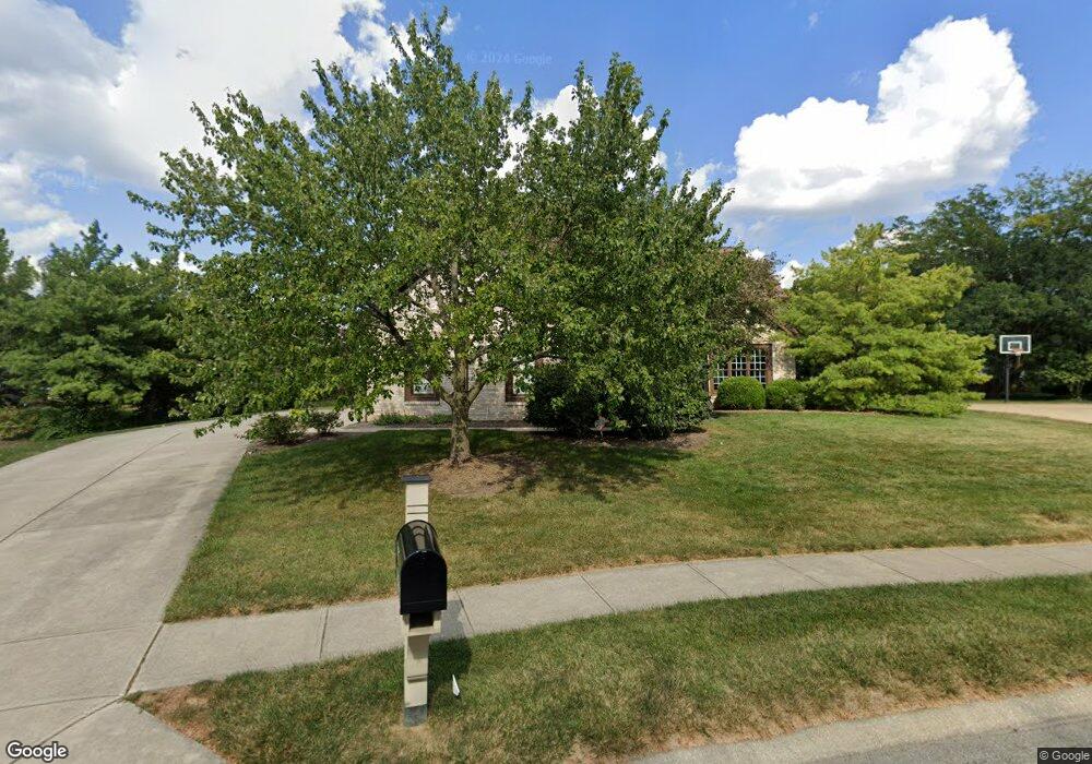
13855 Smokey Ridge Dr Carmel, IN 46033
East Carmel NeighborhoodEstimated Value: $816,802 - $887,000
3
Beds
4
Baths
3,458
Sq Ft
$247/Sq Ft
Est. Value
About This Home
This home is located at 13855 Smokey Ridge Dr, Carmel, IN 46033 and is currently estimated at $855,201, approximately $247 per square foot. 13855 Smokey Ridge Dr is a home located in Hamilton County with nearby schools including Cherry Tree Elementary School, Clay Middle School, and Carmel High School.
Ownership History
Date
Name
Owned For
Owner Type
Purchase Details
Closed on
Aug 20, 2001
Sold by
Smokey Hollow Associates
Bought by
Bolles David C and Bolles Bridget M
Current Estimated Value
Home Financials for this Owner
Home Financials are based on the most recent Mortgage that was taken out on this home.
Original Mortgage
$257,440
Outstanding Balance
$100,205
Interest Rate
7.12%
Estimated Equity
$754,996
Create a Home Valuation Report for This Property
The Home Valuation Report is an in-depth analysis detailing your home's value as well as a comparison with similar homes in the area
Home Values in the Area
Average Home Value in this Area
Purchase History
| Date | Buyer | Sale Price | Title Company |
|---|---|---|---|
| Bolles David C | -- | -- |
Source: Public Records
Mortgage History
| Date | Status | Borrower | Loan Amount |
|---|---|---|---|
| Open | Bolles David C | $257,440 | |
| Closed | Bolles David C | $48,270 |
Source: Public Records
Tax History Compared to Growth
Tax History
| Year | Tax Paid | Tax Assessment Tax Assessment Total Assessment is a certain percentage of the fair market value that is determined by local assessors to be the total taxable value of land and additions on the property. | Land | Improvement |
|---|---|---|---|---|
| 2024 | $6,694 | $719,900 | $171,400 | $548,500 |
| 2023 | $6,719 | $601,400 | $110,600 | $490,800 |
| 2022 | $6,190 | $540,000 | $110,600 | $429,400 |
| 2021 | $5,420 | $477,000 | $110,600 | $366,400 |
| 2020 | $5,237 | $461,000 | $110,600 | $350,400 |
| 2019 | $5,199 | $457,700 | $109,000 | $348,700 |
| 2018 | $5,153 | $461,900 | $109,000 | $352,900 |
| 2017 | $4,914 | $440,600 | $109,000 | $331,600 |
| 2016 | $4,693 | $427,500 | $109,000 | $318,500 |
| 2014 | $4,679 | $428,500 | $107,900 | $320,600 |
| 2013 | $4,679 | $432,100 | $107,900 | $324,200 |
Source: Public Records
Map
Nearby Homes
- 3172 Smokey Ridge Ln
- 14011 Grisham Dr
- 2945 Millgate Dr
- 2913 Twain Dr
- 1483 Spruce Dr
- 14554 Taylor Trace Dr
- 1504 Dorchester Place
- 13615 Smokey Hollow Place
- 781 Dayton Dr
- 14610 Village Park Dr E
- 1346 Smokey Row Ln
- 3630 Eaglewood Ct
- 1816 Spruce Dr
- 14901 Windmill Dr
- 1910 Spruce Dr
- 14340 Sydney Ln
- 14737 Setters Rd
- 4655 Allen Dr
- 14980 Oak Hollow Ln E
- 128 1st Ct
- 13851 Smokey Ridge Dr
- 3283 Hawthorne Dr W
- 3275 Hawthorne Dr W
- 13867 Smokey Ridge Dr
- 3259 Hawthorne Dr W
- 13846 Smokey Ridge Dr
- 13837 Smokey Ridge Dr
- 3325 Hawthorne Dr W
- 13828 Smokey Ridge Dr
- 13827 Smokey Ridge Dr
- 3251 Hawthorne Dr W
- 13871 Smokey Ridge Dr
- 3268 Hawthorne Dr W
- 3276 Hawthorne Dr W
- 3361 Hawthorne Dr W
- 3260 Hawthorne Dr W
- 13862 Smokey Ridge Dr
- 13862 Smokey Ridge D
- 3284 Hawthorne Dr W
- 3348 Foster Ridge Ln