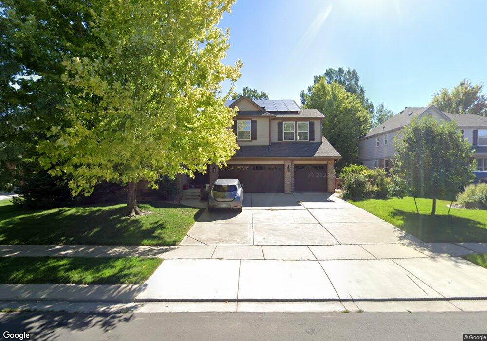
13864 Quail Ridge Dr Broomfield, CO 80020
Aspen Creek NeighborhoodEstimated Value: $1,012,106 - $1,198,000
4
Beds
4
Baths
3,888
Sq Ft
$287/Sq Ft
Est. Value
About This Home
This home is located at 13864 Quail Ridge Dr, Broomfield, CO 80020 and is currently estimated at $1,116,777, approximately $287 per square foot. 13864 Quail Ridge Dr is a home located in Broomfield County with nearby schools including Aspen Creek K-8 School, Broomfield High School, and Nativity: Faith and Reason.
Ownership History
Date
Name
Owned For
Owner Type
Purchase Details
Closed on
Jun 1, 2009
Sold by
Alpers John H and Alpers Tisha R
Bought by
Marshall John Richard Bedford and Petursson Tinna
Current Estimated Value
Home Financials for this Owner
Home Financials are based on the most recent Mortgage that was taken out on this home.
Original Mortgage
$384,000
Outstanding Balance
$242,486
Interest Rate
4.76%
Mortgage Type
Purchase Money Mortgage
Estimated Equity
$874,291
Purchase Details
Closed on
Jan 7, 2005
Sold by
Barber James W and Barber Betty Jo
Bought by
Alpers John H and Alpers Tisha R
Purchase Details
Closed on
Nov 6, 2002
Sold by
Beazer Homes Holdings Corp
Bought by
Alpers John H and Alpers Tisha R
Home Financials for this Owner
Home Financials are based on the most recent Mortgage that was taken out on this home.
Original Mortgage
$300,700
Interest Rate
6%
Create a Home Valuation Report for This Property
The Home Valuation Report is an in-depth analysis detailing your home's value as well as a comparison with similar homes in the area
Home Values in the Area
Average Home Value in this Area
Purchase History
| Date | Buyer | Sale Price | Title Company |
|---|---|---|---|
| Marshall John Richard Bedford | $480,000 | Utc Colorado | |
| Alpers John H | -- | -- | |
| Alpers John H | $406,000 | Land Title |
Source: Public Records
Mortgage History
| Date | Status | Borrower | Loan Amount |
|---|---|---|---|
| Open | Marshall John Richard Bedford | $384,000 | |
| Previous Owner | Alpers John H | $300,700 | |
| Closed | Alpers John H | $4,500 |
Source: Public Records
Tax History Compared to Growth
Tax History
| Year | Tax Paid | Tax Assessment Tax Assessment Total Assessment is a certain percentage of the fair market value that is determined by local assessors to be the total taxable value of land and additions on the property. | Land | Improvement |
|---|---|---|---|---|
| 2025 | $5,336 | $62,280 | $14,740 | $47,540 |
| 2024 | $5,336 | $56,940 | $13,840 | $43,100 |
| 2023 | $5,325 | $62,890 | $15,290 | $47,600 |
| 2022 | $4,297 | $44,450 | $10,770 | $33,680 |
| 2021 | $4,275 | $45,730 | $11,080 | $34,650 |
| 2020 | $4,042 | $42,970 | $10,730 | $32,240 |
| 2019 | $4,035 | $43,270 | $10,800 | $32,470 |
| 2018 | $3,853 | $40,820 | $8,280 | $32,540 |
| 2017 | $3,795 | $45,120 | $9,150 | $35,970 |
| 2016 | $3,887 | $41,220 | $7,040 | $34,180 |
| 2015 | $3,753 | $37,890 | $7,040 | $30,850 |
| 2014 | $3,526 | $37,890 | $7,040 | $30,850 |
Source: Public Records
Map
Nearby Homes
- 13924 Quail Ridge Dr
- 13980 Willow Wood Dr
- 14111 Blue Stem St
- 14115 Blue Stem St
- 5704 W 141st Place
- Torrey Plan at Dillon Pointe
- Antero Plan at Dillon Pointe
- Evans Plan at Dillon Pointe
- 1747 Whistlepig Ln
- 1757 Whistlepig Ln
- 583 Redstone Dr
- 5625 W 141st Ln
- 5621 W 141st Ln
- 5632 W 142nd Ave
- 5630 W 142nd Ave
- Quail Plan at Dillon Pointe - Dillon Pointe - Journey
- Ellie Plan at Dillon Pointe - Dillon Pointe - Journey
- Ruth Plan at Dillon Pointe - Dillon Pointe - Journey
- Carolyn Plan at Dillon Pointe - Dillon Pointe - Journey
- Mckay Plan at Dillon Pointe - Dillon Pointe - Journey
- 13874 Quail Ridge Dr
- 13844 Quail Ridge Dr
- 5906 Aspen Creek Dr
- 5856 Aspen Creek Dr
- 13884 Quail Ridge Dr
- 13824 Quail Ridge Dr
- 5927 Brook Hollow Dr
- 13871 Quail Ridge Dr
- 13851 Quail Ridge Dr
- 13881 Quail Ridge Dr
- 13831 Quail Ridge Dr
- 5806 Aspen Creek Dr
- 5877 Brook Hollow Dr
- 13821 Quail Ridge Dr
- 13814 Quail Ridge Dr
- 5837 Brook Hollow Dr
- 5786 Aspen Creek Dr
- 13811 Quail Ridge Dr
- 5946 Brook Hollow Dr
- 13904 Quail Ridge Dr