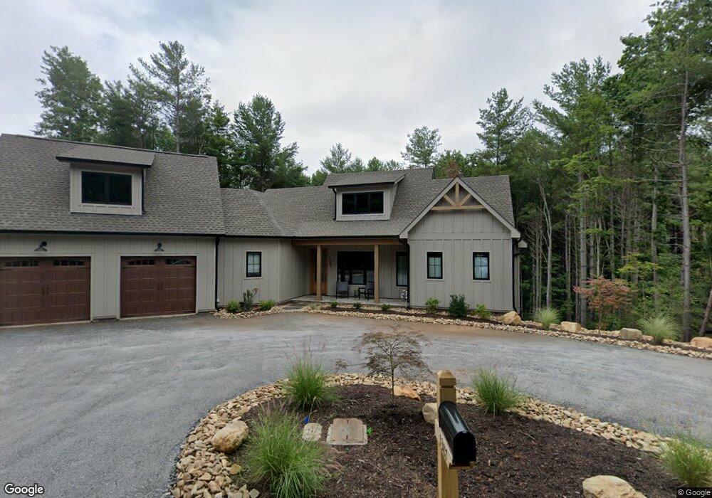
1387 Cedar Branch Ln Unit 71 Morganton, NC 28655
Lake James NeighborhoodEstimated Value: $790,000 - $1,231,000
3
Beds
4
Baths
2,793
Sq Ft
$367/Sq Ft
Est. Value
About This Home
This home is located at 1387 Cedar Branch Ln Unit 71, Morganton, NC 28655 and is currently estimated at $1,026,313, approximately $367 per square foot. 1387 Cedar Branch Ln Unit 71 is a home located in Burke County with nearby schools including Glen Alpine Elementary School, Table Rock Middle School, and Freedom High School.
Ownership History
Date
Name
Owned For
Owner Type
Purchase Details
Closed on
Apr 14, 2022
Sold by
Nieters Gerald F and Nieters Margaret P
Bought by
Mastria Michael F and Mastria Nellie
Current Estimated Value
Purchase Details
Closed on
Aug 14, 2015
Sold by
Daly Kevin S and Daly Lisa S
Bought by
Waltman Burton J and Waltman Jane C
Purchase Details
Closed on
Jun 15, 2006
Sold by
Ethern William R and Ethern Lisa K
Bought by
Daly Kevin and Daly Lisa S
Create a Home Valuation Report for This Property
The Home Valuation Report is an in-depth analysis detailing your home's value as well as a comparison with similar homes in the area
Home Values in the Area
Average Home Value in this Area
Purchase History
| Date | Buyer | Sale Price | Title Company |
|---|---|---|---|
| Mastria Michael F | $180 | G Redmond Dill Jr | |
| Waltman Burton J | $53,500 | Attorney | |
| Daly Kevin | $105,000 | None Available |
Source: Public Records
Tax History Compared to Growth
Tax History
| Year | Tax Paid | Tax Assessment Tax Assessment Total Assessment is a certain percentage of the fair market value that is determined by local assessors to be the total taxable value of land and additions on the property. | Land | Improvement |
|---|---|---|---|---|
| 2025 | $5,159 | $763,564 | $74,800 | $688,764 |
| 2024 | $4,975 | $763,564 | $74,800 | $688,764 |
| 2023 | $479 | $74,800 | $74,800 | $0 |
| 2022 | $445 | $57,400 | $57,400 | $0 |
| 2021 | $445 | $57,400 | $57,400 | $0 |
| 2020 | $436 | $57,400 | $57,400 | $0 |
| 2019 | $445 | $57,400 | $57,400 | $0 |
| 2018 | $476 | $61,380 | $61,380 | $0 |
| 2017 | $476 | $61,380 | $61,380 | $0 |
| 2016 | $516 | $67,940 | $67,940 | $0 |
| 2015 | $516 | $67,940 | $67,940 | $0 |
| 2014 | $516 | $67,940 | $67,940 | $0 |
| 2013 | $516 | $67,940 | $67,940 | $0 |
Source: Public Records
Map
Nearby Homes
- 1387 Cedar Branch Ln
- 1416 Southpointe Dr
- 1441 Southpointe Dr Unit 249
- 5619 Channel View Cove
- 1277 Northview Dr
- 1441 Pheasant Run Ct
- 3107 Channel View Cove
- 1590 Hawks Pointe Ln
- 2148 E Bluewater Dr
- 2108 E Bluewater Dr
- 3100 E Moonlight Place Unit 42
- 2018 Starlight Ln
- 1838 Southpointe Dr
- 2033 Starlight Ln Unit 111
- 1003 Glory Dr Unit 60
- 5140 Beech Bluff Dr
- 5339 Knollview Dr
- 1600 Lillians Point Ct Unit 33
- 1513 Brentwood Place
- 4625 Boyd Moore Ave
- V/L #74 Cedar Branch Ln Unit 74
- V/L#71 Cedar Branch Ln Unit 71
- 1348 Cedar Branch Ln Unit 74
- 1377 Cedar Branch Ln Unit 72
- 1377 Cedar Branch Ln
- 1401 Cedar Branch Ln
- 999 Cedar Branch Ln
- 1440 Southpointe Dr Unit 69
- 1440 Southpointe Dr
- 1398 Cedar Branch Ln
- 1416 Southpointe Dr Unit 67
- 1369 Cedar Branch Ln
- 1369 Cedar Branch Ln Unit 73
- 1376 Cedar Branch Ln
- 1376 Cedar Branch Ln Unit 75
- 93 Lighthouse Ct
- 1291 Bluestone Ct
- 1291 Bluestone Ct Unit 39
- 5062 Lighthouse Ct
- 5124 Lighthouse Ct