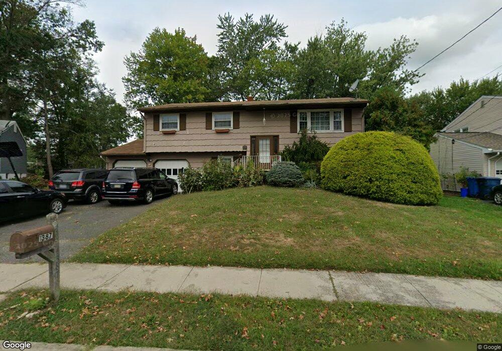
1387 Peoria Place North Brunswick, NJ 08902
Estimated Value: $641,000 - $663,000
5
Beds
2
Baths
2,074
Sq Ft
$313/Sq Ft
Est. Value
About This Home
This home is located at 1387 Peoria Place, North Brunswick, NJ 08902 and is currently estimated at $648,490, approximately $312 per square foot. 1387 Peoria Place is a home located in Middlesex County with nearby schools including John Adams Elementary School, Linwood Middle School, and North Brunswick Twp High School.
Ownership History
Date
Name
Owned For
Owner Type
Purchase Details
Closed on
Apr 25, 2006
Sold by
Savin Michael A
Bought by
Ahinampong Seth and Ahinampong Joana
Current Estimated Value
Home Financials for this Owner
Home Financials are based on the most recent Mortgage that was taken out on this home.
Original Mortgage
$371,955
Interest Rate
6.62%
Purchase Details
Closed on
Aug 12, 1994
Sold by
Moore Edmond
Bought by
Savin Michael and Savin Darcy
Home Financials for this Owner
Home Financials are based on the most recent Mortgage that was taken out on this home.
Original Mortgage
$159,000
Interest Rate
8.61%
Create a Home Valuation Report for This Property
The Home Valuation Report is an in-depth analysis detailing your home's value as well as a comparison with similar homes in the area
Home Values in the Area
Average Home Value in this Area
Purchase History
| Date | Buyer | Sale Price | Title Company |
|---|---|---|---|
| Ahinampong Seth | $383,500 | -- | |
| Savin Michael | $167,500 | -- |
Source: Public Records
Mortgage History
| Date | Status | Borrower | Loan Amount |
|---|---|---|---|
| Previous Owner | Ahinampong Seth | $371,955 | |
| Previous Owner | Savin Michael | $159,000 |
Source: Public Records
Tax History Compared to Growth
Tax History
| Year | Tax Paid | Tax Assessment Tax Assessment Total Assessment is a certain percentage of the fair market value that is determined by local assessors to be the total taxable value of land and additions on the property. | Land | Improvement |
|---|---|---|---|---|
| 2025 | $10,511 | $165,900 | $56,300 | $109,600 |
| 2024 | $10,322 | $165,900 | $56,300 | $109,600 |
| 2023 | $10,322 | $165,900 | $56,300 | $109,600 |
| 2022 | $9,971 | $165,900 | $56,300 | $109,600 |
| 2021 | $7,265 | $165,900 | $56,300 | $109,600 |
| 2020 | $9,599 | $165,900 | $56,300 | $109,600 |
| 2019 | $9,403 | $165,900 | $56,300 | $109,600 |
| 2018 | $9,211 | $165,900 | $56,300 | $109,600 |
| 2017 | $9,048 | $165,900 | $56,300 | $109,600 |
| 2016 | $8,859 | $165,900 | $56,300 | $109,600 |
| 2015 | $8,708 | $165,900 | $56,300 | $109,600 |
| 2014 | $8,610 | $165,900 | $56,300 | $109,600 |
Source: Public Records
Map
Nearby Homes
- 1209 Dakota Rd
- 1464 Columbia Dr
- 1365 Sioux Rd
- 1632 Hudson Ave
- 210 N Oaks Blvd Unit 210
- 1010 N Oaks Blvd
- 1499 La Rose Ave
- 1133 Livingston Ave Unit 11C
- 5208 N Oaks Blvd
- 936 Patton St
- 1314 N Oaks Blvd
- 1078 Newton St
- 89 Pennsylvania Way
- 1067 Grove St
- 63 Pennsylvania Way
- 3807 Birchwood Ct
- 32 Lafayette Ct
- 224 Pennsylvania Way
- 3910 Birchwood Ct
- 276 Constitution Cir
- 1379 Peoria Place
- 1393 Peoria Place
- 1384 Axel Ave
- 1392 Axel Ave
- 1376 Axel Ave
- 1371 Peoria Place
- 1384 Peoria Place
- 1398 Axel Ave
- 1226 W Peoria Place
- 1376 Peoria Place
- 1370 Axel Ave
- 1245 Omaha Rd
- 1237 Omaha Rd
- 1370 Peoria Place
- 1218 W Peoria Place
- 1363 Peoria Place
- 1215 W Peoria Place
- 1251 Omaha Rd
- 1385 Axel Ave
- 1231 Omaha Rd