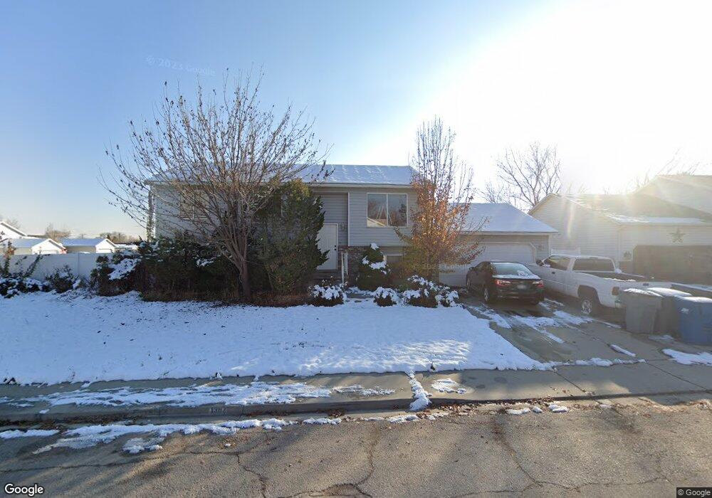
1387 W 540 N Pleasant Grove, UT 84062
Estimated Value: $462,000 - $528,000
4
Beds
1
Bath
1,932
Sq Ft
$259/Sq Ft
Est. Value
About This Home
This home is located at 1387 W 540 N, Pleasant Grove, UT 84062 and is currently estimated at $500,656, approximately $259 per square foot. 1387 W 540 N is a home located in Utah County with nearby schools including Mount Mahogany School, Pleasant Grove Junior High School, and Pleasant Grove High School.
Ownership History
Date
Name
Owned For
Owner Type
Purchase Details
Closed on
Sep 24, 2016
Sold by
Pons Mary E and Pons Jacob M
Bought by
Pons Mary E
Current Estimated Value
Home Financials for this Owner
Home Financials are based on the most recent Mortgage that was taken out on this home.
Original Mortgage
$125,900
Outstanding Balance
$100,564
Interest Rate
3.43%
Mortgage Type
New Conventional
Estimated Equity
$400,092
Purchase Details
Closed on
Mar 30, 2006
Sold by
King Ronald K and King Janalee G
Bought by
Willson Mary E
Home Financials for this Owner
Home Financials are based on the most recent Mortgage that was taken out on this home.
Original Mortgage
$129,000
Interest Rate
6.75%
Mortgage Type
Fannie Mae Freddie Mac
Purchase Details
Closed on
Oct 30, 2001
Sold by
Smith Amber A
Bought by
Smith Amber A and Wilkerson Leonard Byron
Create a Home Valuation Report for This Property
The Home Valuation Report is an in-depth analysis detailing your home's value as well as a comparison with similar homes in the area
Home Values in the Area
Average Home Value in this Area
Purchase History
| Date | Buyer | Sale Price | Title Company |
|---|---|---|---|
| Pons Mary E | -- | Heritage Title Co | |
| Willson Mary E | -- | Empire Land Title Company | |
| Smith Amber A | -- | Equity Title Agency Inc |
Source: Public Records
Mortgage History
| Date | Status | Borrower | Loan Amount |
|---|---|---|---|
| Open | Pons Mary E | $125,900 | |
| Closed | Willson Mary E | $129,000 |
Source: Public Records
Tax History Compared to Growth
Tax History
| Year | Tax Paid | Tax Assessment Tax Assessment Total Assessment is a certain percentage of the fair market value that is determined by local assessors to be the total taxable value of land and additions on the property. | Land | Improvement |
|---|---|---|---|---|
| 2025 | $1,885 | $436,000 | $174,100 | $261,900 |
| 2024 | $1,885 | $225,005 | $0 | $0 |
| 2023 | $1,863 | $227,590 | $0 | $0 |
| 2022 | $1,962 | $238,535 | $0 | $0 |
| 2021 | $1,695 | $313,800 | $124,900 | $188,900 |
| 2020 | $1,561 | $283,200 | $111,500 | $171,700 |
| 2019 | $1,365 | $256,200 | $101,100 | $155,100 |
| 2018 | $1,291 | $229,000 | $94,100 | $134,900 |
| 2017 | $1,295 | $122,375 | $0 | $0 |
| 2016 | $1,200 | $109,450 | $0 | $0 |
| 2015 | $1,221 | $105,490 | $0 | $0 |
| 2014 | $1,144 | $97,845 | $0 | $0 |
Source: Public Records
Map
Nearby Homes
- 5277 W State St Unit 4
- 1557 W State Rd
- 1598 W 220 N
- 271 N 1350 W
- 1525 W 300 N
- 295 N 1580 W
- 1450 W 220 N
- 1541 W 250 N
- 1130 W State Rd
- 1593 W 220 N
- 150 N 1300 W
- 1491 W 1010 St N
- 1542 W 110 N
- 1515 W 1010 St N
- 1429 W 110 N
- 1249 W Cambria Dr Unit 101
- 1502 W 1010 St N Unit 11
- 1406 W 50 N
- 1593 W 110 N Unit 4
- 1470 W 50 N