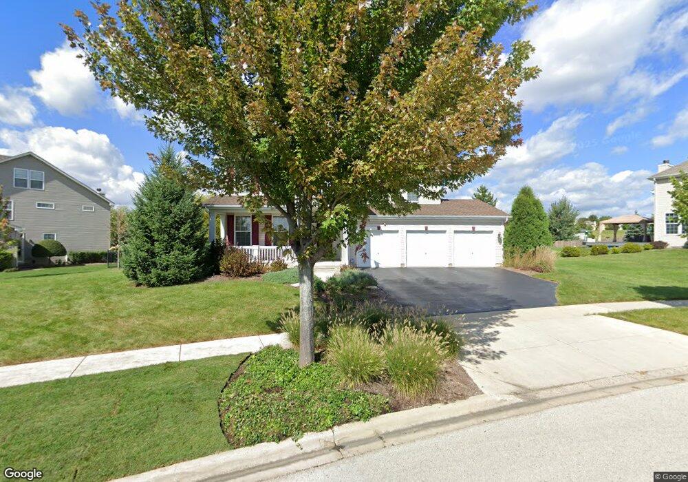
1388 Grand Pointe Blvd West Dundee, IL 60118
Estimated Value: $608,130 - $692,000
4
Beds
--
Bath
3,320
Sq Ft
$194/Sq Ft
Est. Value
About This Home
This home is located at 1388 Grand Pointe Blvd, West Dundee, IL 60118 and is currently estimated at $643,533, approximately $193 per square foot. 1388 Grand Pointe Blvd is a home located in Kane County with nearby schools including Dundee Highlands Elementary School, Dundee Middle School, and West Prairie Middle School.
Ownership History
Date
Name
Owned For
Owner Type
Purchase Details
Closed on
Apr 7, 2023
Sold by
Bogs Mark R and Bogs Anita C
Bought by
Bogs Mark R
Current Estimated Value
Home Financials for this Owner
Home Financials are based on the most recent Mortgage that was taken out on this home.
Original Mortgage
$375,000
Outstanding Balance
$365,300
Interest Rate
6.99%
Mortgage Type
New Conventional
Estimated Equity
$278,233
Purchase Details
Closed on
Dec 16, 2005
Sold by
Grand Pointe Meadows Llc
Bought by
Bogs Mark R and Bogs Anita C
Home Financials for this Owner
Home Financials are based on the most recent Mortgage that was taken out on this home.
Original Mortgage
$342,000
Interest Rate
6.48%
Mortgage Type
Fannie Mae Freddie Mac
Create a Home Valuation Report for This Property
The Home Valuation Report is an in-depth analysis detailing your home's value as well as a comparison with similar homes in the area
Home Values in the Area
Average Home Value in this Area
Purchase History
| Date | Buyer | Sale Price | Title Company |
|---|---|---|---|
| Bogs Mark R | -- | Fidelity National Title | |
| Bogs Mark R | $486,000 | Ticor Title Insurance Co |
Source: Public Records
Mortgage History
| Date | Status | Borrower | Loan Amount |
|---|---|---|---|
| Open | Bogs Mark R | $375,000 | |
| Previous Owner | Bogs Mark R | $342,000 |
Source: Public Records
Tax History Compared to Growth
Tax History
| Year | Tax Paid | Tax Assessment Tax Assessment Total Assessment is a certain percentage of the fair market value that is determined by local assessors to be the total taxable value of land and additions on the property. | Land | Improvement |
|---|---|---|---|---|
| 2024 | $13,907 | $178,616 | $26,492 | $152,124 |
| 2023 | $13,068 | $160,713 | $23,837 | $136,876 |
| 2022 | $11,309 | $134,368 | $23,837 | $110,531 |
| 2021 | $10,922 | $126,870 | $22,507 | $104,363 |
| 2020 | $10,723 | $124,018 | $22,001 | $102,017 |
| 2019 | $11,116 | $125,583 | $20,886 | $104,697 |
| 2018 | $11,772 | $129,431 | $20,472 | $108,959 |
| 2017 | $11,226 | $121,077 | $19,151 | $101,926 |
| 2016 | $11,451 | $117,232 | $18,543 | $98,689 |
| 2015 | -- | $117,591 | $21,296 | $96,295 |
| 2014 | -- | $114,344 | $20,708 | $93,636 |
| 2013 | -- | $117,844 | $21,342 | $96,502 |
Source: Public Records
Map
Nearby Homes
- 36W461 Binnie Rd
- 36W340 Huntley Rd
- 36W690 Winding Trail
- 8022 Sierra Woods Ln Unit 8022
- 6850 Huntley Rd
- lot 009 Huntley Rd
- 8304 Sierra Woods Ln Unit 8304
- 1601 Higgins Rd
- 2742 Connolly Ln
- 2052 Orchard Ln Unit 19C5
- Marianne Plan at Hickory Glen
- Charlotte Plan at Hickory Glen
- 1715 W Main St
- 812 Lindsay Ln
- 822 Lindsay Ln
- 814 Lindsay Ln
- 816 Lindsay Ln
- 813 Lindsay Ln
- 825 Lindsay Ln
- 818 Lindsay Ln
- 2700 Oak Dr
- 1390 Grand Pointe Blvd
- 2702 Oak Dr
- 1429 Walnut Dr
- 1392 Grand Pointe Blvd
- 1394 Grand Pointe Blvd
- 2706 Oak Dr
- 1421 Walnut Dr
- 1426 Walnut Dr
- 2708 Oak Dr
- 1419 Walnut Dr
- 1396 Grand Pointe Blvd
- 1391 Grand Pointe Blvd Unit 2
- 1424 Walnut Dr
- 2710 Oak Dr
- 1389 Grand Pointe Blvd
- 1393 Grand Pointe Blvd Unit 2
- 1428 Walnut Dr
- 1422 Walnut Dr
- 1417 Walnut Dr