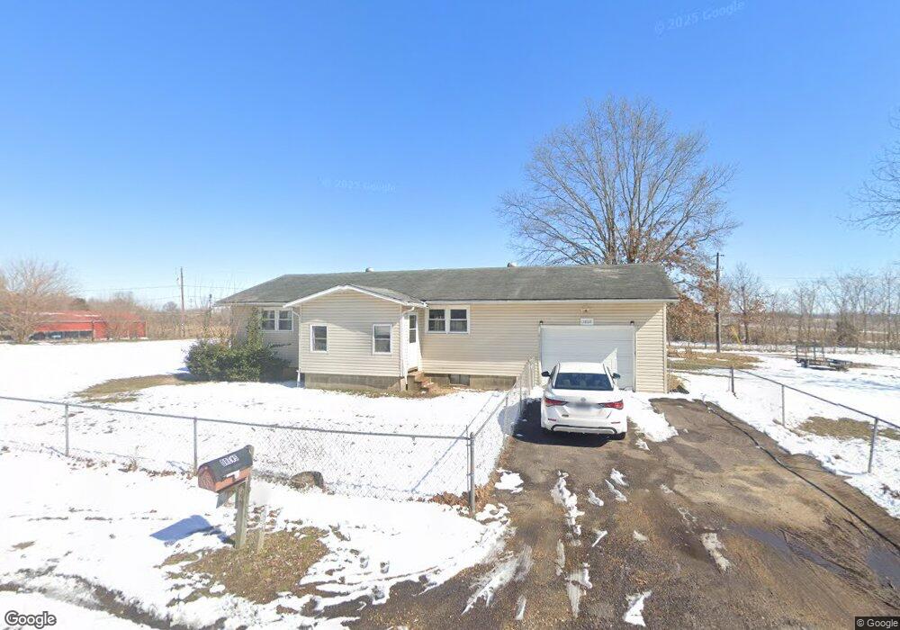
13880 Carrie St Dexter, MO 63841
Estimated Value: $117,029 - $174,000
2
Beds
1
Bath
1,092
Sq Ft
$135/Sq Ft
Est. Value
About This Home
This home is located at 13880 Carrie St, Dexter, MO 63841 and is currently estimated at $147,757, approximately $135 per square foot. 13880 Carrie St is a home located in Stoddard County with nearby schools including Southwest Elementary School, Central Elementary School, and T.S. Hill Middle School.
Ownership History
Date
Name
Owned For
Owner Type
Purchase Details
Closed on
Apr 4, 2022
Sold by
Hagy James A
Bought by
Drews Rachel
Current Estimated Value
Home Financials for this Owner
Home Financials are based on the most recent Mortgage that was taken out on this home.
Original Mortgage
$75,762
Outstanding Balance
$71,687
Interest Rate
4.98%
Mortgage Type
Construction
Estimated Equity
$76,070
Purchase Details
Closed on
May 25, 2021
Sold by
Curtis Betty J
Bought by
Hagy James A
Home Financials for this Owner
Home Financials are based on the most recent Mortgage that was taken out on this home.
Original Mortgage
$63,000
Interest Rate
3%
Mortgage Type
Construction
Purchase Details
Closed on
Sep 15, 2017
Sold by
Robert Curtis and Robert June
Bought by
Robert Curtis and Robert June Curtis
Create a Home Valuation Report for This Property
The Home Valuation Report is an in-depth analysis detailing your home's value as well as a comparison with similar homes in the area
Home Values in the Area
Average Home Value in this Area
Purchase History
| Date | Buyer | Sale Price | Title Company |
|---|---|---|---|
| Drews Rachel | $94,702 | National Title & Escrow Inc | |
| Hagy James A | $78,750 | National Title & Escrow Inc | |
| Robert Curtis | -- | -- |
Source: Public Records
Mortgage History
| Date | Status | Borrower | Loan Amount |
|---|---|---|---|
| Open | Drews Rachel | $75,762 | |
| Previous Owner | Hagy James A | $63,000 |
Source: Public Records
Tax History Compared to Growth
Tax History
| Year | Tax Paid | Tax Assessment Tax Assessment Total Assessment is a certain percentage of the fair market value that is determined by local assessors to be the total taxable value of land and additions on the property. | Land | Improvement |
|---|---|---|---|---|
| 2025 | $489 | $10,887 | $0 | $0 |
| 2024 | $489 | $10,564 | $0 | $0 |
| 2023 | $488 | $10,564 | $0 | $0 |
| 2022 | $469 | $10,165 | $0 | $0 |
| 2021 | $469 | $10,165 | $0 | $0 |
| 2020 | $451 | $9,424 | $0 | $0 |
| 2019 | $450 | $9,709 | $0 | $0 |
| 2018 | $434 | $9,424 | $0 | $0 |
| 2016 | $415 | $9,291 | $0 | $0 |
| 2015 | -- | $9,291 | $0 | $0 |
| 2014 | -- | $9,329 | $0 | $0 |
| 2013 | -- | $0 | $0 | $0 |
Source: Public Records
Map
Nearby Homes
- 14038 County Road 405
- 18049 Thomas Dr
- 14033 County Road 405
- 18328 Lake Circle Dr
- 1309 Ray St
- 1205 Ray St
- 0 N Hickory St Unit MIS25080979
- 910 Carney St
- 902 N Poplar St
- 4 Mcnair St
- 807 N Poplar St
- 112 Mccormick St
- 6 W Taylor St
- 130 Hunt St
- 0 E Kenton Rd Unit MAR25009938
- 9 W Truitt St
- 1207 W Kenton Rd
- 804 N Catalpa St
- 13605 Duley Ln
- 1002 Cottage Ln
- 13851 Carrie St
- 13831 Carrie St
- 13873 Carrie St
- 13844 Charlotte St
- 13913 Carrie St
- 13918 Carrie St
- 13812 Charlotte St
- 13882 Charlotte St
- 13882 Charlotte St
- 13803 Charlotte St Unit 13795
- 13940 Carrie St
- 13937 Carrie St
- 19135 Connie St
- 13908 Charlotte St
- 13841 Charlotte St
- 13831 Charlotte St
- 13938 Charlotte St
- 13885 Charlotte St
- 19282 County Road 702
- 13787 Charlotte St