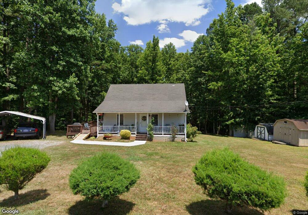
1389 Independence Ave Asheboro, NC 27205
Estimated Value: $181,893 - $259,000
--
Bed
2
Baths
1,075
Sq Ft
$199/Sq Ft
Est. Value
About This Home
This home is located at 1389 Independence Ave, Asheboro, NC 27205 and is currently estimated at $213,973, approximately $199 per square foot. 1389 Independence Ave is a home located in Randolph County with nearby schools including Sycamore Elementary School, Southmont Elementary School, and Southwestern Randolph Middle School.
Ownership History
Date
Name
Owned For
Owner Type
Purchase Details
Closed on
Jul 6, 2020
Sold by
Day Sylvia
Bought by
Day Sylvia and Day Curtis
Current Estimated Value
Home Financials for this Owner
Home Financials are based on the most recent Mortgage that was taken out on this home.
Original Mortgage
$87,626
Outstanding Balance
$77,527
Interest Rate
3.1%
Mortgage Type
FHA
Estimated Equity
$136,446
Purchase Details
Closed on
Oct 11, 2005
Sold by
Braswell Gerald E and Braswell Ruth T
Bought by
Day Sylvia
Home Financials for this Owner
Home Financials are based on the most recent Mortgage that was taken out on this home.
Original Mortgage
$75,900
Interest Rate
10%
Mortgage Type
Purchase Money Mortgage
Purchase Details
Closed on
Jul 11, 1997
Bought by
Day Sylvia
Create a Home Valuation Report for This Property
The Home Valuation Report is an in-depth analysis detailing your home's value as well as a comparison with similar homes in the area
Home Values in the Area
Average Home Value in this Area
Purchase History
| Date | Buyer | Sale Price | Title Company |
|---|---|---|---|
| Day Sylvia | -- | None Available | |
| Day Sylvia | $77,000 | None Available | |
| Day Sylvia | $4,500 | -- |
Source: Public Records
Mortgage History
| Date | Status | Borrower | Loan Amount |
|---|---|---|---|
| Open | Day Sylvia | $87,626 | |
| Previous Owner | Day Sylvia | $75,900 |
Source: Public Records
Tax History Compared to Growth
Tax History
| Year | Tax Paid | Tax Assessment Tax Assessment Total Assessment is a certain percentage of the fair market value that is determined by local assessors to be the total taxable value of land and additions on the property. | Land | Improvement |
|---|---|---|---|---|
| 2025 | $879 | $141,720 | $33,210 | $108,510 |
| 2024 | $879 | $141,720 | $33,210 | $108,510 |
| 2023 | $879 | $141,720 | $33,210 | $108,510 |
| 2022 | $714 | $94,860 | $20,010 | $74,850 |
| 2021 | $714 | $94,860 | $20,010 | $74,850 |
| 2020 | $682 | $94,340 | $20,010 | $74,330 |
| 2019 | $682 | $94,340 | $20,010 | $74,330 |
| 2018 | $599 | $80,660 | $13,020 | $67,640 |
| 2016 | $583 | $80,657 | $13,020 | $67,637 |
| 2015 | $585 | $80,657 | $13,020 | $67,637 |
| 2014 | -- | $80,657 | $13,020 | $67,637 |
Source: Public Records
Map
Nearby Homes
- 3828 Zoo Pkwy
- 916 S Creek Ct
- 2473 Zoo Pkwy
- 947 Rockcliff Terrace
- 4263 Zoo Pkwy
- 888 Newbern Ave
- 897 Bray Blvd
- 431 Newbern Ave
- 1201 Lindale Dr
- 0 Bray Blvd
- 3359 US Highway 220 Bus S
- 3359 U S 220 Business
- 248 CrooMcRest Rd
- 240 CrooMcRest Rd
- 0 Sykes Farm Rd
- 353 Auman Ave
- 261 Charles Ave
- 287 Eldorado Rd
- 0 Browers Chapel Rd
- 228 Anchor Dr
- 1524 Liberty Cir
- 1394 Independence Ave
- 1464 Independence Ave
- 1614 Southwood Dr
- 3456 Zoo Pkwy
- 1646 Southwood Dr
- 1086 Freedom Trail
- 1633 Southwood Dr
- 1652 Southwood Dr
- 3602 Zoo Pkwy
- 00 Liberty Cir
- 1031 Freedom Trail
- 1643 Southwood Dr
- 1670 Southwood Dr
- 1651 Southwood Dr
- 3612 Zoo Pkwy
- 1083 Freedom State St
- 3479 Zoo Pkwy
- 1676 Southwood Dr
- 1667 Southwood Dr