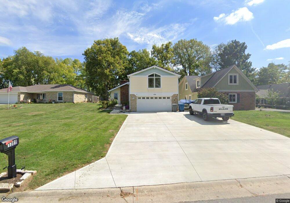
1389 Lighthouse Point Cicero, IN 46034
Estimated Value: $609,000 - $705,000
3
Beds
2
Baths
1,088
Sq Ft
$602/Sq Ft
Est. Value
About This Home
This home is located at 1389 Lighthouse Point, Cicero, IN 46034 and is currently estimated at $655,312, approximately $602 per square foot. 1389 Lighthouse Point is a home located in Hamilton County with nearby schools including Hamilton Heights Primary School, Hamilton Heights Elementary School, and Hamilton Heights Middle School.
Ownership History
Date
Name
Owned For
Owner Type
Purchase Details
Closed on
Sep 15, 2016
Sold by
Elsey James R and Elsey Patricia L
Bought by
Saffold Jerry and Saffold Marlyn Saffold
Current Estimated Value
Home Financials for this Owner
Home Financials are based on the most recent Mortgage that was taken out on this home.
Original Mortgage
$341,406
Outstanding Balance
$272,702
Interest Rate
3.43%
Mortgage Type
VA
Estimated Equity
$382,610
Purchase Details
Closed on
May 21, 2004
Sold by
Mullins Thomas N
Bought by
Elsey James R and Elsey Patricia L
Home Financials for this Owner
Home Financials are based on the most recent Mortgage that was taken out on this home.
Original Mortgage
$160,729
Interest Rate
6.06%
Mortgage Type
FHA
Purchase Details
Closed on
Aug 9, 2002
Sold by
Mullins Cheryl L
Bought by
Mullins Thomas N
Home Financials for this Owner
Home Financials are based on the most recent Mortgage that was taken out on this home.
Original Mortgage
$104,000
Interest Rate
6.4%
Mortgage Type
New Conventional
Create a Home Valuation Report for This Property
The Home Valuation Report is an in-depth analysis detailing your home's value as well as a comparison with similar homes in the area
Home Values in the Area
Average Home Value in this Area
Purchase History
| Date | Buyer | Sale Price | Title Company |
|---|---|---|---|
| Saffold Jerry | -- | Ldnders Escrow & Title Servi | |
| Elsey James R | -- | -- | |
| Mullins Thomas N | -- | -- |
Source: Public Records
Mortgage History
| Date | Status | Borrower | Loan Amount |
|---|---|---|---|
| Open | Saffold Jerry | $341,406 | |
| Previous Owner | Elsey James R | $160,729 | |
| Previous Owner | Mullins Thomas N | $104,000 |
Source: Public Records
Tax History Compared to Growth
Tax History
| Year | Tax Paid | Tax Assessment Tax Assessment Total Assessment is a certain percentage of the fair market value that is determined by local assessors to be the total taxable value of land and additions on the property. | Land | Improvement |
|---|---|---|---|---|
| 2024 | $4,429 | $477,000 | $285,800 | $191,200 |
| 2023 | $4,429 | $442,900 | $285,800 | $157,100 |
| 2022 | $3,995 | $399,500 | $179,600 | $219,900 |
| 2021 | $3,598 | $359,800 | $179,600 | $180,200 |
| 2020 | $3,177 | $317,700 | $179,600 | $138,100 |
| 2019 | $2,827 | $282,700 | $126,600 | $156,100 |
| 2018 | $2,881 | $287,500 | $126,600 | $160,900 |
| 2017 | $2,698 | $269,200 | $126,600 | $142,600 |
| 2016 | $2,698 | $269,200 | $126,600 | $142,600 |
| 2014 | $2,586 | $257,900 | $122,100 | $135,800 |
| 2013 | $2,586 | $243,900 | $129,900 | $114,000 |
Source: Public Records
Map
Nearby Homes
- 949 Nantucket Dr
- 826 N Lanyard Dr
- 815 Morse Landing Dr
- 1940 Stringtown Pike
- 100 Confidential Dr
- 1209 Half Moon Ln
- 130 Overston Ct
- 1180 Shoreline Cir
- 2029 Seven Peaks Dr
- 221 Common Loon Blvd
- 1306 N Catamaran Cir
- 1055 Spinner Ct
- 34 Hovden Dr
- 73 Forest Hollow Dr
- 131 Batteese Dr
- 2390 Lincoln Dr
- 104 Perlican Dr
- 140 Wiley St
- 70 Armitage St
- 14 Morse Ct
- 1429 Lighthouse Point
- 1369 Lighthouse Point
- 1449 Lighthouse Point
- 1140 Nantucket Dr
- 1180 Nantucket Dr
- 1349 Lighthouse Point
- 1380 Lighthouse Point
- 1360 Lighthouse Point
- 1400 Lighthouse Point
- 1120 Nantucket Dr
- 1420 Lighthouse Point
- 1329 Lighthouse Point
- 1340 Lighthouse Point
- 1440 Lighthouse Point
- 1320 Lighthouse Point
- 1100 Nantucket Dr
- 1480 Lighthouse Point
- 1300 Lighthouse Point
- 1089 Nantucket Dr
- 1500 Lighthouse Point