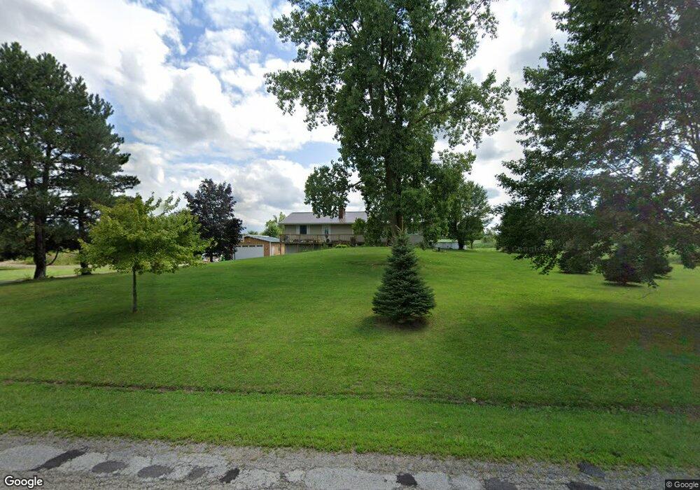
13891 Addison Rd Addison, MI 49220
Estimated Value: $219,000 - $329,000
Studio
1
Bath
952
Sq Ft
$276/Sq Ft
Est. Value
About This Home
This home is located at 13891 Addison Rd, Addison, MI 49220 and is currently estimated at $263,164, approximately $276 per square foot. 13891 Addison Rd is a home located in Hillsdale County with nearby schools including Addison Elementary School, Addison Middle School, and Addison High School.
Ownership History
Date
Name
Owned For
Owner Type
Purchase Details
Closed on
Aug 3, 2022
Sold by
Smith Amie Jo and Estate Of Michael J Smith
Bought by
Smith Amie Jo and Smith Amie Jo
Current Estimated Value
Purchase Details
Closed on
Mar 23, 2012
Sold by
Bank Of America Na
Bought by
Fannie Mae
Purchase Details
Closed on
Feb 24, 2012
Sold by
Morr Michael R and Morr Lisa M
Bought by
Bank Of America N A
Purchase Details
Closed on
Jun 6, 1994
Sold by
Brown Robert N and Brown Luann K
Bought by
Morr Michael R and Morr Lisa M
Create a Home Valuation Report for This Property
The Home Valuation Report is an in-depth analysis detailing your home's value as well as a comparison with similar homes in the area
Purchase History
| Date | Buyer | Sale Price | Title Company |
|---|---|---|---|
| Smith Amie Jo | -- | Not Available | |
| Fannie Mae | -- | None Available | |
| Bank Of America N A | $115,791 | None Available | |
| Morr Michael R | $94,000 | -- |
Source: Public Records
Tax History
| Year | Tax Paid | Tax Assessment Tax Assessment Total Assessment is a certain percentage of the fair market value that is determined by local assessors to be the total taxable value of land and additions on the property. | Land | Improvement |
|---|---|---|---|---|
| 2025 | $694 | $108,900 | $0 | $0 |
| 2024 | $7 | $106,400 | $0 | $0 |
| 2023 | $645 | $99,500 | $0 | $0 |
| 2022 | $1,426 | $105,000 | $0 | $0 |
| 2021 | $1,384 | $87,000 | $0 | $0 |
| 2020 | $1,378 | $66,400 | $0 | $0 |
| 2019 | $1,374 | $65,900 | $0 | $0 |
| 2018 | $1,311 | $58,600 | $0 | $0 |
| 2017 | $1,289 | $55,700 | $0 | $0 |
| 2016 | $1,286 | $52,480 | $0 | $0 |
| 2015 | $575 | $52,480 | $0 | $0 |
| 2013 | -- | $55,120 | $0 | $0 |
| 2012 | $550 | $50,180 | $0 | $0 |
Source: Public Records
Map
Nearby Homes
- 13840 N Adams Rd
- 13820 N Adams Rd
- 4955 N Somerset Rd
- 6482 Sorby Hwy
- 16001 Addison Rd
- 11480 N Adams Rd
- 9571 Waldron Rd
- 2951 N Meridian Rd
- 10421 E Greenlawn Dr
- 0
- VL Manitou Beach Road Proposed
- 0 Manitou Beach Rd Lot B
- 17475 U S 223
- 2251 N Waldron Rd
- 360 Park St
- 348 Lenawee St
- 9059 Tessarri Dr
- 9265 Devils Lake Hwy
- 8676 Cherry Point Dr
- V/L E Chicago Rd
- 13891 Addison Rd Unit ADDISON RD
- 6100 N Somerset Rd
- 8031 N Somerset Rd
- 10501 N Somerset Rd
- 14002 Addison Rd
- 14071 Addison Rd
- 13750 Addison Rd
- 5749 N Somerset Rd
- 5749 N Somerset Rd Unit SOMERSET
- 5749 Somerset Rd
- 5749 Somerset Rd Unit SOMERSET
- 14160 Addison Rd
- 13571 Addison Rd
- 14260 Addison Rd
- 14480 Addison Rd
- 13540 Addison Rd
- 5740 Somerset Rd
- 14340 Addison Rd
- 6100 Somerset Rd
- 6500 Somerset Rd
Your Personal Tour Guide
Ask me questions while you tour the home.