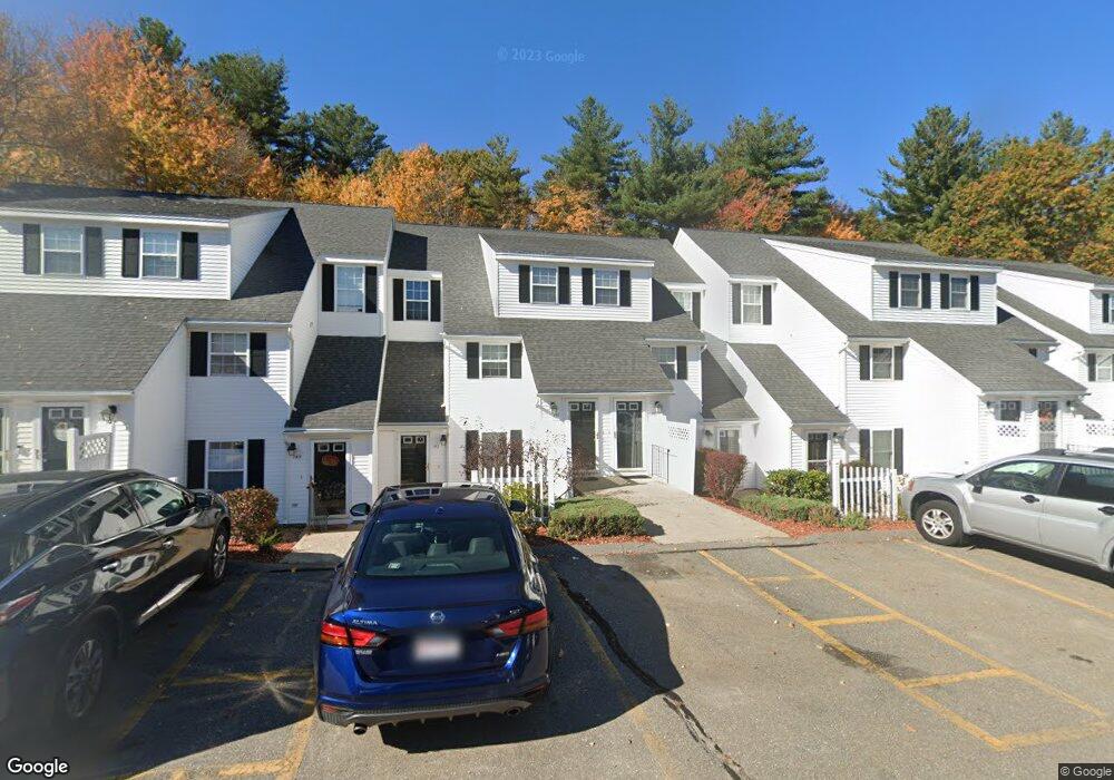
139 Berrington Rd Leominster, MA 01453
Estimated Value: $301,000 - $336,324
2
Beds
2
Baths
1,336
Sq Ft
$239/Sq Ft
Est. Value
About This Home
This home is located at 139 Berrington Rd, Leominster, MA 01453 and is currently estimated at $318,831, approximately $238 per square foot. 139 Berrington Rd is a home located in Worcester County with nearby schools including Leominster High School and St. Anna Catholic School.
Ownership History
Date
Name
Owned For
Owner Type
Purchase Details
Closed on
Nov 15, 2022
Sold by
Raymond Randal J
Bought by
Martin Cathy A and Martin Raymond John
Current Estimated Value
Purchase Details
Closed on
May 24, 2002
Sold by
Liberty Commons Leom
Bought by
Raymond John N and Raymond Alice L
Home Financials for this Owner
Home Financials are based on the most recent Mortgage that was taken out on this home.
Original Mortgage
$45,000
Interest Rate
7.01%
Mortgage Type
Purchase Money Mortgage
Create a Home Valuation Report for This Property
The Home Valuation Report is an in-depth analysis detailing your home's value as well as a comparison with similar homes in the area
Home Values in the Area
Average Home Value in this Area
Purchase History
| Date | Buyer | Sale Price | Title Company |
|---|---|---|---|
| Martin Cathy A | -- | None Available | |
| Raymond John N | $112,365 | -- |
Source: Public Records
Mortgage History
| Date | Status | Borrower | Loan Amount |
|---|---|---|---|
| Previous Owner | Raymond John N | $45,000 |
Source: Public Records
Tax History Compared to Growth
Tax History
| Year | Tax Paid | Tax Assessment Tax Assessment Total Assessment is a certain percentage of the fair market value that is determined by local assessors to be the total taxable value of land and additions on the property. | Land | Improvement |
|---|---|---|---|---|
| 2025 | $3,506 | $249,900 | $0 | $249,900 |
| 2024 | $3,263 | $224,900 | $0 | $224,900 |
| 2023 | $3,245 | $208,800 | $0 | $208,800 |
| 2022 | $2,815 | $170,000 | $0 | $170,000 |
| 2021 | $2,730 | $150,600 | $0 | $150,600 |
| 2020 | $2,524 | $140,400 | $0 | $140,400 |
| 2019 | $2,534 | $136,700 | $0 | $136,700 |
| 2018 | $2,598 | $134,400 | $0 | $134,400 |
| 2017 | $2,385 | $120,900 | $0 | $120,900 |
| 2016 | $2,199 | $112,300 | $0 | $112,300 |
| 2015 | $2,183 | $112,300 | $0 | $112,300 |
| 2014 | $2,301 | $121,800 | $0 | $121,800 |
Source: Public Records
Map
Nearby Homes
- 97 Berrington Rd Unit 97
- 12 Drummer Ln
- 50 Indian Ridge Dr
- 213 Bayberry Hill Ln
- 1237 Central St Unit 15
- 851 Lancaster St
- 23 Lantern Ln
- 675 Willard St
- 315 Grant St
- 197 Chapman Place Unit 197
- 30 Abbey Rd Unit 207
- 10 Abbey Rd Unit 108
- 177 Chapman Place
- 36 Meadow Pond Dr Unit I
- 498 Lancaster St
- 556 Central St Unit 43
- 556 Central St Unit 39
- 60 Howard St
- 2237 Main St
- 6 Longwood Ave
- 145 Berrington Rd
- 137 Berrington Rd
- 131 Berrington Rd
- 129 Berrington Rd
- 127 Berrington Rd
- 125 Berrington Rd
- 123 Berrington Rd
- 131 Berrington Rd Unit 131
- 137 Berrington Rd Unit 137
- 123 Berrington Rd Unit 123
- 119 Berrington Rd
- 117 Berrington Rd
- 113 Berrington Rd
- 109 Berrington Rd
- 109 Berrington Rd Unit 109
- 164 Berrington Rd
- 158 Berrington Rd
- 156 Berrington Rd
- 154 Berrington Rd
- 152 Berrington Rd