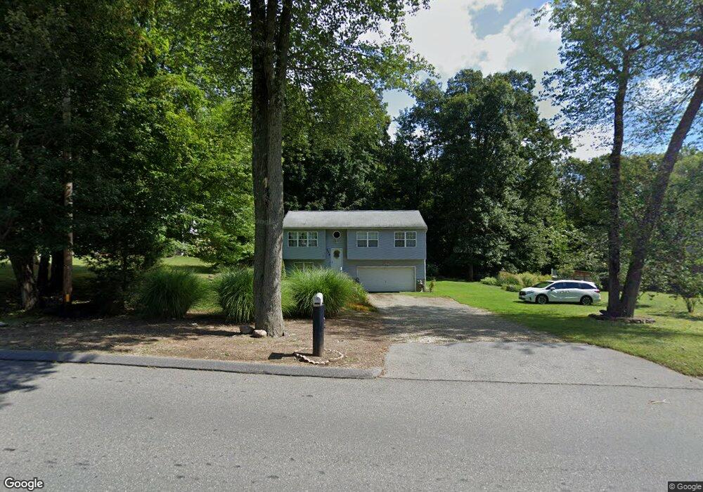
139 Breckenridge St Palmer, MA 01069
Estimated Value: $319,000 - $386,000
3
Beds
2
Baths
1,028
Sq Ft
$331/Sq Ft
Est. Value
About This Home
This home is located at 139 Breckenridge St, Palmer, MA 01069 and is currently estimated at $340,034, approximately $330 per square foot. 139 Breckenridge St is a home located in Hampden County with nearby schools including Old Mill Pond Elementary School, Converse Middle School, and Palmer High School.
Ownership History
Date
Name
Owned For
Owner Type
Purchase Details
Closed on
Apr 8, 2014
Sold by
Bluto Jeffrey A
Bought by
Bluto Joanne
Current Estimated Value
Purchase Details
Closed on
Oct 11, 2001
Sold by
Mead Daniel B and Mead Cynthia A
Bought by
Bluto Jeffrey A and Bluto Joanne
Home Financials for this Owner
Home Financials are based on the most recent Mortgage that was taken out on this home.
Original Mortgage
$95,700
Interest Rate
6.93%
Mortgage Type
Purchase Money Mortgage
Purchase Details
Closed on
Jun 4, 1998
Sold by
Tp Contractors
Bought by
Mead Daniel B and Mead Cynthia A
Create a Home Valuation Report for This Property
The Home Valuation Report is an in-depth analysis detailing your home's value as well as a comparison with similar homes in the area
Home Values in the Area
Average Home Value in this Area
Purchase History
| Date | Buyer | Sale Price | Title Company |
|---|---|---|---|
| Bluto Joanne | -- | -- | |
| Bluto Joanne | -- | -- | |
| Bluto Jeffrey A | $127,700 | -- | |
| Bluto Jeffrey A | $127,700 | -- | |
| Mead Daniel B | $109,900 | -- | |
| Mead Daniel B | $109,900 | -- |
Source: Public Records
Mortgage History
| Date | Status | Borrower | Loan Amount |
|---|---|---|---|
| Previous Owner | Mead Daniel B | $95,700 | |
| Previous Owner | Mead Daniel B | $10,911 |
Source: Public Records
Tax History Compared to Growth
Tax History
| Year | Tax Paid | Tax Assessment Tax Assessment Total Assessment is a certain percentage of the fair market value that is determined by local assessors to be the total taxable value of land and additions on the property. | Land | Improvement |
|---|---|---|---|---|
| 2025 | $5,011 | $276,100 | $61,500 | $214,600 |
| 2024 | $4,682 | $250,800 | $55,800 | $195,000 |
| 2023 | $4,522 | $232,600 | $55,800 | $176,800 |
| 2022 | $4,590 | $214,500 | $48,900 | $165,600 |
| 2021 | $4,175 | $184,500 | $54,300 | $130,200 |
| 2020 | $4,040 | $177,200 | $54,300 | $122,900 |
| 2019 | $3,923 | $177,200 | $54,300 | $122,900 |
| 2018 | $3,833 | $173,600 | $52,800 | $120,800 |
| 2017 | $3,745 | $173,600 | $52,800 | $120,800 |
| 2016 | $3,624 | $170,400 | $51,300 | $119,100 |
| 2015 | $3,394 | $164,500 | $51,300 | $113,200 |
Source: Public Records
Map
Nearby Homes
- 160 Breckenridge St
- 207 Breckenridge St
- Lot 8 Breckenridge St
- 1018-1020 Maple St
- 2034 Pleasant St
- 44 Converse St
- 11 Allen St
- 72 Quaboag Valley Co Op St Unit 70
- L 65-35-1 Pine Hill Dr
- 0 Flynt St
- 0 St Unit 73414881
- 1415 Park St
- Lot 0 Thorndike and Lawrence St
- 62-91 Lawrence St
- Lots 39-42 Lawrence
- 268 Palmer Rd Unit 59
- 268 Palmer Rd Unit 44
- 268 Palmer Rd Unit 27
- 268 Palmer Rd Unit 2
- 135 Thompson St
- 141 Breckenridge St
- 137 Breckenridge St
- 143 Breckenridge St
- 150 Breckenridge St
- 145 Breckenridge St
- 133 Breckenridge St
- 142 Breckenridge St Unit 146
- 147 Breckenridge St Unit 151
- 131 Breckenridge St
- 140 Breckenridge St
- 162 Breckenridge St
- 129 Breckenridge St
- 124 Breckenridge St Unit 126
- 155 Breckenridge St
- 123 Breckenridge St
- 122 Breckenridge St
- 189 Breckenridge St
- 117 Breckenridge St
- 118 Breckenridge St
- 191 Breckenridge St