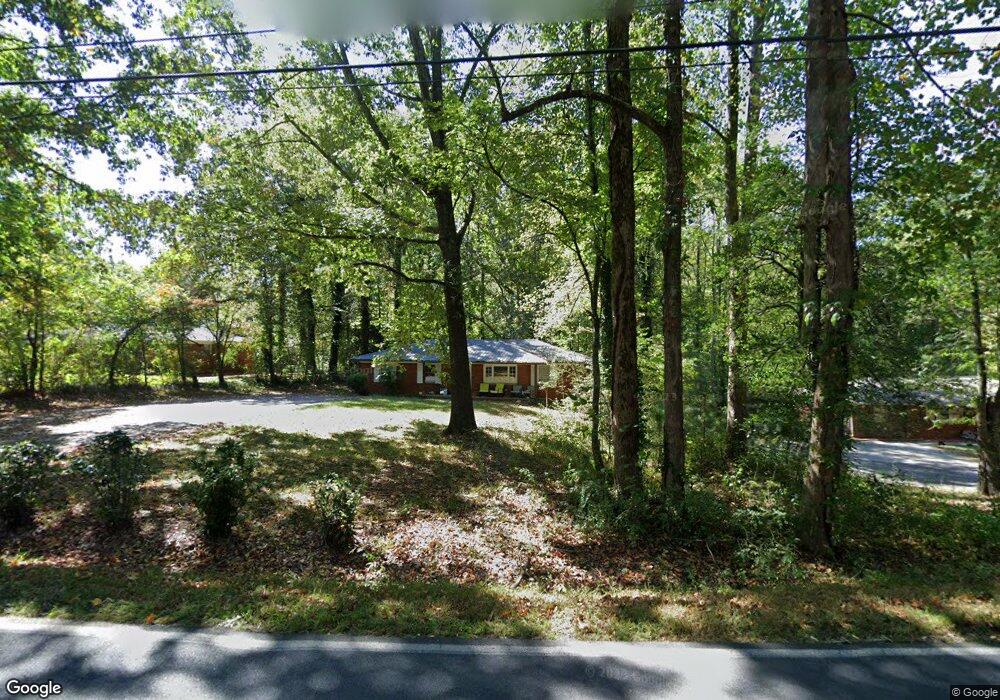
139 Camp Wahsega Rd Dahlonega, GA 30533
Estimated Value: $269,971 - $372,000
--
Bed
1
Bath
1,524
Sq Ft
$211/Sq Ft
Est. Value
About This Home
This home is located at 139 Camp Wahsega Rd, Dahlonega, GA 30533 and is currently estimated at $321,993, approximately $211 per square foot. 139 Camp Wahsega Rd is a home located in Lumpkin County with nearby schools including Clay County Middle School and Lumpkin County High School.
Ownership History
Date
Name
Owned For
Owner Type
Purchase Details
Closed on
Nov 10, 2004
Sold by
Dover Melissa and Dover Victor R
Bought by
Harrell Benjamin A and Harrell Lani S
Current Estimated Value
Purchase Details
Closed on
Sep 7, 2004
Sold by
Minobe Randy T
Bought by
Dover Melissa and Dover Victor R
Purchase Details
Closed on
Nov 3, 1997
Sold by
Thorns Elaine
Bought by
Minobe Randy T
Purchase Details
Closed on
Sep 2, 1993
Sold by
Burnette Priscilla
Bought by
Thorns Elaine
Purchase Details
Closed on
Apr 22, 1993
Sold by
Anderson Frances
Bought by
Burnette Priscilla
Purchase Details
Closed on
Aug 1, 1975
Bought by
Anderson Frances
Create a Home Valuation Report for This Property
The Home Valuation Report is an in-depth analysis detailing your home's value as well as a comparison with similar homes in the area
Home Values in the Area
Average Home Value in this Area
Purchase History
| Date | Buyer | Sale Price | Title Company |
|---|---|---|---|
| Harrell Benjamin A | $110,500 | -- | |
| Dover Melissa | $106,200 | -- | |
| Minobe Randy T | $78,000 | -- | |
| Thorns Elaine | $54,000 | -- | |
| Burnette Priscilla | $10,000 | -- | |
| Anderson Frances | -- | -- |
Source: Public Records
Tax History Compared to Growth
Tax History
| Year | Tax Paid | Tax Assessment Tax Assessment Total Assessment is a certain percentage of the fair market value that is determined by local assessors to be the total taxable value of land and additions on the property. | Land | Improvement |
|---|---|---|---|---|
| 2024 | $1,892 | $64,859 | $6,000 | $58,859 |
| 2023 | $1,423 | $60,491 | $6,000 | $54,491 |
| 2022 | $1,325 | $53,516 | $6,000 | $47,516 |
| 2021 | $1,148 | $44,840 | $6,000 | $38,840 |
| 2020 | $1,150 | $43,598 | $6,000 | $37,598 |
| 2019 | $1,161 | $43,598 | $6,000 | $37,598 |
| 2018 | $1,118 | $39,394 | $6,000 | $33,394 |
| 2017 | $1,119 | $38,682 | $6,000 | $32,682 |
| 2016 | $1,059 | $35,408 | $6,000 | $29,408 |
| 2015 | $944 | $35,408 | $6,000 | $29,408 |
| 2014 | $944 | $35,807 | $6,000 | $29,807 |
| 2013 | -- | $36,604 | $6,000 | $30,604 |
Source: Public Records
Map
Nearby Homes
- 0 Camp Wahsega Rd Unit 7600956
- 0 Camp Wahsega Rd Unit 10547292
- 357 Camp Wahsega Rd
- 181 Gilreath Way
- 22 Deer Ridge Rd
- 955 Camp Wahsega Rd
- 122 Tritt Rd
- 70 Avery Trail
- 77 Old River Rd
- 96 Elbert Gaddis Rd
- 98 Elbert Gaddis Rd
- 149 Highland Rd S
- 65 Golden Autumn Dr
- 159 Misty Way
- 97 Beaumont Dr
- 1202 Oak Grove Rd
- 238 Grand View St
- LOT 6 Sky Country Rd
- 64 Hickory Ln
- 163 Camp Wahsega Rd
- 121 Camp Wahsega Rd
- 52 Cane Creek Valley Rd Unit 7
- 70 Cane Creek Valley Rd Unit 8
- 70 Cane Creek Valley Rd
- 90 Camp Wahsega Rd
- 24 Cane Creek Valley Rd Unit 6
- 24 Cane Creek Valley Rd
- 130 Camp Wahsega Rd
- 63 Cane Creek Valley Rd
- 0 Wahsega Rd Unit 8391584
- 0 Wahsega Rd Unit 6021520
- 100 Camp Wahsega Rd
- 75 Cane Creek Valley Rd Unit 15
- 75 Cane Creek Valley Rd
- 110 Cane Creek Valley Rd
- 91 Cane Creek Valley Rd
- 55 Cane Creek Valley Rd
- 181 Camp Wahsega Rd
- 99 Cane Creek Valley Rd