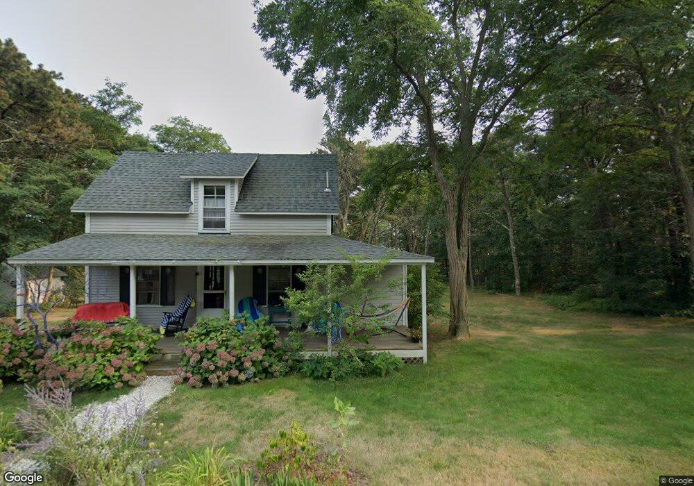
139 Cannon Hill Rd Wellfleet, MA 2667
Estimated Value: $350,000 - $911,000
--
Bed
--
Bath
--
Sq Ft
0.44
Acres
About This Home
This home is located at 139 Cannon Hill Rd, Wellfleet, MA 2667 and is currently estimated at $706,499. 139 Cannon Hill Rd is a home located in Barnstable County with nearby schools including Wellfleet Elementary School, Nauset Regional Middle School, and Nauset Regional High School.
Ownership History
Date
Name
Owned For
Owner Type
Purchase Details
Closed on
Jun 16, 2000
Sold by
Arnold Lois and Arnold Richard E
Bought by
Bernstein Martin and Bernstein Judith
Current Estimated Value
Home Financials for this Owner
Home Financials are based on the most recent Mortgage that was taken out on this home.
Original Mortgage
$140,000
Outstanding Balance
$49,426
Interest Rate
8.24%
Mortgage Type
Purchase Money Mortgage
Estimated Equity
$657,073
Create a Home Valuation Report for This Property
The Home Valuation Report is an in-depth analysis detailing your home's value as well as a comparison with similar homes in the area
Home Values in the Area
Average Home Value in this Area
Purchase History
| Date | Buyer | Sale Price | Title Company |
|---|---|---|---|
| Bernstein Martin | $215,000 | -- | |
| Bernstein Martin | $215,000 | -- |
Source: Public Records
Mortgage History
| Date | Status | Borrower | Loan Amount |
|---|---|---|---|
| Open | Bernstein Martin | $140,000 | |
| Closed | Bernstein Martin | $140,000 |
Source: Public Records
Tax History Compared to Growth
Tax History
| Year | Tax Paid | Tax Assessment Tax Assessment Total Assessment is a certain percentage of the fair market value that is determined by local assessors to be the total taxable value of land and additions on the property. | Land | Improvement |
|---|---|---|---|---|
| 2025 | $2,150 | $302,400 | $302,400 | $0 |
| 2024 | $1,967 | $288,000 | $288,000 | $0 |
| 2023 | $1,699 | $244,100 | $244,100 | $0 |
| 2022 | $1,666 | $214,100 | $214,100 | $0 |
| 2021 | $1,503 | $191,200 | $191,200 | $0 |
| 2020 | $1,559 | $201,200 | $201,200 | $0 |
| 2019 | $1,555 | $201,200 | $201,200 | $0 |
| 2018 | $1,445 | $201,200 | $201,200 | $0 |
| 2017 | $1,364 | $201,200 | $201,200 | $0 |
| 2016 | $1,361 | $199,300 | $199,300 | $0 |
| 2015 | $1,338 | $197,300 | $197,300 | $0 |
Source: Public Records
Map
Nearby Homes
- 60 Long Ave Unit E
- 25 1st Ave
- 95 Barker St
- 55 Harvard St
- 90 Paine Hollow Rd
- 40 Leilla Rich Dr
- 1937 State Hwy Rte 6 Unit 8
- 245 Paine Hollow Rd
- 2032 State Hwy Rte 6 Unit F/ (6)
- 175 Delphi Path
- 30 Sam Hollow Rd
- 80 Woodlot Rd
- 215 Pilgrim Spring Rd Unit 6
- 20 Lils Way
- 175 Cliff Rd
- 125 Governor Foss Dr
- 90 Blue Heron Rd
- 345 Cove Rd
- 90 Ring Rd
- 35 Tecumseh Rd
- 85 Cannon Hill Rd
- 25 Water St
- 20 Western Ave
- 95 Cannon Hill Rd
- 80 Cannon Hill Rd
- 25 H St
- 98 Cannon Hill Rd
- 1015 G St
- 1017 G St
- 3 H St
- 115 Cannon Hill Rd
- 104 Cannon Hill Rd
- 1055 Blackfish Ln
- 1005 G St
- 75 Cannon Hill Rd
- 110 Cannon Hill Rd
- 65 Cannon Hill Rd
- 51 H St
- 40 Cannon Hill Rd- Wellfleet
- 40 Cannon Hill Rd