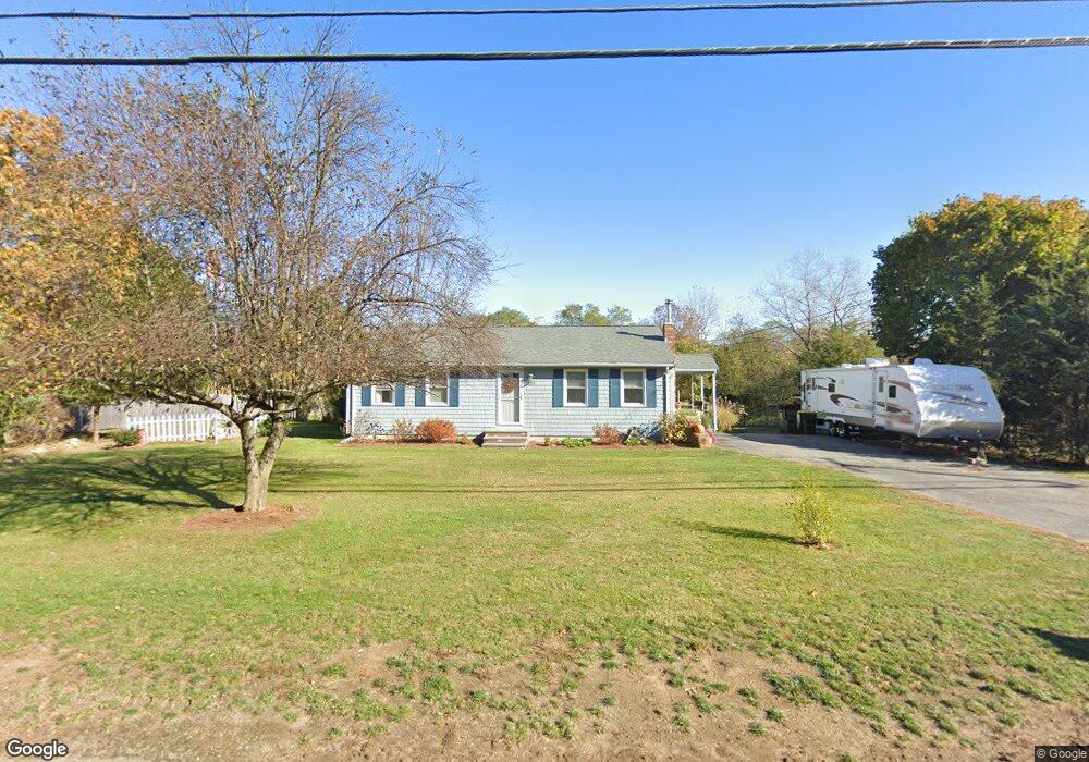
139 Center St Bellingham, MA 02019
Estimated Value: $457,000 - $502,000
2
Beds
1
Bath
1,560
Sq Ft
$309/Sq Ft
Est. Value
About This Home
This home is located at 139 Center St, Bellingham, MA 02019 and is currently estimated at $481,274, approximately $308 per square foot. 139 Center St is a home located in Norfolk County with nearby schools including Joseph F. DiPietro Elementary, Bellingham High School, and Rise Prep Mayoral Academy Middle School.
Ownership History
Date
Name
Owned For
Owner Type
Purchase Details
Closed on
Aug 27, 2025
Sold by
Kenneth & G Benjamin Ret and Benjamin
Bought by
Peterson Keanna and Fortes Flavio L
Current Estimated Value
Home Financials for this Owner
Home Financials are based on the most recent Mortgage that was taken out on this home.
Original Mortgage
$427,500
Outstanding Balance
$426,762
Interest Rate
6.75%
Mortgage Type
Purchase Money Mortgage
Estimated Equity
$54,512
Purchase Details
Closed on
Oct 25, 2024
Sold by
Benjamin Kenneth L and Benjamin Geraldine
Bought by
Benjamin
Purchase Details
Closed on
May 26, 2015
Sold by
Platt Andrew and Platt Margaret
Bought by
Benjamin Kenneth L and Benjamin Geraldine
Home Financials for this Owner
Home Financials are based on the most recent Mortgage that was taken out on this home.
Original Mortgage
$236,734
Interest Rate
3.66%
Mortgage Type
New Conventional
Purchase Details
Closed on
Aug 31, 2009
Sold by
Rose Richard F
Bought by
Platt Andrew and Platt Margaret
Home Financials for this Owner
Home Financials are based on the most recent Mortgage that was taken out on this home.
Original Mortgage
$216,600
Interest Rate
5.17%
Mortgage Type
Purchase Money Mortgage
Purchase Details
Closed on
Jun 2, 1993
Sold by
Smith Ronald A and Smith Elvena
Bought by
Rose Richard F
Home Financials for this Owner
Home Financials are based on the most recent Mortgage that was taken out on this home.
Original Mortgage
$103,150
Interest Rate
7.33%
Mortgage Type
Purchase Money Mortgage
Create a Home Valuation Report for This Property
The Home Valuation Report is an in-depth analysis detailing your home's value as well as a comparison with similar homes in the area
Home Values in the Area
Average Home Value in this Area
Purchase History
| Date | Buyer | Sale Price | Title Company |
|---|---|---|---|
| Peterson Keanna | $450,000 | -- | |
| Benjamin | -- | None Available | |
| Benjamin Kenneth L | $232,000 | -- | |
| Platt Andrew | $228,000 | -- | |
| Rose Richard F | $104,900 | -- | |
| Benjamin Kenneth L | $232,000 | -- | |
| Platt Andrew | $228,000 | -- | |
| Rose Richard F | $104,900 | -- |
Source: Public Records
Mortgage History
| Date | Status | Borrower | Loan Amount |
|---|---|---|---|
| Open | Peterson Keanna | $427,500 | |
| Previous Owner | Benjamin Kenneth L | $236,734 | |
| Previous Owner | Platt Andrew | $216,600 | |
| Previous Owner | Rose Richard F | $103,150 |
Source: Public Records
Tax History Compared to Growth
Tax History
| Year | Tax Paid | Tax Assessment Tax Assessment Total Assessment is a certain percentage of the fair market value that is determined by local assessors to be the total taxable value of land and additions on the property. | Land | Improvement |
|---|---|---|---|---|
| 2025 | $4,689 | $373,300 | $143,400 | $229,900 |
| 2024 | $4,509 | $350,600 | $131,000 | $219,600 |
| 2023 | $4,343 | $332,800 | $124,600 | $208,200 |
| 2022 | $4,273 | $303,500 | $105,000 | $198,500 |
| 2021 | $4,146 | $287,700 | $105,000 | $182,700 |
| 2020 | $3,881 | $272,900 | $105,000 | $167,900 |
| 2019 | $3,790 | $266,700 | $105,000 | $161,700 |
| 2018 | $3,561 | $247,100 | $105,900 | $141,200 |
| 2017 | $3,417 | $238,300 | $105,900 | $132,400 |
| 2016 | $3,345 | $234,100 | $110,200 | $123,900 |
| 2015 | $3,206 | $225,000 | $105,900 | $119,100 |
| 2014 | $3,196 | $218,000 | $102,400 | $115,600 |
Source: Public Records
Map
Nearby Homes
- 66 Newland Ave
- 6 Fleuette Dr
- 1250 Pulaski Blvd
- 4 Little Tree Ln
- 17 Susan Ln
- 352 Lake St
- 124 Lake St
- 361 S Main St
- 36 Indian Run Rd
- 540 Pulaski Blvd
- 340 Wrentham Rd
- 41 Mansion St
- 26 Iris Ln
- 29 Squire Ln
- 1 Clover Dr
- 65 Palmetto Dr Unit 65
- 21 Palmetto Dr Unit 21
- 70 Oswego St
- 24 Palmetto Dr Unit 24
- 30 Oak St