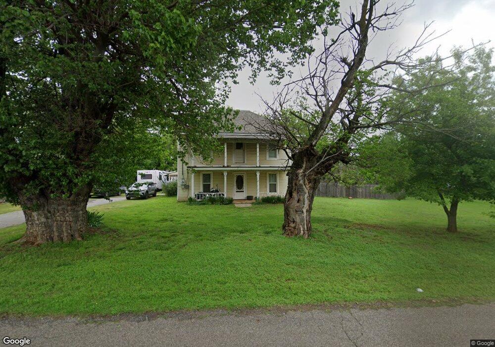
139 E Perry Ln Mustang, OK 73064
Estimated Value: $184,000 - $226,000
3
Beds
2
Baths
2,048
Sq Ft
$102/Sq Ft
Est. Value
About This Home
This home is located at 139 E Perry Ln, Mustang, OK 73064 and is currently estimated at $208,752, approximately $101 per square foot. 139 E Perry Ln is a home located in Canadian County with nearby schools including Mustang Elementary School, Mustang Horizon Intermediate School, and Mustang Middle School.
Ownership History
Date
Name
Owned For
Owner Type
Purchase Details
Closed on
Sep 22, 2021
Sold by
Simpson and Vernon
Bought by
Alvarado Marty and Alvarado Cherie
Current Estimated Value
Purchase Details
Closed on
Nov 8, 1994
Sold by
Gerlach Verna Leota and Gerlach Robert E
Purchase Details
Closed on
Oct 19, 1994
Sold by
Stivers Eugene L and Stivers Rosalyne
Bought by
Simpson Nancy
Purchase Details
Closed on
Sep 20, 1994
Sold by
City Of Mustang
Purchase Details
Closed on
Feb 7, 1989
Purchase Details
Closed on
Jan 12, 1989
Create a Home Valuation Report for This Property
The Home Valuation Report is an in-depth analysis detailing your home's value as well as a comparison with similar homes in the area
Home Values in the Area
Average Home Value in this Area
Purchase History
| Date | Buyer | Sale Price | Title Company |
|---|---|---|---|
| Alvarado Marty | -- | None Listed On Document | |
| -- | $25,000 | -- | |
| Simpson Nancy | -- | -- | |
| -- | -- | -- | |
| -- | -- | -- | |
| -- | -- | -- |
Source: Public Records
Tax History Compared to Growth
Tax History
| Year | Tax Paid | Tax Assessment Tax Assessment Total Assessment is a certain percentage of the fair market value that is determined by local assessors to be the total taxable value of land and additions on the property. | Land | Improvement |
|---|---|---|---|---|
| 2024 | $615 | $7,377 | $2,863 | $4,514 |
| 2023 | $615 | $7,163 | $2,706 | $4,457 |
| 2022 | $601 | $6,954 | $2,542 | $4,412 |
| 2021 | $685 | $6,752 | $2,364 | $4,388 |
| 2020 | $656 | $6,430 | $2,134 | $4,296 |
| 2019 | $625 | $6,124 | $1,925 | $4,199 |
| 2018 | $608 | $5,832 | $1,849 | $3,983 |
| 2017 | $572 | $5,555 | $1,748 | $3,807 |
| 2016 | $546 | $5,555 | $1,758 | $3,797 |
| 2015 | -- | $5,038 | $1,549 | $3,489 |
| 2014 | -- | $4,798 | $1,440 | $3,358 |
Source: Public Records
Map
Nearby Homes
- 138 E Carson Ln
- 3313 Little Creek Dr
- 3309 Little Creek Dr
- 3301 Little Creek Dr
- 3317 Little Creek Dr
- 3305 Little Creek Dr
- 3401 Little Creek Dr
- 4000 Becky Ln
- 4004 Becky Ln
- 3325 Little Creek Dr
- 3321 Little Creek Dr
- 3329 Little Creek Dr
- 3405 Little Creek Dr
- 3409 Little Creek Dr
- 3413 Little Creek Dr
- 4024 Becky Ln
- 316 E Greenwood Ln
- 531 E Juniper Ln
- 427 S Castlerock Circle Ln
- 425 W Linden Dr
- 139 E Perry Ln
- 908 S Jones Ln
- 904 S Jones Ln
- 130 E Perry Ln
- 915 S Lewis Ln
- 811 S Lewis Ln
- 146 E Forster Ln
- 138 E Forster Ln
- 826 S Lewis Ln
- 806 S Jones Ln
- 912 S Jones Ln
- 121 E Perry Ln
- 208 E Perry Ln
- 813 S Jones Ln
- 117 E Perry Ln
- 923 S Lewis Ln
- 215 E Perry Ln
- 139 E Dowden Ln
- 916 S Jones Ln
- 806 S Lewis Ln