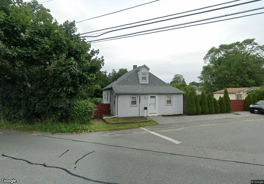
139 Elmwood Ave Swansea, MA 02777
Ocean Grove NeighborhoodEstimated Value: $354,000 - $403,892
4
Beds
1
Bath
1,082
Sq Ft
$350/Sq Ft
Est. Value
About This Home
This home is located at 139 Elmwood Ave, Swansea, MA 02777 and is currently estimated at $378,473, approximately $349 per square foot. 139 Elmwood Ave is a home located in Bristol County with nearby schools including Joseph Case High School and Swansea Wood School.
Ownership History
Date
Name
Owned For
Owner Type
Purchase Details
Closed on
Sep 23, 2025
Sold by
Rodrigues James
Bought by
Island Time T and Rodrigues
Current Estimated Value
Purchase Details
Closed on
Apr 5, 2001
Sold by
Santos Joseph and Santos Sandra
Bought by
Rodrigues James
Create a Home Valuation Report for This Property
The Home Valuation Report is an in-depth analysis detailing your home's value as well as a comparison with similar homes in the area
Home Values in the Area
Average Home Value in this Area
Purchase History
| Date | Buyer | Sale Price | Title Company |
|---|---|---|---|
| Island Time T | -- | -- | |
| Rodrigues James | $132,000 | -- |
Source: Public Records
Mortgage History
| Date | Status | Borrower | Loan Amount |
|---|---|---|---|
| Previous Owner | Rodrigues James | $210,000 | |
| Previous Owner | Rodrigues James | $100,000 | |
| Previous Owner | Rodrigues James | $151,500 |
Source: Public Records
Tax History Compared to Growth
Tax History
| Year | Tax Paid | Tax Assessment Tax Assessment Total Assessment is a certain percentage of the fair market value that is determined by local assessors to be the total taxable value of land and additions on the property. | Land | Improvement |
|---|---|---|---|---|
| 2025 | $3,791 | $318,000 | $170,000 | $148,000 |
| 2024 | $3,789 | $316,000 | $170,000 | $146,000 |
| 2023 | $3,370 | $256,700 | $126,300 | $130,400 |
| 2022 | $3,117 | $226,800 | $109,800 | $117,000 |
| 2021 | $3,117 | $199,400 | $114,800 | $84,600 |
| 2020 | $3,169 | $203,400 | $119,800 | $83,600 |
| 2019 | $2,868 | $184,900 | $103,100 | $81,800 |
| 2018 | $2,645 | $173,100 | $99,400 | $73,700 |
| 2017 | $2,385 | $179,600 | $95,100 | $84,500 |
| 2016 | $2,288 | $169,200 | $91,800 | $77,400 |
| 2015 | $2,111 | $160,800 | $91,800 | $69,000 |
| 2014 | $2,251 | $175,300 | $91,800 | $83,500 |
Source: Public Records
Map
Nearby Homes
- 193 Linden St
- 41,43,& 55 Laurel Ave
- 153 Puffer Ave
- 20 Sherbourne Ave
- 502 Ocean Grove Ave
- 41 James Ave
- 196 Coolidge St
- 159 Wilder St
- 25 Inverness Rd
- 105 Birchwood Dr
- 19 Keller Ave
- 123 Calef Ave
- 19 Richard Rd
- 110 Seaview Ave
- 34 Columbia Rd
- 127 Sheraton Ave
- 79 Cedar Ave
- 95 Winslow Way
- 8 2nd St
- 30 Front St
- 131 Elmwood Ave
- 56 Clancy St
- 60 Clancy St
- 145 Pinehurst Ave
- 42 Clancy St
- 125 Elmwood Ave
- 166 Pinehurst Ave Unit 9
- 166 Pinehurst Ave Unit 11
- 166 Pinehurst Ave Unit 20
- 166 Pinehurst Ave Unit 10
- 166 Pinehurst Ave Unit 28
- 166 Pinehurst Ave Unit 25
- 166 Pinehurst Ave Unit 13
- 166 Pinehurst Ave Unit 19
- 166 Pinehurst Ave Unit 16
- 166 Pinehurst Ave Unit 14
- 166 Pinehurst Ave Unit 5
- 166 Pinehurst Ave Unit 1 A
- 166 Pinehurst Ave Unit 26 B
- 166 Pinehurst Ave Unit 23 B