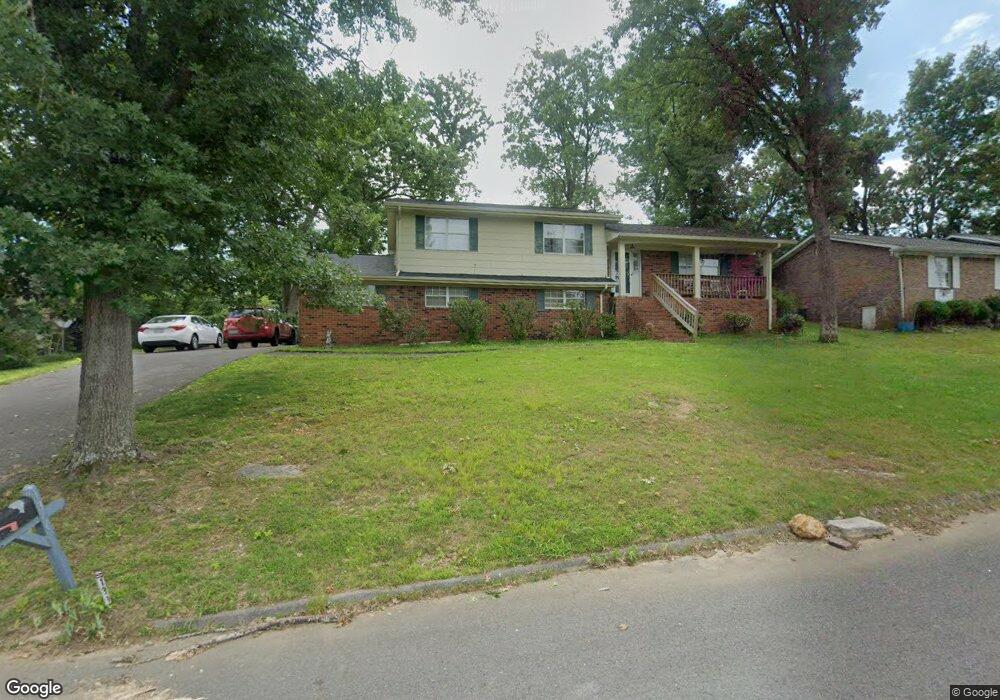
139 General Hays Rd Fort Oglethorpe, GA 30742
Estimated Value: $274,000 - $321,000
--
Bed
3
Baths
1,460
Sq Ft
$199/Sq Ft
Est. Value
About This Home
This home is located at 139 General Hays Rd, Fort Oglethorpe, GA 30742 and is currently estimated at $290,159, approximately $198 per square foot. 139 General Hays Rd is a home located in Catoosa County with nearby schools including Battlefield Primary School, Battlefield Elementary School, and Lakeview Middle School.
Ownership History
Date
Name
Owned For
Owner Type
Purchase Details
Closed on
Nov 30, 2009
Sold by
Fones Jackie D
Bought by
Waltrip Blayne C
Current Estimated Value
Home Financials for this Owner
Home Financials are based on the most recent Mortgage that was taken out on this home.
Original Mortgage
$114,000
Outstanding Balance
$74,776
Interest Rate
5.01%
Mortgage Type
New Conventional
Estimated Equity
$215,383
Purchase Details
Closed on
Nov 25, 1994
Bought by
Fones Jackie D
Create a Home Valuation Report for This Property
The Home Valuation Report is an in-depth analysis detailing your home's value as well as a comparison with similar homes in the area
Home Values in the Area
Average Home Value in this Area
Purchase History
| Date | Buyer | Sale Price | Title Company |
|---|---|---|---|
| Waltrip Blayne C | $120,000 | -- | |
| Fones Jackie D | $87,000 | -- |
Source: Public Records
Mortgage History
| Date | Status | Borrower | Loan Amount |
|---|---|---|---|
| Open | Waltrip Blayne C | $114,000 |
Source: Public Records
Tax History Compared to Growth
Tax History
| Year | Tax Paid | Tax Assessment Tax Assessment Total Assessment is a certain percentage of the fair market value that is determined by local assessors to be the total taxable value of land and additions on the property. | Land | Improvement |
|---|---|---|---|---|
| 2024 | $2,133 | $91,410 | $9,600 | $81,810 |
| 2023 | $1,700 | $71,310 | $9,600 | $61,710 |
| 2022 | $1,489 | $56,640 | $9,600 | $47,040 |
| 2021 | $1,409 | $56,640 | $9,600 | $47,040 |
| 2020 | $1,477 | $50,006 | $9,600 | $40,406 |
| 2019 | $1,381 | $50,006 | $9,600 | $40,406 |
| 2018 | $1,537 | $49,046 | $8,640 | $40,406 |
| 2017 | $1,412 | $48,750 | $8,640 | $40,110 |
| 2016 | $1,370 | $45,485 | $8,640 | $36,845 |
| 2015 | -- | $45,485 | $8,640 | $36,845 |
| 2014 | -- | $45,485 | $8,640 | $36,845 |
| 2013 | -- | $45,484 | $8,640 | $36,844 |
Source: Public Records
Map
Nearby Homes
- 6 Rocky Ford Rd
- 1305 Park Forrest Dr
- 64 Stovall St
- 99 Battlewood Dr
- 124 Colony Cir
- 183 McDonald Dr
- 84 Elaine Cir
- 351 Franklin Cir
- 52 S Glade Rd
- 0 Battlefield Pkwy Unit 129870
- 38 Phillips Dr
- 59 Gattis Dr
- 129 Cedar Grove Ln
- 504 Frieda Dr
- 325 Mockingbird Ln
- 17 Southshore Dr
- 15 Walker Ave
- 300 Dogwood Ln
- 301 Dogwood Ln
- 8 Phillips Dr
- 139 General Hayes Rd
- 135 General Hays Rd
- 135 General Hayes Rd
- 143 General Hays Rd
- 00 General Hays Rd
- 0 General Hays Rd
- 138 Stuart Rd
- 136 Stuart Rd
- 138 General Hays Rd
- 147 General Hayes Rd
- 142 General Hays Rd
- 131 General Hays Rd
- 131 General Hayes Rd
- 134 General Hays Rd
- 134 General Hays Rd Unit O
- 130 Stuart Rd
- 134 General Hayes Rd
- 147 General Hays Rd
- 142 Stuart Rd
- 146 General Hays Rd