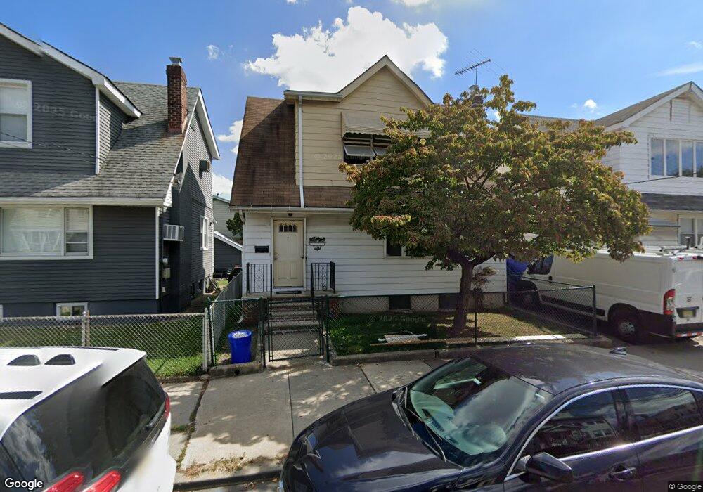
139 Grove St Bloomfield, NJ 07003
Estimated Value: $468,273 - $526,000
--
Bed
--
Bath
1,200
Sq Ft
$413/Sq Ft
Est. Value
About This Home
This home is located at 139 Grove St, Bloomfield, NJ 07003 and is currently estimated at $495,318, approximately $412 per square foot. 139 Grove St is a home located in Essex County with nearby schools including Carteret School, Bloomfield Middle School, and Bloomfield High School.
Ownership History
Date
Name
Owned For
Owner Type
Purchase Details
Closed on
Aug 20, 2007
Sold by
Zoino Lucia
Bought by
Sterling Elizabeth and Allbrook James
Current Estimated Value
Home Financials for this Owner
Home Financials are based on the most recent Mortgage that was taken out on this home.
Original Mortgage
$297,350
Outstanding Balance
$189,419
Interest Rate
6.78%
Mortgage Type
Purchase Money Mortgage
Estimated Equity
$305,899
Create a Home Valuation Report for This Property
The Home Valuation Report is an in-depth analysis detailing your home's value as well as a comparison with similar homes in the area
Home Values in the Area
Average Home Value in this Area
Purchase History
| Date | Buyer | Sale Price | Title Company |
|---|---|---|---|
| Sterling Elizabeth | $313,000 | First American Title Ins Co |
Source: Public Records
Mortgage History
| Date | Status | Borrower | Loan Amount |
|---|---|---|---|
| Open | Sterling Elizabeth | $297,350 |
Source: Public Records
Tax History Compared to Growth
Tax History
| Year | Tax Paid | Tax Assessment Tax Assessment Total Assessment is a certain percentage of the fair market value that is determined by local assessors to be the total taxable value of land and additions on the property. | Land | Improvement |
|---|---|---|---|---|
| 2025 | $9,768 | $298,900 | $90,400 | $208,500 |
| 2024 | $9,768 | $298,900 | $90,400 | $208,500 |
| 2022 | $9,571 | $298,900 | $90,400 | $208,500 |
| 2021 | $9,394 | $298,900 | $90,400 | $208,500 |
| 2020 | $9,251 | $298,900 | $90,400 | $208,500 |
| 2019 | $8,153 | $204,800 | $89,000 | $115,800 |
| 2018 | $8,118 | $204,800 | $89,000 | $115,800 |
| 2017 | $7,995 | $204,800 | $89,000 | $115,800 |
| 2016 | $7,905 | $204,800 | $89,000 | $115,800 |
| 2015 | $7,834 | $204,800 | $89,000 | $115,800 |
| 2014 | $7,690 | $204,800 | $89,000 | $115,800 |
Source: Public Records
Map
Nearby Homes
- 267 N 17th St
- 265 N 17th St
- 42 La France Ave
- 107 La France Ave
- 413 Beardsley Ave Unit 3
- 413 Beardsley Ave
- 228 N 17th St
- 219 N 16th St
- 220 N 17th St
- 23 Belmont Ave
- 41 Heckel St
- 20 Heckel St Unit 3
- 20 Heckel St
- 18 Brook St
- 200 N 15th St
- 76 Heckel St
- 80 Heckel St
- 21 Lexington Ave
- 96 Heckel St
- 149 Leslie St
- 135 Grove St
- 141 Grove St
- 16 Royalton Place
- 131 Grove St
- 12 Royalton Place
- 17 Tunbridge Place
- 127 Grove St
- 15 Tunbridge Place
- 10 Royalton Place
- 142 Grove St
- 142 Grove St Unit 2
- 142 Grove St Unit 1
- 11 Tunbridge Place
- 148 Grove St
- 140 Grove St
- 9 Tunbridge Place
- 15 Royalton Place
- 134 Grove St
- 11 Royalton Place
- 325 Ampere Pkwy