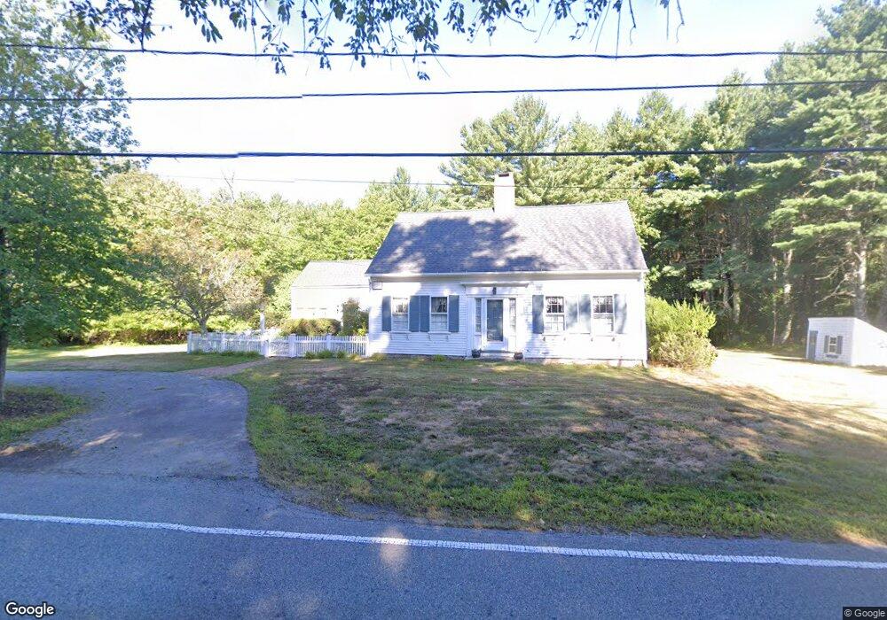
139 Hanover St Hanover, MA 02339
Estimated Value: $577,509 - $683,000
3
Beds
5
Baths
1,951
Sq Ft
$330/Sq Ft
Est. Value
About This Home
This home is located at 139 Hanover St, Hanover, MA 02339 and is currently estimated at $643,627, approximately $329 per square foot. 139 Hanover St is a home located in Plymouth County with nearby schools including Hanover High School, Cadence Academy Preschool - Hanover, and Cardinal Cushing Centers.
Ownership History
Date
Name
Owned For
Owner Type
Purchase Details
Closed on
Sep 7, 2018
Sold by
Stone Barbara A
Bought by
139 Hanover Street Rt
Current Estimated Value
Purchase Details
Closed on
Feb 14, 1968
Bought by
Stone Barbara A
Create a Home Valuation Report for This Property
The Home Valuation Report is an in-depth analysis detailing your home's value as well as a comparison with similar homes in the area
Home Values in the Area
Average Home Value in this Area
Purchase History
| Date | Buyer | Sale Price | Title Company |
|---|---|---|---|
| 139 Hanover Street Rt | -- | -- | |
| Stone Barbara A | -- | -- |
Source: Public Records
Mortgage History
| Date | Status | Borrower | Loan Amount |
|---|---|---|---|
| Previous Owner | Stone Barbara A | $100,000 | |
| Previous Owner | Stone Barbara A | $75,000 | |
| Previous Owner | Stone Barbara A | $45,000 |
Source: Public Records
Tax History Compared to Growth
Tax History
| Year | Tax Paid | Tax Assessment Tax Assessment Total Assessment is a certain percentage of the fair market value that is determined by local assessors to be the total taxable value of land and additions on the property. | Land | Improvement |
|---|---|---|---|---|
| 2025 | $6,749 | $546,500 | $284,200 | $262,300 |
| 2024 | $7,302 | $568,700 | $284,200 | $284,500 |
| 2023 | $7,165 | $531,100 | $258,900 | $272,200 |
| 2022 | $7,512 | $492,600 | $246,200 | $246,400 |
| 2021 | $7,128 | $436,500 | $201,100 | $235,400 |
| 2020 | $7,607 | $466,400 | $212,700 | $253,700 |
| 2019 | $6,963 | $424,300 | $212,700 | $211,600 |
| 2018 | $6,912 | $424,600 | $212,700 | $211,900 |
| 2017 | $6,770 | $409,800 | $208,700 | $201,100 |
| 2016 | $6,746 | $400,100 | $190,100 | $210,000 |
| 2015 | $5,494 | $340,200 | $176,400 | $163,800 |
Source: Public Records
Map
Nearby Homes
- 14 Longwood Ln Unit 14
- 265 Silver St
- 186 Elm St
- 180 Elm St
- 20 Meadow Brook Rd
- 62 Larchmont Ln
- 26 Church St
- 250 Center St
- 28 Old Shipyard Ln
- 51 Cervelli Farm Dr
- 37 Dr
- 23 Cervelli Farm Dr
- 38 Cervelli Farm Dr
- 9 Cervelli Farm Dr
- 114 Graham Hill Dr
- 436 Center St
- 116 Spring Meadow Ln
- 55 Shipyard Ln
- 7 Farmside Dr
- 8 Old Farm Rd
- 146 Hanover St
- 134 Hanover St
- 121 Hanover St
- 165 Hanover St
- 15 1st Parish Ln
- 118 Hanover St
- 33 1st Parish Ln
- 1 1st Parish Ln Unit 1
- 106 Hanover St
- 183 Hanover St
- 180 Hanover St
- 45 1st Parish Ln
- 96 Hanover St
- 40 1st Parish Ln
- 195 Hanover St
- 195 Hanover St Unit 1B
- 83 Hanover St
- 84 Hanover St
- 205 Hanover St
- 46 Rockland St Unit 2