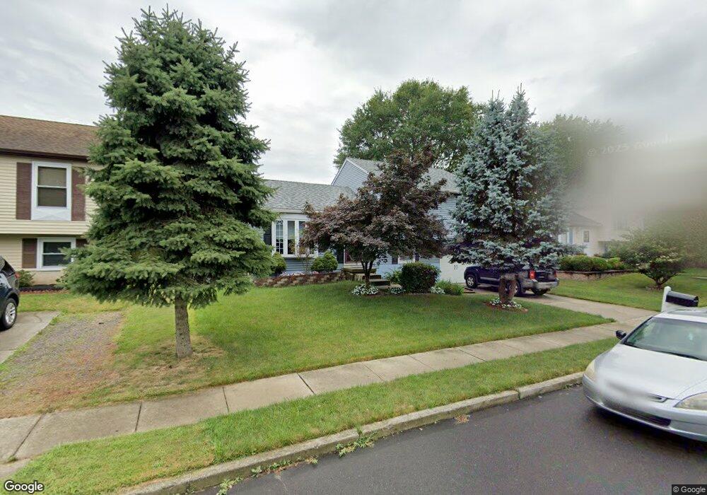
139 Independence Dr Morrisville, PA 19067
Estimated Value: $443,856 - $520,000
3
Beds
3
Baths
1,152
Sq Ft
$418/Sq Ft
Est. Value
About This Home
This home is located at 139 Independence Dr, Morrisville, PA 19067 and is currently estimated at $481,464, approximately $417 per square foot. 139 Independence Dr is a home located in Bucks County with nearby schools including Eleanor Roosevelt Elementary School, Pennwood Middle School, and Pennsbury High School.
Ownership History
Date
Name
Owned For
Owner Type
Purchase Details
Closed on
Nov 12, 2015
Sold by
Aime Isaac Fils
Bought by
Aime Dana Fils
Current Estimated Value
Purchase Details
Closed on
May 12, 2010
Sold by
Fils Aime Isaac and Fils Aime Dana
Bought by
Fils Aime Isaac
Purchase Details
Closed on
Aug 16, 1996
Sold by
Green Richard and Green Vicki
Bought by
Fils Aime Isaac and Fils Aime Dana
Home Financials for this Owner
Home Financials are based on the most recent Mortgage that was taken out on this home.
Original Mortgage
$132,925
Interest Rate
8.18%
Mortgage Type
FHA
Create a Home Valuation Report for This Property
The Home Valuation Report is an in-depth analysis detailing your home's value as well as a comparison with similar homes in the area
Home Values in the Area
Average Home Value in this Area
Purchase History
| Date | Buyer | Sale Price | Title Company |
|---|---|---|---|
| Aime Dana Fils | -- | None Available | |
| Fils Aime Isaac | -- | None Available | |
| Fils Aime Isaac | $141,500 | -- |
Source: Public Records
Mortgage History
| Date | Status | Borrower | Loan Amount |
|---|---|---|---|
| Previous Owner | Fils Aime Isaac | $132,925 |
Source: Public Records
Tax History Compared to Growth
Tax History
| Year | Tax Paid | Tax Assessment Tax Assessment Total Assessment is a certain percentage of the fair market value that is determined by local assessors to be the total taxable value of land and additions on the property. | Land | Improvement |
|---|---|---|---|---|
| 2025 | $5,790 | $26,000 | $5,280 | $20,720 |
| 2024 | $5,790 | $26,000 | $5,280 | $20,720 |
| 2023 | $5,548 | $26,000 | $5,280 | $20,720 |
| 2022 | $5,375 | $26,000 | $5,280 | $20,720 |
| 2021 | $5,271 | $26,000 | $5,280 | $20,720 |
| 2020 | $5,271 | $26,000 | $5,280 | $20,720 |
| 2019 | $5,179 | $26,000 | $5,280 | $20,720 |
| 2018 | $5,115 | $26,000 | $5,280 | $20,720 |
| 2017 | $4,986 | $26,000 | $5,280 | $20,720 |
| 2016 | $4,986 | $26,000 | $5,280 | $20,720 |
| 2015 | $4,781 | $26,000 | $5,280 | $20,720 |
| 2014 | $4,781 | $26,000 | $5,280 | $20,720 |
Source: Public Records
Map
Nearby Homes
- 10 Makefield Rd
- 115 Winding Way
- 113 Juliet Rd
- 413 Alden Ave
- 404 Alden Ave
- 5 Patrick Ln
- 229 Walton Dr
- 199 Share Dr
- 670 Lincoln Hwy
- 494 Keating Dr
- 120 Vermont Ln
- LOT 021-003 W M Y Ln
- 184 Crestview Way
- 581 Nottingham Dr
- 329 Sherwood Dr
- 320 Melvin Ave N
- 79 Sutphin Pines
- 46 Moon Dr
- 554 Doloro Dr
- 942 Roeloffs Ct
- 141 Independence Dr
- 137 Independence Dr
- 143 Independence Dr
- 135 Independence Dr
- 128 Independence Dr
- 126 Independence Dr
- 130 Independence Dr
- 145 Independence Dr
- 124 Independence Dr
- 133 Independence Dr
- 132 Independence Dr
- 147 Independence Dr
- 131 Independence Dr
- 420 Federal Ln
- 122 Independence Dr
- 134 Independence Dr
- 421 Musket Dr
- 419 Musket Dr
- 129 Independence Dr
- 423 Musket Dr