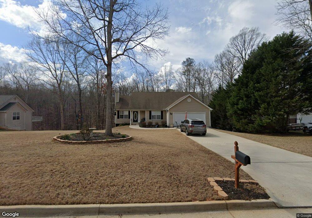
139 Kimbell Farm Dr Locust Grove, GA 30248
Estimated Value: $294,000 - $314,000
4
Beds
3
Baths
2,904
Sq Ft
$104/Sq Ft
Est. Value
About This Home
This home is located at 139 Kimbell Farm Dr, Locust Grove, GA 30248 and is currently estimated at $301,335, approximately $103 per square foot. 139 Kimbell Farm Dr is a home located in Henry County with nearby schools including Unity Grove Elementary School, Locust Grove Middle School, and Locust Grove High School.
Ownership History
Date
Name
Owned For
Owner Type
Purchase Details
Closed on
Jul 31, 2017
Sold by
Pierce Barbara J
Bought by
Pustelak Robert
Current Estimated Value
Home Financials for this Owner
Home Financials are based on the most recent Mortgage that was taken out on this home.
Original Mortgage
$162,298
Outstanding Balance
$134,805
Interest Rate
3.88%
Mortgage Type
VA
Estimated Equity
$166,530
Purchase Details
Closed on
Mar 2, 2012
Sold by
Wells Fargo Bank Na
Bought by
Pierce Barbara J
Home Financials for this Owner
Home Financials are based on the most recent Mortgage that was taken out on this home.
Original Mortgage
$86,734
Interest Rate
3.9%
Mortgage Type
New Conventional
Purchase Details
Closed on
Nov 26, 2002
Sold by
Suburban Builders Inc
Bought by
Parker Michael A
Home Financials for this Owner
Home Financials are based on the most recent Mortgage that was taken out on this home.
Original Mortgage
$129,820
Interest Rate
6.3%
Mortgage Type
New Conventional
Create a Home Valuation Report for This Property
The Home Valuation Report is an in-depth analysis detailing your home's value as well as a comparison with similar homes in the area
Home Values in the Area
Average Home Value in this Area
Purchase History
| Date | Buyer | Sale Price | Title Company |
|---|---|---|---|
| Pustelak Robert | $169,900 | -- | |
| Pierce Barbara J | $85,000 | -- | |
| Parker Michael A | $128,000 | -- |
Source: Public Records
Mortgage History
| Date | Status | Borrower | Loan Amount |
|---|---|---|---|
| Open | Pustelak Robert | $162,298 | |
| Previous Owner | Pierce Barbara J | $86,734 | |
| Previous Owner | Parker Michael A | $129,820 |
Source: Public Records
Tax History Compared to Growth
Tax History
| Year | Tax Paid | Tax Assessment Tax Assessment Total Assessment is a certain percentage of the fair market value that is determined by local assessors to be the total taxable value of land and additions on the property. | Land | Improvement |
|---|---|---|---|---|
| 2025 | $3,865 | $141,904 | $14,000 | $127,904 |
| 2024 | $3,865 | $129,160 | $14,000 | $115,160 |
| 2023 | $3,103 | $125,680 | $14,000 | $111,680 |
| 2022 | $3,057 | $102,360 | $14,000 | $88,360 |
| 2021 | $2,695 | $87,040 | $14,000 | $73,040 |
| 2020 | $2,386 | $73,960 | $12,000 | $61,960 |
| 2019 | $2,332 | $71,680 | $12,000 | $59,680 |
| 2018 | $2,189 | $65,600 | $10,800 | $54,800 |
| 2016 | $2,190 | $56,040 | $10,000 | $46,040 |
| 2015 | $2,070 | $51,320 | $10,000 | $41,320 |
| 2014 | $2,000 | $48,960 | $10,000 | $38,960 |
Source: Public Records
Map
Nearby Homes
- 143 Kimbell Farm Dr
- 218 Baxter Ln
- 521 Deadwood Trail
- 601 Amerigo Ct
- 100 Harbin Trail
- 121, 125, 129 Case Dr
- 1126 Old Jackson Rd
- 1000 Coan Dr
- 281 Laney Dr
- 995 Old Jackson Rd
- 604 Onieda Dr
- 705 Seabolt Rd
- 705 S Bethany Rd
- 215 Laney Rd
- 678 Seabolt Rd
- 767 Old Jackson Rd
- 125 Laney Ct
- 1850 Old Jackson Rd
- 165 Caraway Rd
- 201 Nina Cir
- 139 Kimbell Farm Dr Unit III
- 141 Kimbell Farm Dr Unit III
- 137 Kimbell Farm Dr
- 137 Kimbell Farm Dr Unit III
- 138 Kimbell Farm Dr
- 138 Kimbell Farm Dr Unit III
- 140 Kimbell Farm Dr
- 136 Kimbell Farm Dr
- 136 Kimbell Farm Dr Unit III
- 142 Kimbell Farm Dr
- 145 Kimbell Farm Dr
- 133 Kimbell Farm Dr
- 415 Kimbell Way
- 146 Kimbell Farm Dr
- 146 Kimbell Farm Dr Unit III
- 131 Kimbell Farm Dr
- 400 Kimbell Way Unit 17
- 400 Kimbell Way Unit 400
- 400 Kimbell Way
- 0 Kimbell Way Unit 7175288