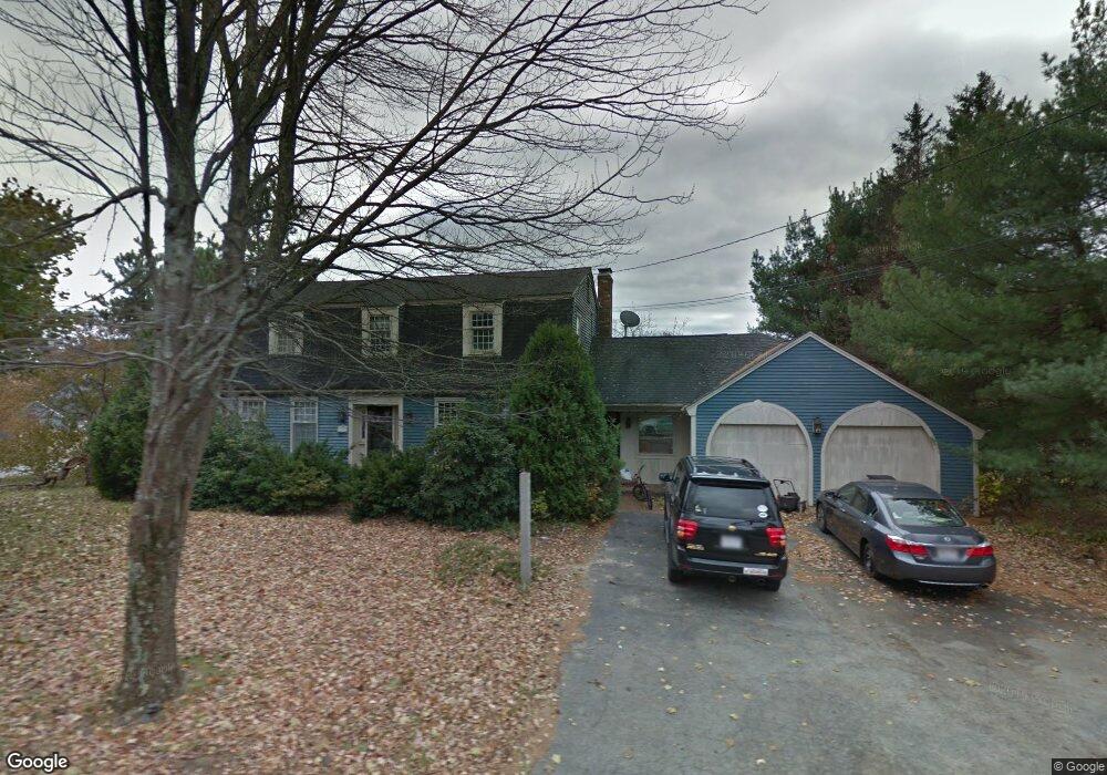
139 Laurel St West Boylston, MA 01583
Estimated Value: $615,000 - $700,000
3
Beds
3
Baths
2,503
Sq Ft
$260/Sq Ft
Est. Value
About This Home
This home is located at 139 Laurel St, West Boylston, MA 01583 and is currently estimated at $650,627, approximately $259 per square foot. 139 Laurel St is a home located in Worcester County with nearby schools including Major Edwards Elementary School and West Boylston Junior/Senior High School.
Ownership History
Date
Name
Owned For
Owner Type
Purchase Details
Closed on
May 20, 2008
Sold by
Marchese Mary L and Marchese Michael
Bought by
Hubbard Kristin and Hubbard Peter E
Current Estimated Value
Home Financials for this Owner
Home Financials are based on the most recent Mortgage that was taken out on this home.
Original Mortgage
$345,100
Interest Rate
5.91%
Mortgage Type
Purchase Money Mortgage
Purchase Details
Closed on
Aug 31, 1998
Sold by
Lenkarski Paul B and Lenkarski Susan A
Bought by
Marchese Michael and Marchese Mary L
Create a Home Valuation Report for This Property
The Home Valuation Report is an in-depth analysis detailing your home's value as well as a comparison with similar homes in the area
Home Values in the Area
Average Home Value in this Area
Purchase History
| Date | Buyer | Sale Price | Title Company |
|---|---|---|---|
| Hubbard Kristin | $370,000 | -- | |
| Marchese Michael | $255,000 | -- |
Source: Public Records
Mortgage History
| Date | Status | Borrower | Loan Amount |
|---|---|---|---|
| Open | Marchese Michael | $346,004 | |
| Closed | Hubbard Kristin | $345,100 | |
| Previous Owner | Marchese Michael | $100,000 |
Source: Public Records
Tax History Compared to Growth
Tax History
| Year | Tax Paid | Tax Assessment Tax Assessment Total Assessment is a certain percentage of the fair market value that is determined by local assessors to be the total taxable value of land and additions on the property. | Land | Improvement |
|---|---|---|---|---|
| 2025 | $83 | $595,100 | $104,700 | $490,400 |
| 2024 | $7,224 | $488,800 | $104,700 | $384,100 |
| 2023 | $7,103 | $455,900 | $103,800 | $352,100 |
| 2022 | $6,975 | $394,500 | $103,800 | $290,700 |
| 2021 | $6,623 | $358,800 | $100,000 | $258,800 |
| 2020 | $6,483 | $348,900 | $100,000 | $248,900 |
| 2019 | $6,292 | $333,800 | $100,000 | $233,800 |
| 2018 | $5,638 | $301,200 | $100,000 | $201,200 |
| 2017 | $5,723 | $304,400 | $100,000 | $204,400 |
| 2016 | $5,587 | $302,800 | $93,300 | $209,500 |
| 2015 | $5,671 | $309,200 | $92,300 | $216,900 |
Source: Public Records
Map
Nearby Homes
- 287 Laurel St
- 16 N Main St
- 26 Townsend Dr
- 0 North St
- Lot 1 Manning St
- 20 Winthrop St
- 136 Sterling St Unit A3
- 0 Boutelle Rd
- 61 Boutelle Rd
- 156 Prospect St
- 223 Worcester Rd
- 2 Lakeview Ave
- 18 Laurel Ave
- 21 Myrtle Ave
- 152 Worcester St Unit 8
- 751 Mason Rd
- 4 Jewett Rd Unit B
- 4 Jewett Rd Unit A
- 54 Maple St
- 62 Maple St