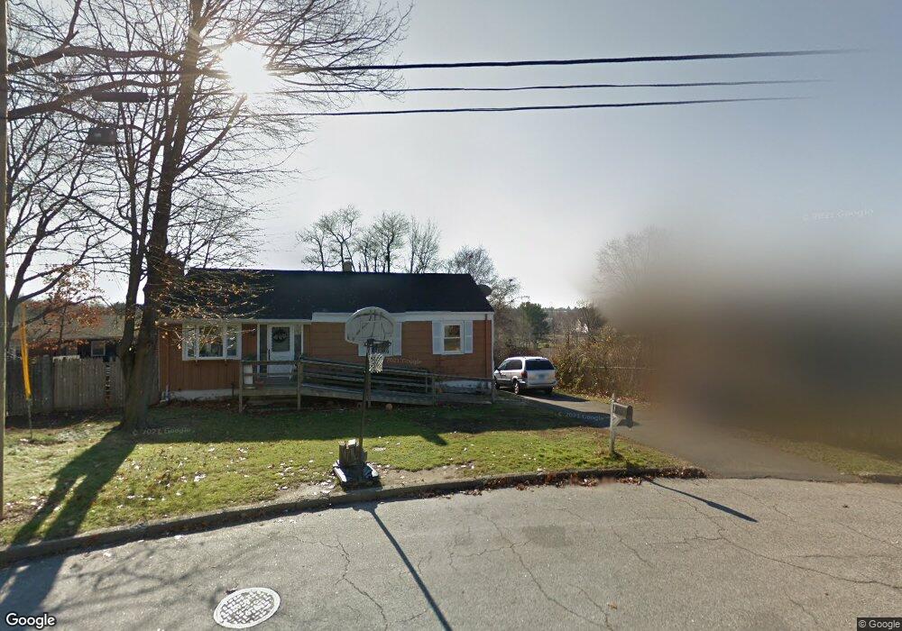
139 Little Deer Rd Bridgeport, CT 06606
North End NeighborhoodEstimated Value: $449,675 - $491,000
6
Beds
3
Baths
1,420
Sq Ft
$335/Sq Ft
Est. Value
About This Home
This home is located at 139 Little Deer Rd, Bridgeport, CT 06606 and is currently estimated at $475,669, approximately $334 per square foot. 139 Little Deer Rd is a home located in Fairfield County with nearby schools including John Winthrop School, Central High School, and St Andrew School.
Ownership History
Date
Name
Owned For
Owner Type
Purchase Details
Closed on
Feb 13, 1995
Sold by
Miranda Marcos P and Miranda Celeste A
Bought by
Boursiquot Eddy and Boursiquot Sylvie
Current Estimated Value
Purchase Details
Closed on
Oct 27, 1993
Sold by
Richard Henry
Bought by
Miranda Marcos and Miranda Celeste
Create a Home Valuation Report for This Property
The Home Valuation Report is an in-depth analysis detailing your home's value as well as a comparison with similar homes in the area
Home Values in the Area
Average Home Value in this Area
Purchase History
| Date | Buyer | Sale Price | Title Company |
|---|---|---|---|
| Boursiquot Eddy | $116,000 | -- | |
| Boursiquot Eddy | $116,000 | -- | |
| Miranda Marcos | $95,000 | -- | |
| Miranda Marcos | $95,000 | -- |
Source: Public Records
Mortgage History
| Date | Status | Borrower | Loan Amount |
|---|---|---|---|
| Open | Miranda Marcos | $210,000 | |
| Closed | Miranda Marcos | $183,800 | |
| Closed | Miranda Marcos | $183,600 |
Source: Public Records
Tax History Compared to Growth
Tax History
| Year | Tax Paid | Tax Assessment Tax Assessment Total Assessment is a certain percentage of the fair market value that is determined by local assessors to be the total taxable value of land and additions on the property. | Land | Improvement |
|---|---|---|---|---|
| 2025 | $7,639 | $175,820 | $83,610 | $92,210 |
| 2024 | $7,639 | $175,820 | $83,610 | $92,210 |
| 2023 | $7,639 | $175,820 | $83,610 | $92,210 |
| 2022 | $7,639 | $175,820 | $83,610 | $92,210 |
| 2021 | $7,639 | $175,820 | $83,610 | $92,210 |
| 2020 | $7,819 | $144,820 | $65,470 | $79,350 |
| 2019 | $7,819 | $144,820 | $65,470 | $79,350 |
| 2018 | $7,874 | $144,820 | $65,470 | $79,350 |
| 2017 | $7,874 | $144,820 | $65,470 | $79,350 |
| 2016 | $7,874 | $144,820 | $65,470 | $79,350 |
| 2015 | $6,871 | $162,820 | $64,410 | $98,410 |
| 2014 | $6,871 | $162,820 | $64,410 | $98,410 |
Source: Public Records
Map
Nearby Homes
- 173 Anton Dr
- 50 Greenhouse Rd Unit 65D
- 50 Greenhouse Rd Unit 42C
- 394 Anton Dr
- 87 Oliver St
- 64 Dobson St
- 236 Edgemoor Rd Unit D
- 65 Dobson St
- 9 Patricia Rd Unit C
- 114 Oxford St
- 344 Cambridge St
- 72 Herald Ave
- 84 Oxford St
- 265 Vincellette St
- 2851 Old Town Rd
- 2998 Madison Ave Unit C
- 288 Sunrise Terrace
- 490 Woodside Ave
- 333 Vincellette St Unit 109
- 230 Cherry Hill Dr Unit 2B
- 149 Little Deer Rd
- 131 Little Deer Rd
- 50 Sunburst Rd
- 70 Sunburst Rd
- 140 Little Deer Rd
- 115 Little Deer Rd
- 36 Sunburst Rd
- 161 Little Deer Rd
- 86 Sunburst Rd
- 166 Little Deer Rd
- 177 Little Deer Rd
- 105 Little Deer Rd
- 24 Sunburst Rd
- 50 Greenhouse Rd Unit 33B
- 50 Greenhouse Rd Unit 74D
- 50 Greenhouse Rd Unit 74B
- 50 Greenhouse Rd Unit 74A
- 50 Greenhouse Rd Unit 66D
- 50 Greenhouse Rd Unit 66C