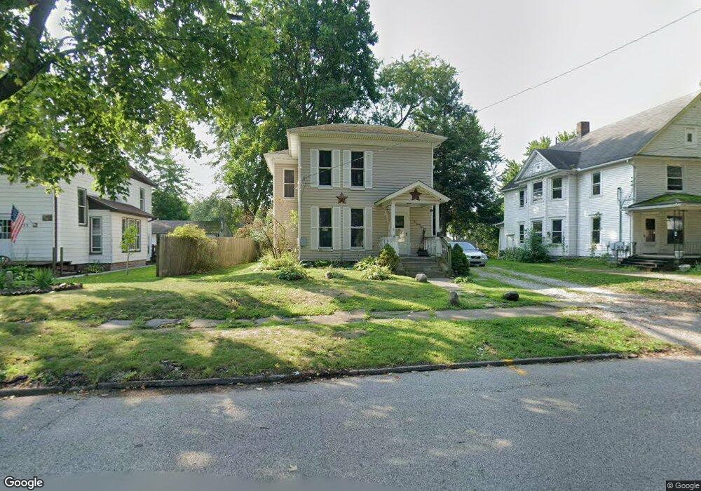
139 Marshall St Conneaut, OH 44030
Estimated Value: $94,000 - $119,000
3
Beds
2
Baths
1,726
Sq Ft
$63/Sq Ft
Est. Value
About This Home
This home is located at 139 Marshall St, Conneaut, OH 44030 and is currently estimated at $109,083, approximately $63 per square foot. 139 Marshall St is a home located in Ashtabula County with nearby schools including Lakeshore Primary Elementary School, Gateway Elementary School, and Conneaut Middle School.
Ownership History
Date
Name
Owned For
Owner Type
Purchase Details
Closed on
Feb 28, 2024
Sold by
Crosbie Robert and Crosbie Elaine Sue
Bought by
Smith Vera and Smith Dale
Current Estimated Value
Purchase Details
Closed on
Dec 21, 2000
Sold by
State Street Bank & Trus
Bought by
Crosbie Robert
Purchase Details
Closed on
Aug 15, 2000
Sold by
Shrf Encil S Bailey Pr
Bought by
State Street Bank & Trust Co Trustee
Create a Home Valuation Report for This Property
The Home Valuation Report is an in-depth analysis detailing your home's value as well as a comparison with similar homes in the area
Home Values in the Area
Average Home Value in this Area
Purchase History
| Date | Buyer | Sale Price | Title Company |
|---|---|---|---|
| Smith Vera | $22,420 | None Listed On Document | |
| Crosbie Robert | $20,900 | -- | |
| State Street Bank & Trust Co Trustee | $20,000 | -- |
Source: Public Records
Tax History Compared to Growth
Tax History
| Year | Tax Paid | Tax Assessment Tax Assessment Total Assessment is a certain percentage of the fair market value that is determined by local assessors to be the total taxable value of land and additions on the property. | Land | Improvement |
|---|---|---|---|---|
| 2024 | $1,283 | $17,540 | $2,870 | $14,670 |
| 2023 | $835 | $17,540 | $2,870 | $14,670 |
| 2022 | $780 | $14,430 | $2,210 | $12,220 |
| 2021 | $793 | $14,430 | $2,210 | $12,220 |
| 2020 | $793 | $14,430 | $2,210 | $12,220 |
| 2019 | $532 | $9,450 | $1,400 | $8,050 |
| 2018 | $508 | $9,450 | $1,400 | $8,050 |
| 2017 | $507 | $9,450 | $1,400 | $8,050 |
| 2016 | $689 | $14,080 | $2,070 | $12,010 |
| 2015 | $696 | $14,080 | $2,070 | $12,010 |
| 2014 | $1,007 | $23,070 | $2,070 | $21,000 |
| 2013 | $659 | $15,510 | $1,960 | $13,550 |
Source: Public Records
Map
Nearby Homes
- 143 Marshall St Unit 145
- 133 Marshall St
- 149 Marshall St
- 134 Poplar St
- 127 Marshall St
- 124 Poplar St
- 144 Poplar St
- 155 Marshall St
- 121 Marshall St
- 140 Marshall St
- 118 Poplar St
- 136 Marshall St
- 148 Marshall St
- 150 Poplar St
- 132 Marshall St
- 163 Marshall St
- 128 Marshall St
- 112 Poplar St
- 156 Marshall St
- 115 Marshall St