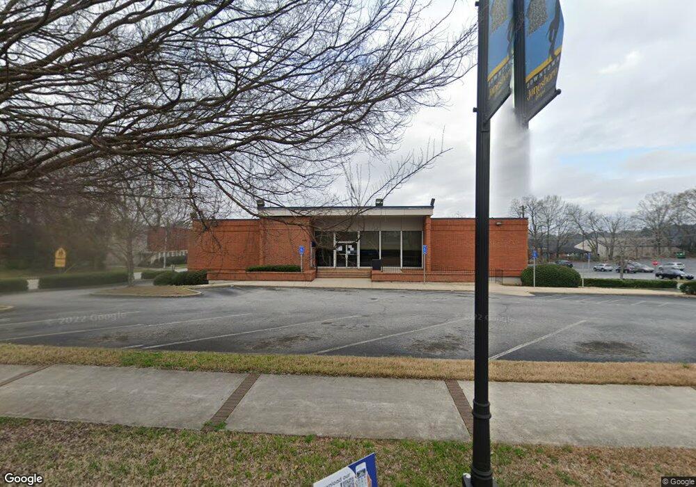
139 N Main St Jonesboro, GA 30236
Estimated Value: $3,885,469
--
Bed
--
Bath
4,302
Sq Ft
$903/Sq Ft
Est. Value
About This Home
This home is located at 139 N Main St, Jonesboro, GA 30236 and is currently estimated at $3,885,469, approximately $903 per square foot. 139 N Main St is a home located in Clayton County with nearby schools including Lee Street Elementary School, Jonesboro Middle School, and Jonesboro High School.
Ownership History
Date
Name
Owned For
Owner Type
Purchase Details
Closed on
Apr 22, 2019
Sold by
National Retail Properties Lp
Bought by
Pilot Properties Llc
Current Estimated Value
Purchase Details
Closed on
Jun 20, 2013
Sold by
Ia Branch Portfolio Llc
Bought by
National Retail Properties Lp
Purchase Details
Closed on
Mar 28, 2008
Sold by
Suntrust Bank
Bought by
Ia Branch Portfolio Llc
Home Financials for this Owner
Home Financials are based on the most recent Mortgage that was taken out on this home.
Original Mortgage
$34,311,000
Interest Rate
6.08%
Mortgage Type
New Conventional
Create a Home Valuation Report for This Property
The Home Valuation Report is an in-depth analysis detailing your home's value as well as a comparison with similar homes in the area
Home Values in the Area
Average Home Value in this Area
Purchase History
| Date | Buyer | Sale Price | Title Company |
|---|---|---|---|
| Pilot Properties Llc | $2,145,000 | -- | |
| Pilot Properties Llc | -- | -- | |
| National Retail Properties Lp | $1,676,000 | -- | |
| Ia Branch Portfolio Llc | $1,564,000 | -- |
Source: Public Records
Mortgage History
| Date | Status | Borrower | Loan Amount |
|---|---|---|---|
| Previous Owner | Ia Branch Portfolio Llc | $34,311,000 |
Source: Public Records
Tax History Compared to Growth
Tax History
| Year | Tax Paid | Tax Assessment Tax Assessment Total Assessment is a certain percentage of the fair market value that is determined by local assessors to be the total taxable value of land and additions on the property. | Land | Improvement |
|---|---|---|---|---|
| 2024 | $15,116 | $387,480 | $35,080 | $352,400 |
| 2023 | $13,990 | $387,480 | $35,080 | $352,400 |
| 2022 | $15,207 | $387,480 | $35,080 | $352,400 |
| 2021 | $15,304 | $387,480 | $35,080 | $352,400 |
| 2020 | $14,926 | $373,200 | $35,000 | $338,200 |
| 2019 | $14,704 | $362,200 | $35,000 | $327,200 |
| 2018 | $12,498 | $362,200 | $35,000 | $327,200 |
| 2017 | $13,444 | $330,400 | $35,000 | $295,400 |
| 2016 | $13,444 | $330,400 | $35,000 | $295,400 |
| 2015 | $13,218 | $0 | $0 | $0 |
| 2014 | $13,141 | $330,400 | $35,000 | $295,400 |
Source: Public Records
Map
Nearby Homes
- 135 Main St
- 109 Stockbridge Rd
- 215 King St
- 151 Irvin St
- 181 Dean St
- 1250 Grove Pkwy
- 116 Stewart Ave
- 192 Cloud St
- 9758 Highway 54
- 123 Arnold Place
- 408 N Mcdonough St
- 1433 Butler St
- 776 Jeb Stuart Dr
- 761 Robert e Lee Pkwy
- 0 State Highway 54
- 242 Lake Jodeco Rd
- 8474 Magnolia Dr
- 8645 Embrey Dr
- 304 Mercer Dr
- 8399 Carlington Ln
- 145 N Main St
- 147 B N Main
- 127 N Main St
- 151 N Main St Unit Suite-B
- 151 N Main St Unit Suite-A
- 151 N Main St
- 125 N Main St
- 122 N Mcdonough St
- 104 N Mcdonough St
- 118 N Mcdonough St
- 150 N Mcdonough St Unit 1
- 150 N Mcdonough St
- 120 N Mcdonough St
- 120 N Mcdonough St Unit 205
- 120 N Mcdonough St Unit 500
- 120 N Mcdonough St Unit 202
- 120 N Mcdonough St Unit 920
- 120 N Mcdonough St Unit 118A
- 120 N Mcdonough St Unit 108
- 120 N Mcdonough St Unit 204