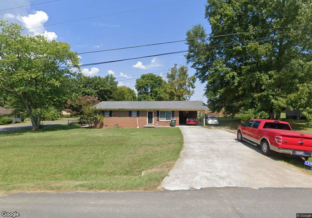
139 N Whitfield Dr NE Dalton, GA 30721
Estimated Value: $212,760 - $257,000
3
Beds
2
Baths
1,498
Sq Ft
$158/Sq Ft
Est. Value
About This Home
This home is located at 139 N Whitfield Dr NE, Dalton, GA 30721 and is currently estimated at $236,190, approximately $157 per square foot. 139 N Whitfield Dr NE is a home located in Whitfield County with nearby schools including Varnell Elementary School, Coahulla Creek High School, and Cedar Valley Christian Academy.
Ownership History
Date
Name
Owned For
Owner Type
Purchase Details
Closed on
Jul 18, 2006
Sold by
Not Provided
Bought by
Grant Clint and Grant Christa
Current Estimated Value
Home Financials for this Owner
Home Financials are based on the most recent Mortgage that was taken out on this home.
Original Mortgage
$122,000
Outstanding Balance
$72,548
Interest Rate
6.68%
Mortgage Type
New Conventional
Estimated Equity
$163,642
Purchase Details
Closed on
Apr 3, 2003
Sold by
Gilreath Carol
Bought by
Morrison Dewitt W and Morrison Rebecca M
Purchase Details
Closed on
Mar 1, 1994
Bought by
Gilreath Carol
Create a Home Valuation Report for This Property
The Home Valuation Report is an in-depth analysis detailing your home's value as well as a comparison with similar homes in the area
Home Values in the Area
Average Home Value in this Area
Purchase History
| Date | Buyer | Sale Price | Title Company |
|---|---|---|---|
| Grant Clint | $122,000 | -- | |
| Morrison Dewitt W | $106,700 | -- | |
| Gilreath Carol | $65,000 | -- |
Source: Public Records
Mortgage History
| Date | Status | Borrower | Loan Amount |
|---|---|---|---|
| Open | Grant Clint | $122,000 |
Source: Public Records
Tax History Compared to Growth
Tax History
| Year | Tax Paid | Tax Assessment Tax Assessment Total Assessment is a certain percentage of the fair market value that is determined by local assessors to be the total taxable value of land and additions on the property. | Land | Improvement |
|---|---|---|---|---|
| 2024 | $1,441 | $79,350 | $9,240 | $70,110 |
| 2023 | $1,441 | $55,044 | $7,000 | $48,044 |
| 2022 | $934 | $40,214 | $7,000 | $33,214 |
| 2021 | $934 | $40,214 | $7,000 | $33,214 |
| 2020 | $941 | $39,782 | $7,000 | $32,782 |
| 2019 | $951 | $39,782 | $7,000 | $32,782 |
| 2018 | $961 | $39,782 | $7,000 | $32,782 |
| 2017 | $961 | $39,782 | $7,000 | $32,782 |
| 2016 | $796 | $35,134 | $5,250 | $29,884 |
| 2014 | $759 | $35,584 | $5,250 | $30,334 |
| 2013 | -- | $35,584 | $5,250 | $30,334 |
Source: Public Records
Map
Nearby Homes
- 3147 Cleveland Hwy
- 3025 Cleveland Hwy
- 3216 Cleveland Hwy
- 2002 Broadacre Dr NW
- 222 Pacer Ln
- 230 Pacer Ln
- 303 Cherokee Trail NW
- 0 Pacer Ln
- 337 Pacer Ln Unit 4
- 322 Pacer Ln
- 287 Williams Rd NW
- 360 Pacer Ln
- 3050 Cleveland Hwy
- 329 Kempton Ln
- 3450 Misty Meadows Dr NW
- 3201 Maple Grove Dr NW
- 1425 Wiggs Dr
- 609 Cherokee Trail NW
- 153 Cochran Dr NE
- 106 Albertson Dr
- 139 N Whitfield Dr NE
- 138 N Whitfield Dr NE
- 145 N Whitfield Dr NE
- 134 N Whitfield Dr NE
- 144 N Whitfield Dr NE
- 131 N Whitfield Dr NE
- 148 N Whitfield Dr NE
- 128 N Whitfield Dr NE
- 207 Tanglewood Dr NE
- 171 N North Whitfield Dr
- 209 Tanglewood Dr NE
- 153 N Whitfield Dr NE
- 125 N Whitfield Dr NE
- 205 Tanglewood Dr NE
- 152 N Whitfield Dr NE
- 247 Hazel Ln NE
- 211 Tanglewood Dr NE
- 243 Hazel Ln NE
- 248 Hazel Ln NE
- 213 Tanglewood Dr NE