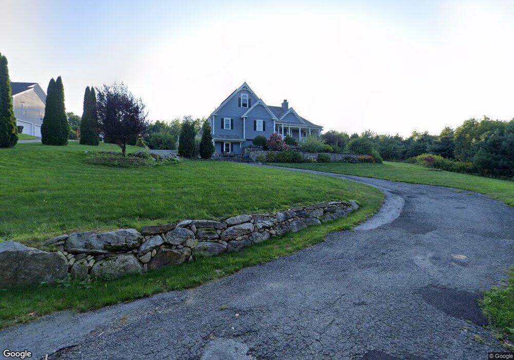
139 Osgood Rd Charlton, MA 01507
Estimated Value: $778,691 - $873,000
4
Beds
3
Baths
2,568
Sq Ft
$315/Sq Ft
Est. Value
About This Home
This home is located at 139 Osgood Rd, Charlton, MA 01507 and is currently estimated at $807,673, approximately $314 per square foot. 139 Osgood Rd is a home with nearby schools including Shepherd Hill Regional High School.
Ownership History
Date
Name
Owned For
Owner Type
Purchase Details
Closed on
Dec 18, 2012
Sold by
Nylin George K Est and Nylin
Bought by
Cestaro Gerald P and Cestaro Robin L
Current Estimated Value
Home Financials for this Owner
Home Financials are based on the most recent Mortgage that was taken out on this home.
Original Mortgage
$573,000
Outstanding Balance
$407,199
Interest Rate
4%
Mortgage Type
Adjustable Rate Mortgage/ARM
Estimated Equity
$400,474
Create a Home Valuation Report for This Property
The Home Valuation Report is an in-depth analysis detailing your home's value as well as a comparison with similar homes in the area
Home Values in the Area
Average Home Value in this Area
Purchase History
| Date | Buyer | Sale Price | Title Company |
|---|---|---|---|
| Cestaro Gerald P | $61,500 | -- | |
| Cestaro Gerald P | $61,500 | -- | |
| Cestaro Gerald P | $61,500 | -- |
Source: Public Records
Mortgage History
| Date | Status | Borrower | Loan Amount |
|---|---|---|---|
| Open | Cestaro Gerald P | $573,000 | |
| Closed | Cestaro Gerald P | $573,000 |
Source: Public Records
Tax History Compared to Growth
Tax History
| Year | Tax Paid | Tax Assessment Tax Assessment Total Assessment is a certain percentage of the fair market value that is determined by local assessors to be the total taxable value of land and additions on the property. | Land | Improvement |
|---|---|---|---|---|
| 2025 | $8,755 | $786,600 | $91,600 | $695,000 |
| 2024 | $8,590 | $757,500 | $86,600 | $670,900 |
| 2023 | $8,371 | $687,800 | $86,600 | $601,200 |
| 2022 | $8,573 | $645,100 | $79,200 | $565,900 |
| 2021 | $6,328 | $421,600 | $69,300 | $352,300 |
| 2020 | $6,225 | $416,700 | $64,400 | $352,300 |
| 2019 | $6,155 | $416,700 | $64,400 | $352,300 |
| 2018 | $5,625 | $416,700 | $64,400 | $352,300 |
| 2017 | $6,476 | $459,300 | $64,400 | $394,900 |
| 2016 | $6,329 | $459,300 | $64,400 | $394,900 |
| 2015 | $6,164 | $459,300 | $64,400 | $394,900 |
| 2014 | $891 | $70,400 | $70,400 | $0 |
Source: Public Records
Map
Nearby Homes
- Lot 0 N Sturbridge Rd
- 3 Cranberry Meadow Shore Rd
- 208 Sunset Dr
- 86 Jolicoeur Ave
- 49 Jennings Rd
- 45 Jennings Rd
- 199 Center Depot Rd
- 204 Brookfield Rd
- 38 Stevens Park Rd
- 65 Old Spencer Rd
- 216 Brookfield Rd
- Lot 3 0 N Sullivan Rd
- Lot 6 0 N Sullivan Rd
- Lot 5 0 N Sullivan Rd
- Lot 4 0 N Sullivan Rd
- 9 Knollwood Dr
- 38 N Sullivan Rd
- 7 Little Muggett Rd
- 9 Hebert Rd
- 0 Worcester Rd
- 137 Osgood Rd
- 135 Osgood Rd
- 136 Osgood Rd
- 125 N Sturbridge Rd
- 129 Osgood Rd
- 117 N Sturbridge Rd
- 117 N Sturbridge Rd
- 120 N Sturbridge Rd
- 134 Osgood Rd
- 122 N Sturbridge Rd
- 132 Osgood Rd
- 127 Osgood Rd
- 115 N Sturbridge Rd
- 116 N Sturbridge Rd
- 133 N Sturbridge Rd
- 130 Osgood Rd
- 125 Osgood Rd
- 135 N Sturbridge Rd
- 109 N Sturbridge Rd
- 134 N Sturbridge Rd