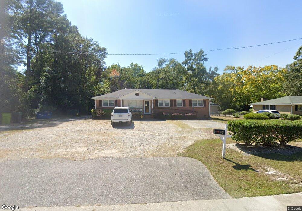
139 Rabon Rd Columbia, SC 29223
Dentsville NeighborhoodEstimated Value: $190,783
2
Beds
1
Bath
1,508
Sq Ft
$127/Sq Ft
Est. Value
About This Home
This home is located at 139 Rabon Rd, Columbia, SC 29223 and is currently priced at $190,783, approximately $126 per square foot. 139 Rabon Rd is a home located in Richland County with nearby schools including Windsor Elementary School, E. L. Wright Middle School, and Westwood High School.
Ownership History
Date
Name
Owned For
Owner Type
Purchase Details
Closed on
Nov 17, 2020
Sold by
Kaieteur Holdings Llc
Bought by
Hgf Properties Llc
Current Estimated Value
Home Financials for this Owner
Home Financials are based on the most recent Mortgage that was taken out on this home.
Original Mortgage
$118,240
Outstanding Balance
$85,406
Interest Rate
2.8%
Mortgage Type
Commercial
Purchase Details
Closed on
Oct 21, 2005
Sold by
Herrington Mary Ann
Bought by
Kaieteur Holdings Llc
Home Financials for this Owner
Home Financials are based on the most recent Mortgage that was taken out on this home.
Original Mortgage
$148,000
Interest Rate
5.66%
Mortgage Type
Commercial
Create a Home Valuation Report for This Property
The Home Valuation Report is an in-depth analysis detailing your home's value as well as a comparison with similar homes in the area
Home Values in the Area
Average Home Value in this Area
Purchase History
| Date | Buyer | Sale Price | Title Company |
|---|---|---|---|
| Hgf Properties Llc | $147,800 | None Available | |
| Hgf Properties Llc | -- | None Listed On Document | |
| Kaieteur Holdings Llc | $185,000 | -- |
Source: Public Records
Mortgage History
| Date | Status | Borrower | Loan Amount |
|---|---|---|---|
| Open | Hgf Properties Llc | $118,240 | |
| Closed | Hgf Properties Llc | $118,240 | |
| Previous Owner | Kaieteur Holdings Llc | $148,000 | |
| Closed | Kaieteur Holdings Llc | $18,500 |
Source: Public Records
Tax History Compared to Growth
Tax History
| Year | Tax Paid | Tax Assessment Tax Assessment Total Assessment is a certain percentage of the fair market value that is determined by local assessors to be the total taxable value of land and additions on the property. | Land | Improvement |
|---|---|---|---|---|
| 2024 | $5,769 | $170,000 | $0 | $0 |
| 2023 | $5,769 | $0 | $0 | $0 |
| 2022 | $5,273 | $147,800 | $76,500 | $71,300 |
| 2021 | $5,274 | $8,870 | $0 | $0 |
| 2020 | $5,084 | $8,490 | $0 | $0 |
| 2019 | $5,067 | $8,490 | $0 | $0 |
| 2018 | $6,546 | $11,020 | $0 | $0 |
| 2017 | $6,378 | $11,020 | $0 | $0 |
| 2016 | $6,345 | $11,020 | $0 | $0 |
| 2015 | $6,162 | $11,020 | $0 | $0 |
| 2014 | $6,085 | $183,600 | $0 | $0 |
| 2013 | -- | $11,020 | $0 | $0 |
Source: Public Records
Map
Nearby Homes
- 224 Todd Branch Dr
- 132 Greengate Dr
- 11 Royalgate Dr
- 216 Rabon Rd
- 6230 Two Notch Rd
- 57 Royalgate Dr
- 8824 Two Notch Rd
- 201 Weir Dr
- 3016 Chipping Ln
- 3090 Appleby Ln
- 3040 Kilkee Cir
- 2927 Cranbrook Ln
- 9429 S Chelsea Rd
- 2905 Saint Ives Rd
- 227 Flora Dr
- 109 Travers Ln
- 9607 Dunbarton Dr
- 3002 Woodway Ln
- 2901 Woodway Ln
- 105 Lionsgate Dr
- 1 Royalgate Dr
- 2 Royalgate Dr
- 208 Todd Branch Dr
- 204 Todd Branch Dr
- 200 Todd Branch Dr
- 212 Todd Branch Dr
- 134 Todd Branch Dr
- 7 Royalgate Dr
- 8 Royalgate Dr
- 9 Royalgate Dr
- 130 Todd Branch Dr
- 216 Todd Branch Dr
- 220 Todd Branch Dr
- 126 Todd Branch Dr
- 215 Todd Branch Dr
- 122 Todd Branch Dr
- 221 Todd Branch Dr
- 115 Todd Branch Dr
- 228 Todd Branch Dr
- 118 Todd Branch Dr