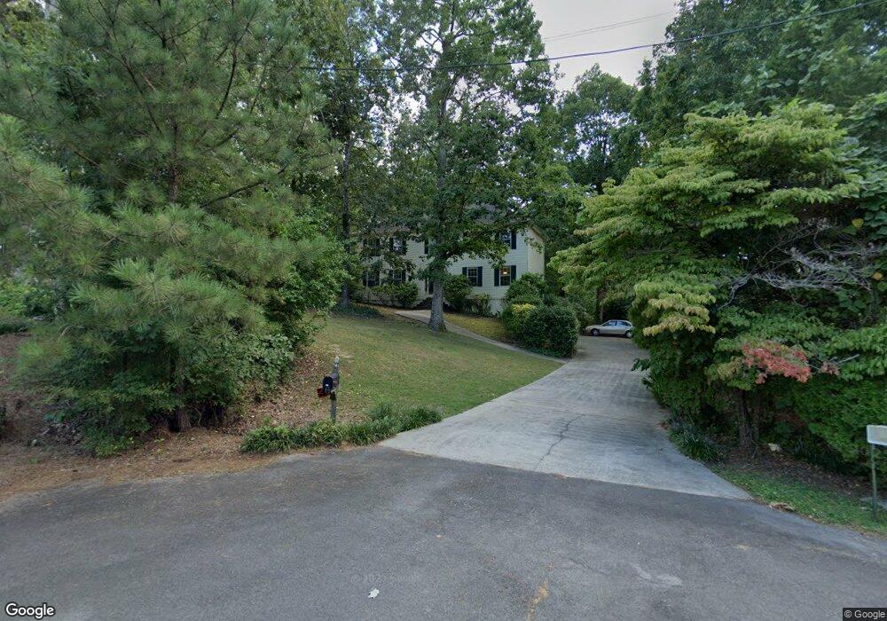
139 Ralston Ct Dalton, GA 30721
Estimated Value: $329,163 - $380,000
--
Bed
2
Baths
2,304
Sq Ft
$153/Sq Ft
Est. Value
About This Home
This home is located at 139 Ralston Ct, Dalton, GA 30721 and is currently estimated at $353,041, approximately $153 per square foot. 139 Ralston Ct is a home located in Whitfield County with nearby schools including New Hope Elementary School, New Hope Middle School, and Northwest Whitfield County High School.
Ownership History
Date
Name
Owned For
Owner Type
Purchase Details
Closed on
Jul 11, 2003
Sold by
Burns Burl R and Burns Barbara L
Bought by
Dotson Jason and Dotson Jennifer
Current Estimated Value
Purchase Details
Closed on
Jul 1, 2003
Sold by
Dotson Jason and Dotson Jennifer
Bought by
Dotson Jason and Dotson Jennifer
Purchase Details
Closed on
Sep 1, 1998
Bought by
Burns Burl R and Burns Barbara L
Create a Home Valuation Report for This Property
The Home Valuation Report is an in-depth analysis detailing your home's value as well as a comparison with similar homes in the area
Home Values in the Area
Average Home Value in this Area
Purchase History
| Date | Buyer | Sale Price | Title Company |
|---|---|---|---|
| Dotson Jason | $165,000 | -- | |
| Dotson Jason | -- | -- | |
| Burns Burl R | $6,000 | -- |
Source: Public Records
Tax History Compared to Growth
Tax History
| Year | Tax Paid | Tax Assessment Tax Assessment Total Assessment is a certain percentage of the fair market value that is determined by local assessors to be the total taxable value of land and additions on the property. | Land | Improvement |
|---|---|---|---|---|
| 2024 | $2,707 | $141,532 | $14,600 | $126,932 |
| 2023 | $2,707 | $97,136 | $12,800 | $84,336 |
| 2022 | $2,236 | $84,375 | $12,800 | $71,575 |
| 2021 | $2,237 | $84,375 | $12,800 | $71,575 |
| 2020 | $2,282 | $83,752 | $12,800 | $70,952 |
| 2019 | $2,314 | $83,752 | $12,800 | $70,952 |
| 2018 | $1,810 | $66,723 | $12,800 | $53,923 |
| 2017 | $1,810 | $66,723 | $12,800 | $53,923 |
| 2016 | $1,464 | $57,162 | $5,250 | $51,912 |
| 2014 | $1,340 | $57,162 | $5,250 | $51,912 |
| 2013 | -- | $57,162 | $5,250 | $51,912 |
Source: Public Records
Map
Nearby Homes
- 2002 Broadacre Dr NW
- 609 Cherokee Trail NW
- 303 Cherokee Trail NW
- 3147 Cleveland Hwy
- 287 Williams Rd NW
- 1425 Wiggs Dr
- 3025 Cleveland Hwy
- 3201 Maple Grove Dr NW
- 3216 Cleveland Hwy
- 1626 Lagenia Ct
- 3450 Misty Meadows Dr NW
- 337 Pacer Ln Unit 4
- 360 Pacer Ln
- 322 Pacer Ln
- 0 Pacer Ln
- 1015 S Ridge Dr
- 466 Scarlet Dr
- 329 Kempton Ln
- 0 West R W Ridge Dr
- 499 Ralston Ct
- 497 Ralston Ct
- 138 Ralston Ct
- 133 Ralston Ct
- 2053 Woodridge Ln
- 2045 Woodridge Ln
- 495 Bethany Dr
- 2052 Woodridge Ln
- 2057 Woodridge Ln
- 489 Bethany Dr
- 2050 Woodridge Ln
- 485 Bethany Dr
- 491 Bethany Dr
- 488 Bethany Dr Unit 10679
- 488 Bethany Dr
- 229 Bethany Dr
- 487 Bethany Dr
- 483 Bethany Dr
- 238 Bethany Dr
- 249 Bethany Dr