Estimated Value: $575,043 - $656,000
4
Beds
3
Baths
2,594
Sq Ft
$237/Sq Ft
Est. Value
About This Home
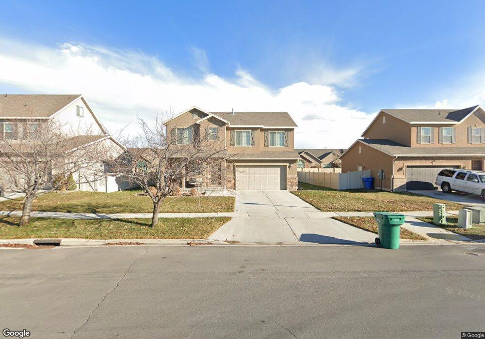
This home is located at 139 S 2035 W Unit 224, Lehi, UT 84043 and is currently estimated at $615,261, approximately $237 per square foot. 139 S 2035 W Unit 224 is a home located in Utah County with nearby schools including Snow Springs Elementary, Willowcreek Middle School, and Lehi High School.
Ownership History
Date
Name
Owned For
Owner Type
Purchase Details
Closed on
Oct 17, 2025
Sold by
Simon Wesley and Simon Jenica
Bought by
Winn Matthew Robert
Current Estimated Value
Home Financials for this Owner
Home Financials are based on the most recent Mortgage that was taken out on this home.
Original Mortgage
$554,028
Outstanding Balance
$554,028
Interest Rate
6.5%
Mortgage Type
FHA
Estimated Equity
$61,233
Purchase Details
Closed on
Nov 29, 2012
Sold by
Simon Wesley
Bought by
Simon Wesley and Simon Jenice
Home Financials for this Owner
Home Financials are based on the most recent Mortgage that was taken out on this home.
Original Mortgage
$222,115
Interest Rate
3.33%
Mortgage Type
New Conventional
Purchase Details
Closed on
Nov 21, 2012
Sold by
Richmond American Homes Of Urah Inc
Bought by
Simon Wesley
Home Financials for this Owner
Home Financials are based on the most recent Mortgage that was taken out on this home.
Original Mortgage
$222,115
Interest Rate
3.33%
Mortgage Type
New Conventional
Create a Home Valuation Report for This Property
The Home Valuation Report is an in-depth analysis detailing your home's value as well as a comparison with similar homes in the area
Home Values in the Area
Average Home Value in this Area
Purchase History
| Date | Buyer | Sale Price | Title Company |
|---|---|---|---|
| Winn Matthew Robert | -- | Protitle | |
| Simon Wesley | -- | First American Title Company | |
| Simon Wesley | -- | First American Title Company |
Source: Public Records
Mortgage History
| Date | Status | Borrower | Loan Amount |
|---|---|---|---|
| Open | Winn Matthew Robert | $554,028 | |
| Previous Owner | Simon Wesley | $222,115 |
Source: Public Records
Tax History Compared to Growth
Tax History
| Year | Tax Paid | Tax Assessment Tax Assessment Total Assessment is a certain percentage of the fair market value that is determined by local assessors to be the total taxable value of land and additions on the property. | Land | Improvement |
|---|---|---|---|---|
| 2025 | $2,519 | $301,290 | $207,200 | $340,600 |
| 2024 | $2,519 | $294,745 | $0 | $0 |
| 2023 | $2,374 | $301,675 | $0 | $0 |
| 2022 | $2,303 | $283,635 | $0 | $0 |
| 2021 | $2,061 | $383,900 | $119,900 | $264,000 |
| 2020 | $1,943 | $357,700 | $111,000 | $246,700 |
| 2019 | $1,869 | $357,700 | $111,000 | $246,700 |
| 2018 | $1,758 | $318,100 | $96,200 | $221,900 |
| 2017 | $1,733 | $166,650 | $0 | $0 |
| 2016 | $1,686 | $150,425 | $0 | $0 |
| 2015 | $1,584 | $134,145 | $0 | $0 |
| 2014 | $1,569 | $132,110 | $0 | $0 |
Source: Public Records
Map
Nearby Homes
- 202 S 2035 W
- 131 S 1900 W Unit 2
- 2162 W Main St Unit E303
- 2178 W Main St Unit D301
- 1784 W Grays Place
- 41 N 2150 W
- 210 S Tamarak Cir
- 1743 W Grays Place
- 105 N 2430 W
- 122 N 2430 W Unit 1
- The Roslyn Plan at Carla's Cove
- The Tracie Plan at Carla's Cove
- The Brooke Plan at Carla's Cove
- The Jackie Plan at Carla's Cove
- 161 S 1475 W
- 380 S 1500 W
- 603 S 2500 W
- 581 S 1500 W
- 1379 W 425 S
- 811 S 2300 W
- 149 S 2035 W
- 129 S 2035 W
- 167 S 2035 W
- 152 S 2035 W
- 75 S Willow Circle Loop Unit K
- 75 S Willow Circle Loop Unit L
- 75 S Willow Circle Loop Unit J
- 75 S Willow Circle Loop Unit H
- 75 S Willow Circle Loop Unit I
- 75 S Willow Circle Loop Unit E
- 75 S Willow Circle Loop Unit F
- 75 S Willow Circle Loop Unit C
- 75 S Willow Circle Loop Unit B
- 75 S Willow Circle Loop Unit G
- 75 S Willow Circle Loop Unit D
- 75 S Willow Circle Loop Unit A
- 75 S Willow Circle Loop
- 126 S 1970 W
- 126 S 1970 W
- 126 S 1970 W