Estimated Value: $161,000 - $212,000
2
Beds
1
Bath
1,024
Sq Ft
$181/Sq Ft
Est. Value
About This Home
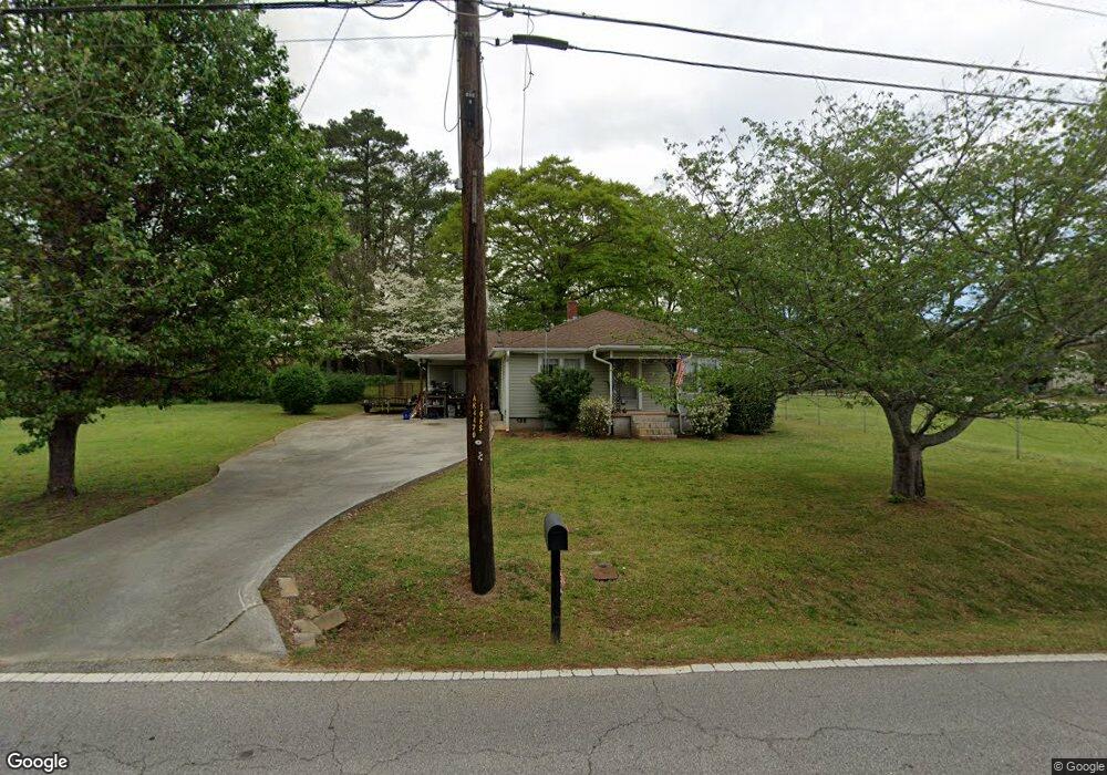
This home is located at 139 Seaboard Ave, Hiram, GA 30141 and is currently estimated at $185,287, approximately $180 per square foot. 139 Seaboard Ave is a home located in Paulding County with nearby schools including Hiram Elementary School, P. B. Ritch Middle School, and Hiram High School.
Ownership History
Date
Name
Owned For
Owner Type
Purchase Details
Closed on
Jan 6, 2011
Sold by
Us Bk Na Of Nd
Bought by
Graham Willard L
Current Estimated Value
Purchase Details
Closed on
Oct 5, 2010
Sold by
Buchanan Stacy L
Bought by
Us Bk Na Of Nd
Purchase Details
Closed on
Mar 19, 2003
Sold by
Williams Linda E
Bought by
Buchanan Stacy L
Home Financials for this Owner
Home Financials are based on the most recent Mortgage that was taken out on this home.
Original Mortgage
$96,900
Interest Rate
5.86%
Mortgage Type
VA
Create a Home Valuation Report for This Property
The Home Valuation Report is an in-depth analysis detailing your home's value as well as a comparison with similar homes in the area
Home Values in the Area
Average Home Value in this Area
Purchase History
| Date | Buyer | Sale Price | Title Company |
|---|---|---|---|
| Graham Willard L | $40,000 | -- | |
| Us Bk Na Of Nd | $36,000 | -- | |
| Buchanan Stacy L | $95,000 | -- |
Source: Public Records
Mortgage History
| Date | Status | Borrower | Loan Amount |
|---|---|---|---|
| Previous Owner | Buchanan Stacy L | $96,900 |
Source: Public Records
Tax History Compared to Growth
Tax History
| Year | Tax Paid | Tax Assessment Tax Assessment Total Assessment is a certain percentage of the fair market value that is determined by local assessors to be the total taxable value of land and additions on the property. | Land | Improvement |
|---|---|---|---|---|
| 2024 | $1,712 | $68,804 | $11,040 | $57,764 |
| 2023 | $1,700 | $65,216 | $10,760 | $54,456 |
| 2022 | $1,517 | $58,200 | $8,480 | $49,720 |
| 2021 | $1,260 | $43,364 | $6,600 | $36,764 |
| 2020 | $1,172 | $39,468 | $6,240 | $33,228 |
| 2019 | $1,117 | $37,076 | $9,200 | $27,876 |
| 2018 | $848 | $28,144 | $9,880 | $18,264 |
| 2017 | $809 | $26,488 | $9,880 | $16,608 |
Source: Public Records
Map
Nearby Homes
- 153 Oak St
- 100 Trailside Way
- 138 Trailside Way
- 154 Trailside Way
- 149 Trailside Cir
- 56 Trailview Ct
- 101 Trailview Ln
- 208 Trailside Way
- 585 Hiram Douglasville Hwy
- 491 Hiram Douglasville Hwy
- 175 Arnold Ln
- 329 Hiram Douglasville Hwy
- 244 Rosedale Dr
- 263 Hiram Douglasville Hwy
- 485 Angham Rd
- 954 Pool Rd
- 6053 Hiram Industrial Dr
- 480 Pool Rd
- 000 Us Highway 278
- 194 Prospect Path
- 125 Seaboard Ave
- 311 Center St
- 24 Oak St
- 77 Seaboard Ave
- 126 Seaboard Ave
- 50 Oak St
- 201 Seaboard Ave
- 56 Oak St
- 156 North Ave
- 158 North Ave
- 275 Center St
- 332 Center St
- 219 Seaboard Ave
- 18 Towne Park Dr
- 18 Towne Park Dr Unit 1
- 78 Oak St
- 0 Towne Park Dr Unit 7610248
- 0 Towne Park Dr Unit 5664368
- 40 Towne Park Dr
- 250 North Ave