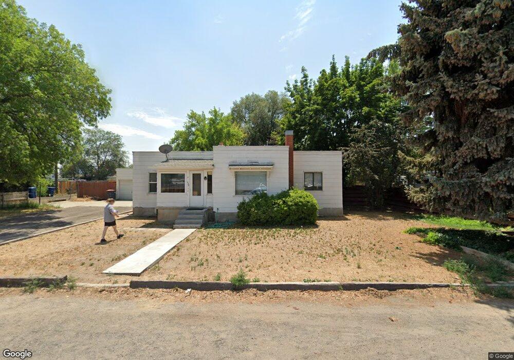
139 Shoup Ave W Twin Falls, ID 83301
Estimated Value: $328,000 - $350,963
3
Beds
2
Baths
2,179
Sq Ft
$157/Sq Ft
Est. Value
About This Home
This home is located at 139 Shoup Ave W, Twin Falls, ID 83301 and is currently estimated at $342,241, approximately $157 per square foot. 139 Shoup Ave W is a home located in Twin Falls County with nearby schools including I.B. Perrine Elementary School, Robert Stuart Junior High School, and Canyon Ridge High School.
Ownership History
Date
Name
Owned For
Owner Type
Purchase Details
Closed on
Oct 28, 2015
Sold by
Hudelson Larry Dennis
Bought by
Hudelson Cortney
Current Estimated Value
Purchase Details
Closed on
Mar 23, 2015
Sold by
Hudelson Cortney M and Marvin Cortney M
Bought by
Hudelson Larry and Hudelson Cortney
Purchase Details
Closed on
Aug 8, 2011
Sold by
Marvin Michael G
Bought by
Marvin Michael G and Marvin Cartney M
Purchase Details
Closed on
Aug 13, 2009
Sold by
Wilson Jane
Bought by
Wilson Myron
Purchase Details
Closed on
Jun 29, 2009
Sold by
Paxton George H and Paxton Alma Mae
Bought by
Marvin Michael G
Create a Home Valuation Report for This Property
The Home Valuation Report is an in-depth analysis detailing your home's value as well as a comparison with similar homes in the area
Home Values in the Area
Average Home Value in this Area
Purchase History
| Date | Buyer | Sale Price | Title Company |
|---|---|---|---|
| Hudelson Cortney | -- | None Available | |
| Hudelson Larry | -- | None Available | |
| Marvin Michael G | -- | -- | |
| Wilson Myron | -- | -- | |
| Marvin Michael G | -- | -- |
Source: Public Records
Tax History Compared to Growth
Tax History
| Year | Tax Paid | Tax Assessment Tax Assessment Total Assessment is a certain percentage of the fair market value that is determined by local assessors to be the total taxable value of land and additions on the property. | Land | Improvement |
|---|---|---|---|---|
| 2024 | $1,316 | $264,356 | $71,323 | $193,033 |
| 2023 | $1,428 | $297,835 | $71,323 | $226,512 |
| 2022 | $1,748 | $277,678 | $44,850 | $232,828 |
| 2021 | $1,656 | $219,929 | $44,850 | $175,079 |
| 2020 | $1,424 | $186,644 | $49,580 | $137,064 |
| 2019 | $1,653 | $185,071 | $44,850 | $140,221 |
| 2018 | $1,509 | $159,719 | $31,016 | $128,703 |
| 2017 | $1,335 | $142,451 | $31,016 | $111,435 |
| 2016 | $1,281 | $127,787 | $0 | $0 |
| 2015 | $1,246 | $127,787 | $31,016 | $96,771 |
| 2012 | -- | $104,352 | $0 | $0 |
Source: Public Records
Map
Nearby Homes
- 125 Shoup Ave W
- 195 Washington St N
- 235 Washington St N
- 181 Austin Ave
- 952 2nd Ave W
- 284 Heyburn Ave W
- 357 Casa Grande Ct
- 134 Adams St
- 219 Monroe St
- 216 Borah Ave W
- 375 Monroe St
- 651 2nd Ave W
- 214 Quincy St
- 419 Heyburn Ave W
- 805 4th Ave W
- 285 Carney St
- 631 3rd Ave W
- 371 Dubois Ave
- 170 Jackson St
- 305 Filer Ave W
- 204 Richardson Dr
- 189 Washington St N
- 209 Washington St N
- 203 Richardson Dr
- 177 Washington St N
- 230 Richardson Dr
- 219 Washington St N
- 215 Richardson Dr
- 231 Washington St N
- 210 Washington St N
- 238 Richardson Dr
- 206 Ostrander St N
- 227 Richardson Dr
- 198 Washington St N
- 190 Washington St N
- 226 Washington St N
- 182 Washington St N
- 239 Richardson Dr
- 249 Washington St N
- 172 Washington St N