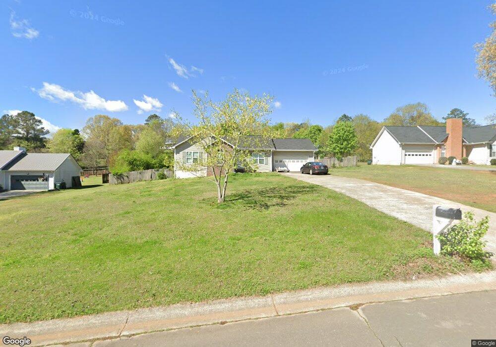
139 Spencer Dr SW Calhoun, GA 30701
Estimated Value: $225,360 - $261,000
3
Beds
2
Baths
1,126
Sq Ft
$215/Sq Ft
Est. Value
About This Home
This home is located at 139 Spencer Dr SW, Calhoun, GA 30701 and is currently estimated at $241,590, approximately $214 per square foot. 139 Spencer Dr SW is a home located in Gordon County with nearby schools including Swain Elementary School, Ashworth Middle School, and Gordon Central High School.
Ownership History
Date
Name
Owned For
Owner Type
Purchase Details
Closed on
Jun 19, 2007
Sold by
Mosley Shirley M
Bought by
Aker Tennille N
Current Estimated Value
Home Financials for this Owner
Home Financials are based on the most recent Mortgage that was taken out on this home.
Original Mortgage
$121,000
Outstanding Balance
$83,825
Interest Rate
6.35%
Mortgage Type
New Conventional
Estimated Equity
$157,765
Purchase Details
Closed on
Aug 29, 2001
Sold by
Tanner Eric A and Tanner Keisha L
Bought by
Aker Shirley M
Purchase Details
Closed on
May 18, 1998
Bought by
Tanner Eric A and Tanner Keisha L
Create a Home Valuation Report for This Property
The Home Valuation Report is an in-depth analysis detailing your home's value as well as a comparison with similar homes in the area
Home Values in the Area
Average Home Value in this Area
Purchase History
| Date | Buyer | Sale Price | Title Company |
|---|---|---|---|
| Aker Tennille N | $121,000 | -- | |
| Aker Shirley M | $78,500 | -- | |
| Tanner Eric A | $76,900 | -- |
Source: Public Records
Mortgage History
| Date | Status | Borrower | Loan Amount |
|---|---|---|---|
| Open | Aker Tennille N | $121,000 |
Source: Public Records
Tax History Compared to Growth
Tax History
| Year | Tax Paid | Tax Assessment Tax Assessment Total Assessment is a certain percentage of the fair market value that is determined by local assessors to be the total taxable value of land and additions on the property. | Land | Improvement |
|---|---|---|---|---|
| 2024 | $1,486 | $60,480 | $7,000 | $53,480 |
| 2023 | $1,394 | $56,880 | $7,000 | $49,880 |
| 2022 | $1,390 | $53,440 | $7,000 | $46,440 |
| 2021 | $1,187 | $44,360 | $7,000 | $37,360 |
| 2020 | $1,226 | $44,800 | $7,000 | $37,800 |
| 2019 | $1,233 | $44,800 | $7,000 | $37,800 |
| 2018 | $1,149 | $41,880 | $7,000 | $34,880 |
| 2017 | $1,125 | $39,960 | $7,000 | $32,960 |
| 2016 | $1,128 | $39,960 | $7,000 | $32,960 |
| 2015 | $1,119 | $39,320 | $7,000 | $32,320 |
| 2014 | $1,041 | $37,758 | $7,000 | $30,758 |
Source: Public Records
Map
Nearby Homes
- 261 Liberty Ln SW
- 490 McDaniel Station Rd SW
- 506 McDaniel Station Rd SW
- 458 McDaniel Station Rd SW
- 474 McDaniel Station Rd SW
- 271 Old Belwood Rd SE
- 110 Darby Rd SW
- 1401 U S 41
- 211 Darby Rd SW
- 0 Richardson Rd SE Unit 10474273
- 0 Richardson Rd SE Unit 7537183
- 201 Porch Loop SE
- 1311 Us Highway 41
- 0 Highway 53 Spur SW Unit 7529096
- 00 Belmont Dr
- 220 Porch Loop SE
- 0 Reeves Station Rd SW Unit 10548197
- 0 Reeves Station Rd SW Unit 7601645
- 0 W Belmont Dr Unit 10489910
- 121 Foxhall Dr SW
- 127 Spencer Dr SW
- 144 Spencer Dr SW
- 118 Spencer Dr SW
- 115 Spencer Dr SW
- 163 Spencer Dr SW
- 158 Spencer Dr SW
- 101 Spencer Dr SW
- 175 Spencer Dr SW
- 240 Nelson Lake Rd SW
- 176 Spencer Dr SW
- 122 Nelson Lake Rd SW
- 187 Spencer Dr SW
- 186 Spencer Dr SW
- 286 Nelson Lake Rd SW
- 197 Spencer Dr SW
- 0 Spencer Dr SW Unit 7049422
- 0 Spencer Dr SW Unit 8262355
- 198 Spencer Dr SW
- 00 Nelson Lake Rd SW
- 207 Spencer Dr SW