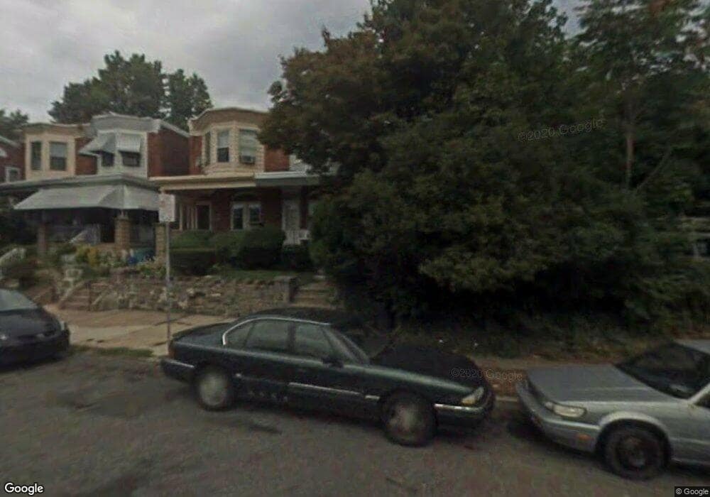
139 W Clarkson Ave Philadelphia, PA 19120
Olney NeighborhoodEstimated Value: $194,000 - $206,000
3
Beds
1
Bath
1,260
Sq Ft
$159/Sq Ft
Est. Value
About This Home
This home is located at 139 W Clarkson Ave, Philadelphia, PA 19120 and is currently estimated at $200,000, approximately $158 per square foot. 139 W Clarkson Ave is a home located in Philadelphia County with nearby schools including James R. Lowell Elementary School, Grover Washington Middle School, and Samuel Fels High School.
Ownership History
Date
Name
Owned For
Owner Type
Purchase Details
Closed on
Feb 2, 2010
Sold by
Deutsche Bank National Trust Company
Bought by
Varughese Kalackattu C
Current Estimated Value
Purchase Details
Closed on
Nov 9, 2009
Sold by
Harris Levis
Bought by
Deutsche Bank National Trust Company
Purchase Details
Closed on
Apr 30, 1998
Sold by
Geller Lawrence H
Bought by
Harris Levis
Create a Home Valuation Report for This Property
The Home Valuation Report is an in-depth analysis detailing your home's value as well as a comparison with similar homes in the area
Home Values in the Area
Average Home Value in this Area
Purchase History
| Date | Buyer | Sale Price | Title Company |
|---|---|---|---|
| Varughese Kalackattu C | $44,000 | None Available | |
| Deutsche Bank National Trust Company | $60,000 | None Available | |
| Harris Levis | $49,900 | -- |
Source: Public Records
Tax History Compared to Growth
Tax History
| Year | Tax Paid | Tax Assessment Tax Assessment Total Assessment is a certain percentage of the fair market value that is determined by local assessors to be the total taxable value of land and additions on the property. | Land | Improvement |
|---|---|---|---|---|
| 2025 | $2,342 | $203,400 | $40,680 | $162,720 |
| 2024 | $2,342 | $203,400 | $40,680 | $162,720 |
| 2023 | $2,342 | $167,300 | $33,460 | $133,840 |
| 2022 | $1,338 | $167,300 | $33,460 | $133,840 |
| 2021 | $1,338 | $0 | $0 | $0 |
| 2020 | $1,338 | $0 | $0 | $0 |
| 2019 | $1,244 | $0 | $0 | $0 |
| 2018 | $1,445 | $0 | $0 | $0 |
| 2017 | $1,445 | $0 | $0 | $0 |
| 2016 | $10,084 | $0 | $0 | $0 |
| 2015 | $10,084 | $0 | $0 | $0 |
| 2014 | -- | $103,200 | $17,817 | $85,383 |
| 2012 | -- | $10,752 | $2,210 | $8,542 |
Source: Public Records
Map
Nearby Homes
- 164 W Clarkson Ave
- 5511 N 2nd St
- 5531 N 2nd St
- 5534 N American St
- 5324 N 3rd St
- 5619 N American St
- 5413 N Front St
- 5227 31 N American St
- 150 W Fisher Ave
- 163 W Chew Ave
- 5230 N 2nd St
- 5228 N 2nd St
- 5528 N Lawrence St
- 217 Furley St
- 5648 N Lawrence St
- 224 W Duncannon Ave
- 426 W Fisher Ave
- 246 W Duncannon Ave
- 5150 N 2nd St
- 239 Rubicam St
- 141 W Clarkson Ave
- 143 W Clarkson Ave
- 145 W Clarkson Ave
- 5504 N Mascher St
- 5506 N Mascher St
- 5502 N Mascher St
- 147 W Clarkson Ave
- 5500 N Mascher St
- 5510 N Mascher St
- 5505 N Palethorp St
- 5501 N Palethorp St
- 5513 N Palethorp St
- 5512 N Mascher St
- 5515 N Palethorp St
- 150 W Clarkson Ave
- 5514 N Mascher St
- 158 W Clarkson Ave
- 146 W Clarkson Ave
- 160 W Clarkson Ave
- 154 W Clarkson Ave