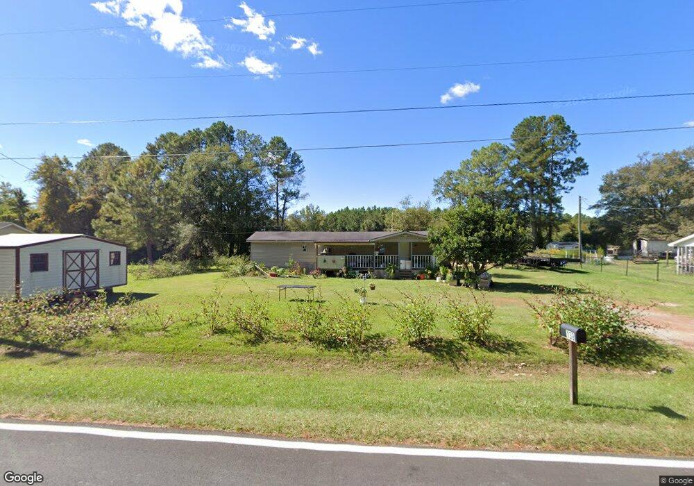
139 W Palm Rd Hazlehurst, GA 31539
Estimated Value: $54,000 - $155,000
3
Beds
2
Baths
720
Sq Ft
$128/Sq Ft
Est. Value
About This Home
This home is located at 139 W Palm Rd, Hazlehurst, GA 31539 and is currently estimated at $92,333, approximately $128 per square foot. 139 W Palm Rd is a home with nearby schools including Jeff Davis Primary School, Jeff Davis Elementary School, and Jeff Davis Middle School.
Ownership History
Date
Name
Owned For
Owner Type
Purchase Details
Closed on
Apr 7, 2018
Sold by
Coronado Stephanie W
Bought by
Luna Wilfrido Roque
Current Estimated Value
Purchase Details
Closed on
Dec 20, 2007
Sold by
Cognion Melinda Palmer
Bought by
Wehbi Melinda
Purchase Details
Closed on
Oct 22, 2001
Sold by
Long Andrea M
Bought by
Palmer Melinda
Purchase Details
Closed on
Sep 22, 1999
Bought by
Long Andrea M
Purchase Details
Closed on
Aug 28, 1997
Bought by
Carver Danny and Carver Sandra J
Purchase Details
Closed on
Jun 27, 1995
Bought by
Aztec Financial Service
Purchase Details
Closed on
Nov 28, 1994
Bought by
The Bank Of Lumber City
Purchase Details
Closed on
Jan 4, 1994
Bought by
Trust Company Bank Of
Purchase Details
Closed on
Jan 22, 1993
Bought by
Ursrey & Company
Purchase Details
Closed on
Mar 18, 1992
Bought by
Ursrey Gerald L
Create a Home Valuation Report for This Property
The Home Valuation Report is an in-depth analysis detailing your home's value as well as a comparison with similar homes in the area
Home Values in the Area
Average Home Value in this Area
Purchase History
| Date | Buyer | Sale Price | Title Company |
|---|---|---|---|
| Luna Wilfrido Roque | $6,000 | -- | |
| Wehbi Melinda | $9,835 | -- | |
| Palmer Melinda | $14,000 | -- | |
| Long Andrea M | $14,000 | -- | |
| Carver Danny | $1,500 | -- | |
| Aztec Financial Service | $30,000 | -- | |
| The Bank Of Lumber City | $44,500 | -- | |
| Trust Company Bank Of | $3,000 | -- | |
| Ursrey & Company | -- | -- | |
| Ursrey Gerald L | $58,000 | -- |
Source: Public Records
Tax History Compared to Growth
Tax History
| Year | Tax Paid | Tax Assessment Tax Assessment Total Assessment is a certain percentage of the fair market value that is determined by local assessors to be the total taxable value of land and additions on the property. | Land | Improvement |
|---|---|---|---|---|
| 2024 | $154 | $5,240 | $3,360 | $1,880 |
| 2023 | $88 | $2,981 | $1,312 | $1,669 |
| 2022 | $88 | $2,981 | $1,312 | $1,669 |
| 2021 | $88 | $2,981 | $1,312 | $1,669 |
| 2020 | $39 | $1,338 | $1,312 | $26 |
| 2019 | $39 | $1,338 | $1,312 | $26 |
| 2018 | $39 | $1,338 | $1,312 | $26 |
| 2017 | $39 | $1,346 | $1,312 | $34 |
Source: Public Records
Map
Nearby Homes
- 102 W Palm Rd
- 0 Collins St
- 393 Douglas Hwy
- 16 Beech Rd
- 00 Pat Dixon St & Charles Rogers Blvd
- 0 Charles Rogers Blvd
- 371 Burketts Ferry Rd
- 27 Park Ln
- 42 Claxton Rd
- 54 Walton Way
- 44 Kersey St
- 45 Elton St
- 77 Jimmy Boatright Dr
- 9 Kersey St
- 116 Walton Way
- 73 Latimer St
- 53 Mockingbird Ln
- 4 Lakeside Dr
- 6 Lynnwood Dr
- 34 Bradford Ln
- 133 W Palm Rd Unit 1
- 133 W Palm Rd
- 143 W Palm Rd
- 122 W Palm Rd
- 121 W Palm Rd
- 281 Broxton Hwy
- 239 Broxton Hwy
- 239 Broxton Hwy
- 111 W Palm Rd
- 114 W Palm Rd
- 273 Broxton Hwy
- 107 W Palm Rd
- 108 W Palm Rd
- 263 Broxton Hwy
- 103 W Palm Rd
- 288 Broxton Hwy
- 296 Broxton Hwy
- 90 W Palm Rd
- 312 Broxton Hwy
- 80 W Palm Rd