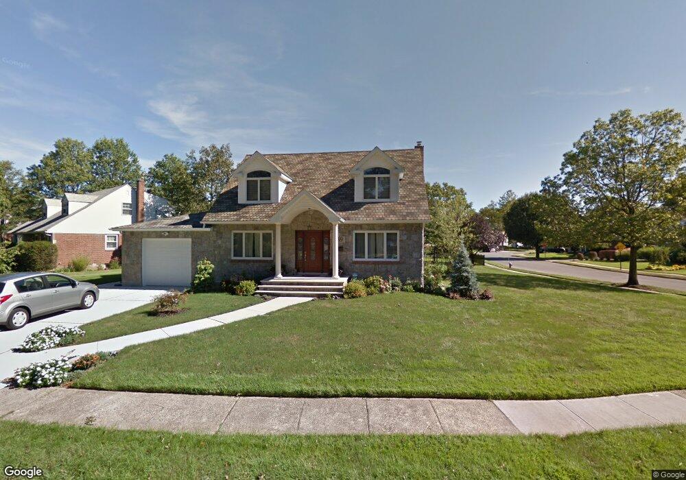
139 Woodoak Dr Westbury, NY 11590
Estimated Value: $1,188,995 - $1,355,000
4
Beds
4
Baths
2,520
Sq Ft
$505/Sq Ft
Est. Value
About This Home
This home is located at 139 Woodoak Dr, Westbury, NY 11590 and is currently estimated at $1,271,998, approximately $504 per square foot. 139 Woodoak Dr is a home located in Nassau County with nearby schools including Cherry Lane School, Rushmore Avenue School, and Carle Place High School.
Ownership History
Date
Name
Owned For
Owner Type
Purchase Details
Closed on
Sep 15, 2016
Sold by
Anteri Salvatore and Anteri Anna
Bought by
Schettino Jeffrey
Current Estimated Value
Home Financials for this Owner
Home Financials are based on the most recent Mortgage that was taken out on this home.
Original Mortgage
$425,000
Outstanding Balance
$339,474
Interest Rate
3.43%
Mortgage Type
New Conventional
Estimated Equity
$932,524
Purchase Details
Closed on
Mar 1, 2011
Sold by
Hymanson Margaret
Bought by
Anteri Salvatore
Home Financials for this Owner
Home Financials are based on the most recent Mortgage that was taken out on this home.
Original Mortgage
$175,000
Interest Rate
4.84%
Mortgage Type
Purchase Money Mortgage
Create a Home Valuation Report for This Property
The Home Valuation Report is an in-depth analysis detailing your home's value as well as a comparison with similar homes in the area
Home Values in the Area
Average Home Value in this Area
Purchase History
| Date | Buyer | Sale Price | Title Company |
|---|---|---|---|
| Schettino Jeffrey | $835,000 | None Available | |
| Anteri Salvatore | $475,000 | -- |
Source: Public Records
Mortgage History
| Date | Status | Borrower | Loan Amount |
|---|---|---|---|
| Open | Schettino Jeffrey | $425,000 | |
| Previous Owner | Anteri Salvatore | $175,000 |
Source: Public Records
Tax History Compared to Growth
Tax History
| Year | Tax Paid | Tax Assessment Tax Assessment Total Assessment is a certain percentage of the fair market value that is determined by local assessors to be the total taxable value of land and additions on the property. | Land | Improvement |
|---|---|---|---|---|
| 2025 | $17,090 | $728 | $298 | $430 |
| 2024 | $4,974 | $809 | $331 | $478 |
| 2023 | $16,363 | $766 | $313 | $453 |
| 2022 | $16,363 | $809 | $331 | $478 |
| 2021 | $17,285 | $812 | $332 | $480 |
| 2020 | $17,443 | $1,232 | $616 | $616 |
| 2019 | $17,334 | $1,270 | $806 | $464 |
| 2018 | $16,819 | $1,270 | $0 | $0 |
| 2017 | $9,785 | $1,270 | $806 | $464 |
| 2016 | $13,621 | $1,270 | $806 | $464 |
| 2015 | $3,755 | $1,270 | $806 | $464 |
| 2014 | $3,755 | $1,270 | $806 | $464 |
| 2013 | $3,570 | $1,270 | $806 | $464 |
Source: Public Records
Map
Nearby Homes
- 332 Jamaica Blvd
- 83 Renison Dr
- 296 Jerome Ave
- 253 Raff Ave
- 43 Shortridge Dr
- 213 Guinea Woods Rd
- 201 Jamaica Blvd
- 229 Rushmore Ave
- 225 Rushmore Ave
- 330 Ellison Ave
- 23 Park Cir
- 211 Mineola Ave
- 172 Harvard St
- 53 Atlantic Ave
- 120 Bruce Terrace
- 323 Barwick Blvd
- 227 Brown St
- 44 Cherry Ln
- 222 Clemens Rd
- 135 Barwick Blvd